Accession No
4846
Brief Description
botanical wall chart showing relative distribution of different types of tree, in different geological periods in West Runton, from experiments in 1967, by S. Bishop, English, 1967
Origin
England; Cambridge
Maker
Bishop, S.
Class
natural history; earth sciences; prints
Earliest Date
1967
Latest Date
1967
Inscription Date
Material
paper; cloth; plastic
Dimensions
breadth 1635mm; height 1010mm
Special Collection
Botanical teaching diagrams from Dept. of Plant Sciences; Cambridge Quaternary Research Collection
Provenance
Transferred from the Department of Plant Sciences, University of Cambridge.
Inscription
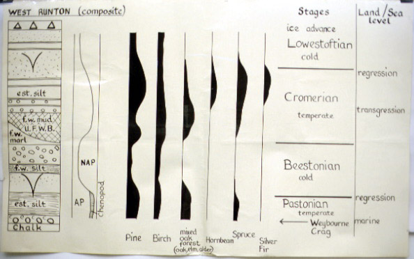
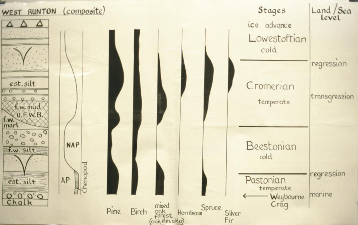
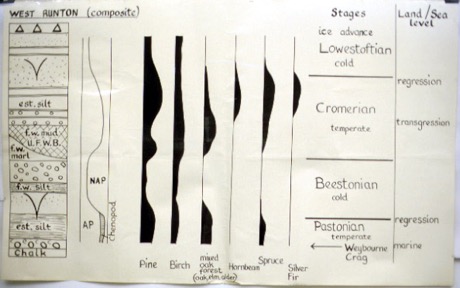
‘WEST RUNTON (composite)’ (top left)
Description Notes
Chart is in five parts. All the parts appear to share the same time axis, which runs vertically (presumably oldest at bottom, though this is not stated).
Far left is a strata cross-section, showing the composition of the different layers of earth at West Runton, with chalk at the bottom.
Left is a schematic showing the division between ‘AP’ and ‘NAP’.
Middle shows the preponderance of trees (Pine, Birch, mixed oak forest, Hornbeam, spruce, and silver fir) throughout the period represented by the section on the far left.
Right, names the geological (?) stages involved (Lowestoftian, Cromerian, Beestonian, and Pastonian) with qualifiers (cold, temperate)
Far right, gives the land/sea level for these stages (regression, transgression or marine).
Ref number on reverse.
Good condition.
Chart 4850 gives a more detailed cross section of the geology of the West Runton Gap. 4848 deals with climatic stages in Norfolk, in the same style.
References
Events
FM:41526
Images (Click to view full size):