Accession No
5172
Brief Description
celestial planisphere, by Poole Brothers, drawn by Jules A. Colas, U.S.A., c. 1887
Origin
U.S.A.; Chicago
Maker
Poole Brothers Colas, Jules A. [artist]
Class
astronomy; demonstration; ephemera
Earliest Date
1887
Latest Date
1900
Inscription Date
1887
Material
paper (card, cardboard); metal (brass, other)
Dimensions
length 580mm; width 480mm
Special Collection
Provenance
Purchased from Tesseract, Box 151, Hastings-on-Hudson, New York 10706, USA from 16/07/1997.
Inscription
on the top
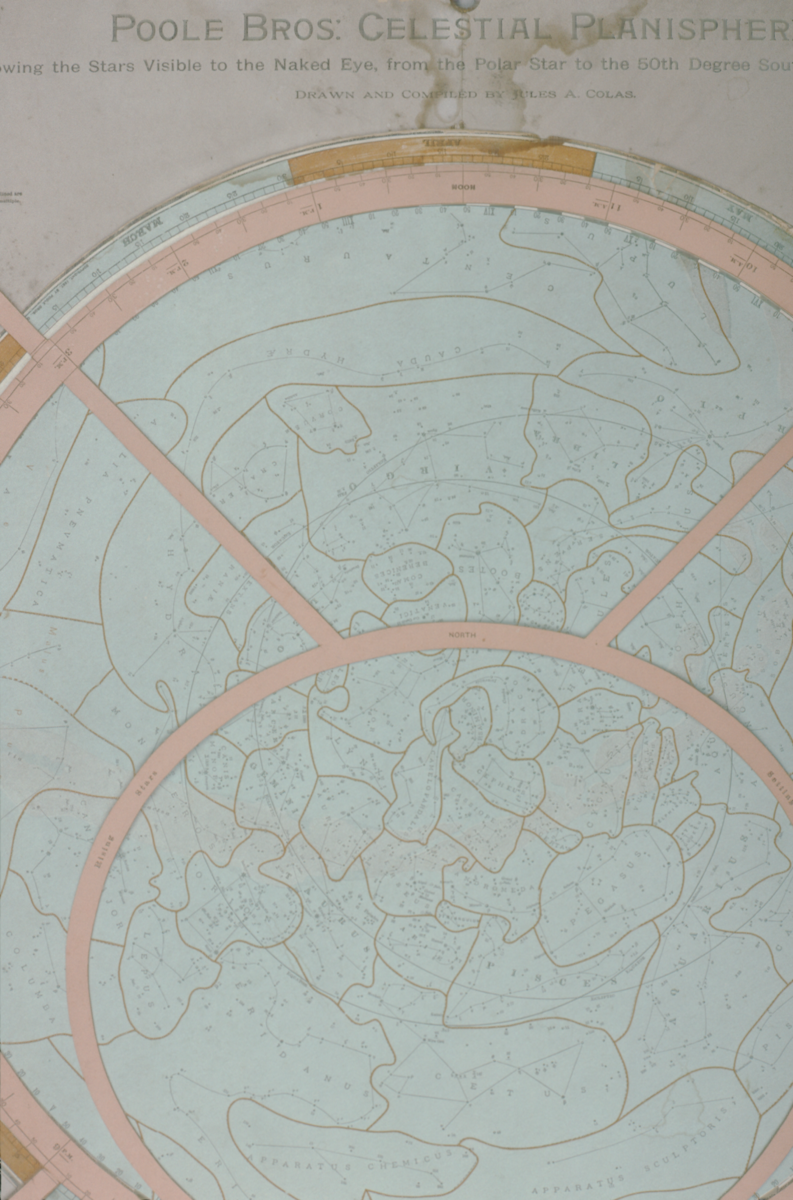
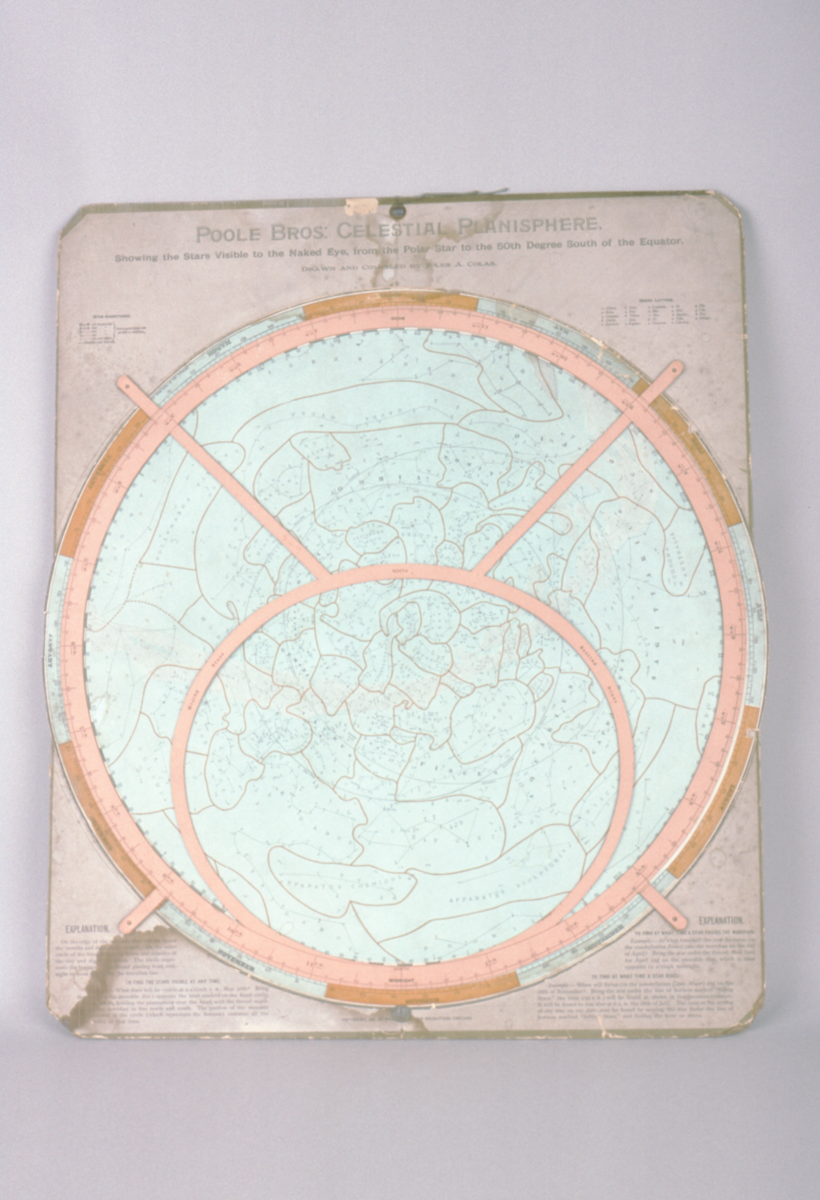
‘POOLE BROS: CELESTIAL PLANISPHERE.’
‘Showing the Stars Visible to the Naked Eye, from the Polar Star to the 50th Degree South of the Equator.’
‘DRAWN AND COMPILED BY JULES A. COLAS.’
Description Notes
Celestial Planisphere, by Poole Bros., USA, c. 1887; drawn by Jules A. Colas.
Copyright is given at the very bottom as 1887, by Poole Bros., Map Engravers, Chicago. The planisphere is of card mounted on to heavy cardboard (mountboard). The planisphere consists of a detailed circular projection of the sky printed in pale blue, complete with constellation boundaries and star identifications and its outer rim segmented into the twelve months of the year, bound by a pierced coordinate system/hour circle of printed salmon coloured card. The system/hour circle is attached to the back card layer by four small metal pins.
Text on the planisphere includes the inscription above AND AT THE BOTTOM OF THE card back board text under the titles ‘EXPLANATION’ ‘TO FIND THE STARS VISIBLE AT ANY TIME.’, ‘TO FIND AT WHAT TIME A STAR PASSES THE MERIDIAN’ and ‘TO FIND AT WHAT TIME A STAR RISES.’ In the top left hand corner is a key for the Star magnitudes and on the right hand corner a key for Greek Letters.
Condition generally good. There are some water stains at the bottom and top of the back board and to the month of April. General wear and tear at the edges of the planisphere and the backboard and the month of May has an old repair using sellotape.
References
Events
Description
Celestial planisphere
A planisphere is a device that shows the groups of stars (constellations) that can be seen in the sky at any time of the year in a particular location.
Different stars are visible in the sky depending on where you are on the earth’s surface. A planisphere is therefore designed for a certain area, showing the stars visible in that particular latitude zone (the position above/below the equator).
A planisphere consists of a star chart, i.e. a map of the sky, with the days of the year around the edge. The star chart is attached at its centre to a circular overlay with the hours of the day around the edge. The overlay has a window or hole so that only a portion of the sky will be visible in the window at any given time. Both parts are mounted so that they are free to rotate about a common pivot point at their centres. By lining up the correct date with the time of day you will get a map of what you can see in the sky at that time.
Since the planisphere shows the three-dimensional night sky on a flat surface, there is some distortion of distances and/or area, depending on what ‘projection’ is used to map the celestial sphere onto the plane surface.
15/04/2008
Created by: Ruth Horry on 15/04/2008
FM:41636
Images (Click to view full size):