Accession No
5183
Brief Description
19 maps from The Physical Atlas, by Alexander Keith Johnston, English/Scottish, 1849
Origin
England; London / Scotland; Edinburgh
Maker
Johnston, Alexander Keith [author and engraver] Johnston, W. [engraver] William Blackwood and Sons [publisher]
Class
prints; cartography
Earliest Date
1849
Latest Date
1849
Inscription Date
Material
paper
Dimensions
(of each sheet) breadth 678mm; height 557mm
Special Collection
Provenance
Purchased from G. David, 16 St. Edward’s Passage, Cambridge, CB2 3PJ, in 27/09/1997.
Inscription
‘PHYSICAL ATLAS’ (top rh corner of each sheet)
‘Engraved by W.& A.K. Johnston.’ (bottom lh corner of each sheet)
‘William Blackwood & Sons, Edinburgh & London.’ (bottom of each sheet)
‘GEOLOGY NO. 1.’ (tr corner of 5183.1)
‘THE MOUNTAIN SYSTEMS
OF
EUROPE
Constructed on the Basis of Contour Lines
From the DRAWINGS OF PROFESSOR BERGHAUS, Berlin.
BY A.K.JOHNSTON, F.R.G.S.’ (title of 5183.1, top left)
‘GEOLOGY NO. 3’ (top rh corner of 5183.2)
‘MOUNTAIN CHAINS
IN
ASIA & EUROPE
Extended from the original drawings of Professor Berghaus
BY A.K.JOHNSTON. F.R.G.S.’(title of 5183.2, at bottom right)
‘GEOLOGY NO. 4’ (top rh corner of 5183.3)
‘MOUNTAIN CHAINS
IN
NORTH AMERICA
With HUMBOLDT’S Plan of
THE VOLCANO OF JURULLO
and an enlarged MAP of the Island of
TRINIDAD
Extended from the Original Designs of
Professor Berghaus, Berlin.
BY A.K.JOHNSTON, F.R.G.S.’ (title of 5183.3, at bottom left)
‘GEOLOGY NO. 5’ (top right corner of 5183.4)
‘MOUNTAIN CHAINS
OF
South America
ACCORDING TO HUMBOLDT, PENTLAND, ESCHWEGE, D’ORBIGNY, BACH &c.
Extended from the Original Designs of
PROFESSOR BERGHAUS, BERLIN,
BY A.K.JOHNSTON, F.R.G.S.’(title of 5183.4, at bottom right)
‘GEOLOGY NO.6’ (top rh corner of 5183.5)
‘ILLUSTRATIONS
OF THE
GLACIER SYSTEMS
OF
THE ALPS
AND OF GLACIAL PHENOMENA IN GENERAL
From the Surveys and Sketches of
PROFESSOR FORBES
The Maps of Raymond, Weiss, Charpentier &c.
BY A.K.JOHNSTON, F.R.G.S.’ (title of 5183.5, at bottom right)
‘GEOLOGY NO. 8’ (top rh corner of 5183.6)
‘COMPARATIVE VIEWS OF REMARKABLE
GEOLOGICAL PHENOMENA
BY A.K. JOHNSTON, F.R.G.S.’ (title of 5183.6, at top)
‘HYDROLOGY NO.1.’ (tope rh corner of 5183.7)
‘PHYSICAL CHART
OF THE
ATLANTIC OCEAN
Showing the Form & direction of the CURRENTS; Distribution of heat at the Surface,
NAVIGATION & TRADE ROUTES, BANKS, ROCKS &c.
Extended from the Original Designs of
PROFESSOR BERGHAUS, BERLIN; BY A.K.JOHNSTON. F.R.G.S.’ (title of 5183.7, at right)
‘hydrology no. 2’ (top rh corner of 5183.8)
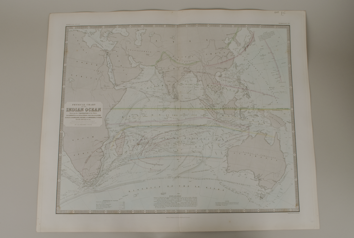
‘PHYSICAL CHART
OF THE
INDIAN OCEAN
SHOWING THE TEMPERATURE of the Water,
the CURRENTS of the AIR and OCEAN, direction of the WIND,
districts of HURRICANES, REGIONS of the MONSOONS & TY-FOONS,
TRADE ROUTES &c.&c.
Extended from the Original Notes & Drawings of
PROFESSOR BERGHAUS, BERLIN,
BY A.K. JOHNSTON, F.R.G.S.’ (title of 5183.8, at left)
‘HYDROLOGY NO. 3’ (top rh corner of 5183.9)
‘PHYSICAL CHART
OF THE
PACIFIC OCEAN
OR GREAT SEA (MARE PACIFICO).
Showing the CURRENTS & TEMPERATURE of the Ocean
THE TRADE ROUTES &c.
Founded on the observations which have been made from
the time of Magalhaen to the Prussian Navigators.
Extended from the Original Designs of
PROFESSOR BERGHAUS, BERLIN,
BY A.K.JOHNSTON, F.R.G.S.’ (title of 5183.9, at top right)
Description Notes
19 printed plates, hand coloured to somewhat varying standards. Edges gilt, incomplete set from 1849 atlas. All good condition with a little spotting/browning except where otherwise stated.
5183.1: contour map showing the mountain systems of Europe
condition fair (some browning)
5183.2: map of the mountain chains in Asia and Europe with four insets: the ‘Raising of the ISLAND OF REGUAIN’, a ‘GEOLOGICAL MAP of JAVA’, a ‘Comparative View of the MEAN HEIGHT of the CONTINENTS.’ and the ‘VOLCANIC KINGDOM OF LUZON’.
condition good
5183.3 Mountain chains in North America
5193.4 Mountain chains of South America
5183.5 Illustrations of the glacier systems of the Alps and of glacial phenomena in general.
5183.6 Comparative views of remarkable geological phenomena (mostly volcanic)
5183.7 Physical chart of the Atlantic Ocean
5183.8 Physical chart of the Indian Ocean
5183.9 Physical chart of the Pacific Ocean
5183.10 Tidal chart of the British seas, some browning
5183.11 The river systems of Asia and Europe
5183.12 The river systems of America
5183.13 Humbolt’s system of isothermal lines, world map, extra centre fold
5183.14 Geographical distribution of the currents of the air, world map
5183.15 Hyterographic or rain map of the world, some labels underlined in pen
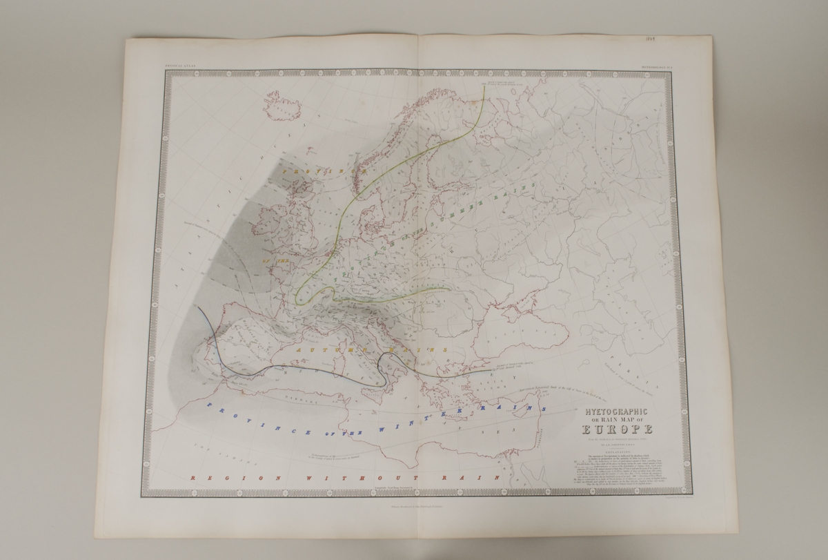
5183.16 Hyetographic or rain map of Europe
5183.17 Map of the lines of equal polarization in the atmosphere (N and S hemispheres)
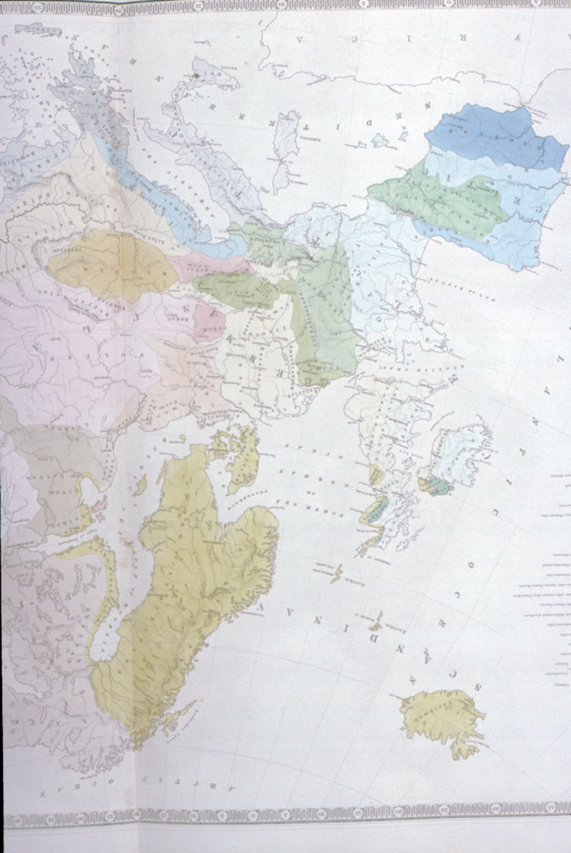
5183.18 Ethnographic map of Europe
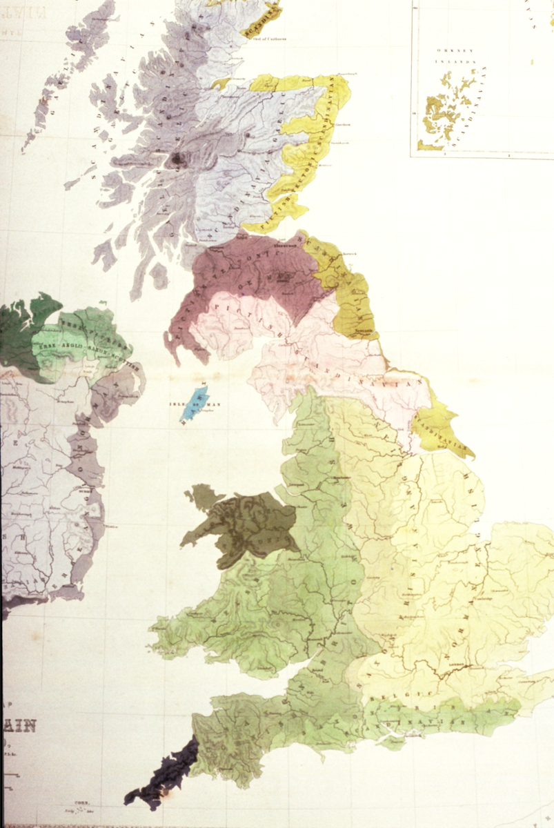
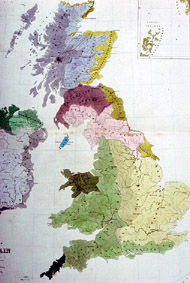
5183.19 Ethnographic map of Great Britain and Ireland
Condition good; complete
References
Allison Ksiazkiewicz; 'Mapping Weather and Modern Meteorology'; Explore Whipple Collections online article; Whipple Museum of the History of Science; University of Cambridge: https://www.whipplemuseum.cam.ac.uk/explore-whipple-collections/meteorology/mapping-weather-and-modern-meteorology
Events
FM:42132
Images (Click to view full size):