Accession No
2691
Brief Description
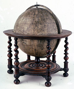
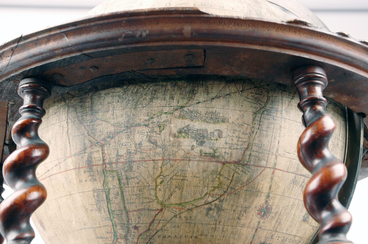
14-inch terrestrial globe, by Robert Morden, William Berry and Philip Lea, English, 1690
Origin
England; London
Maker
Morden, Robert Berry, William and Lea, Phillip
Class
cartography
Earliest Date
1690
Latest Date
1690
Inscription Date
Material
wood (mahogany); paper; metal (brass, iron)
Dimensions
540mm height, 550mm diameter
Special Collection
Provenance
On loan from King’s College, University of Cambridge, Cambridge, England.
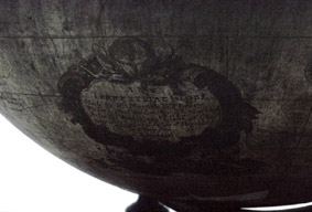
Inscription
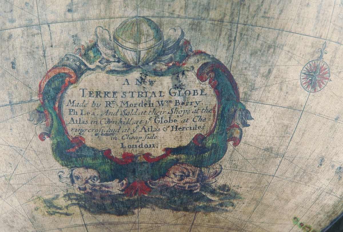
‘A New
TERRESTRIAL GLOBE
Made by Rt. Morden. Wm. Berry.
Ph Lea And Sold at their shops at the
Atlas in Cornhill at ye Globe at Che
ring cross, and at ye Atlas & Hercules
in Cheapside
London’
Description Notes
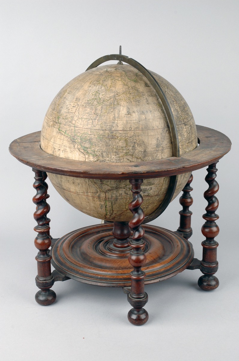
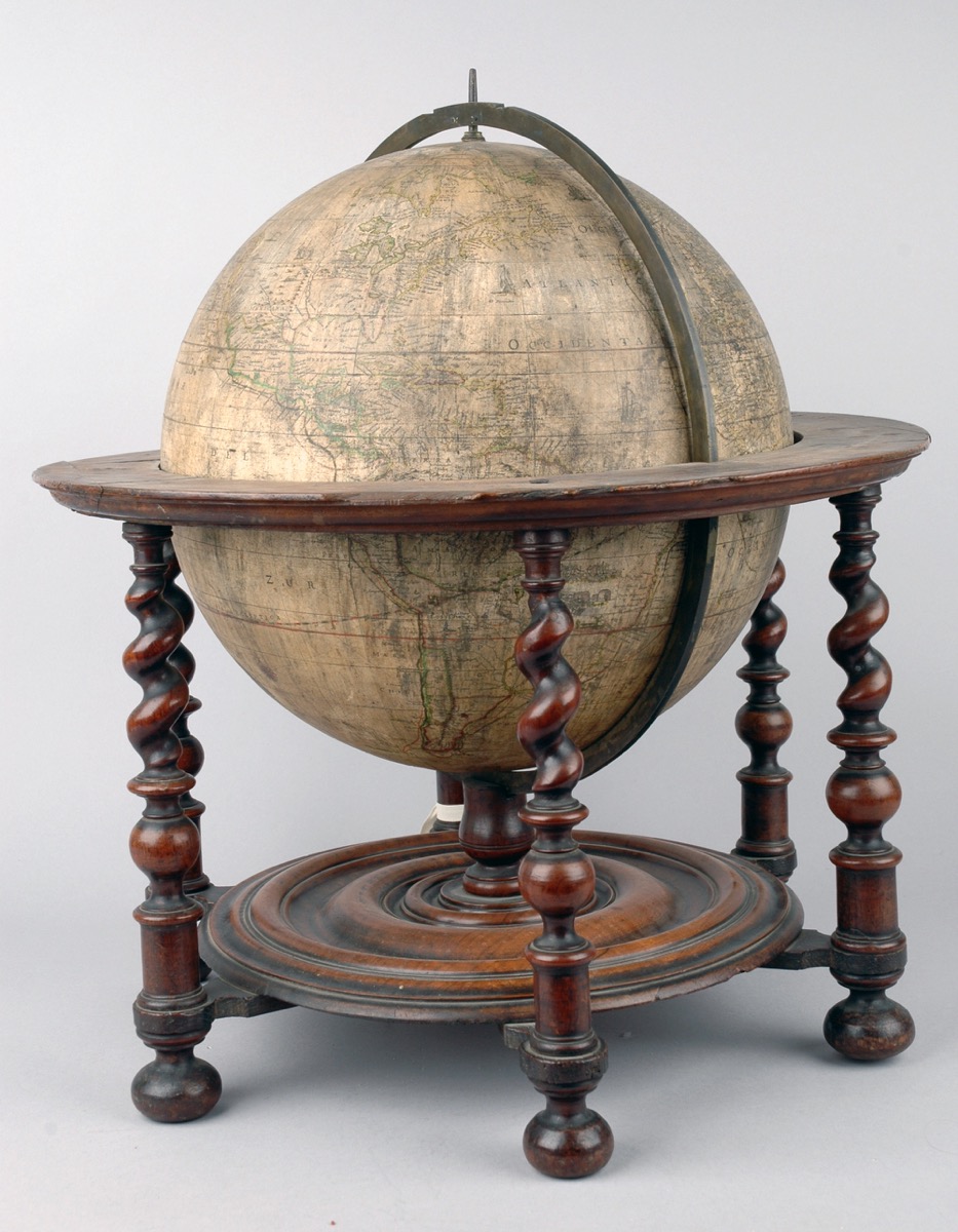
14-inch terrestrial globe by Robert Morden, William Berry and Philip Lea, London, 1690. Plaster sphere with paper gores.
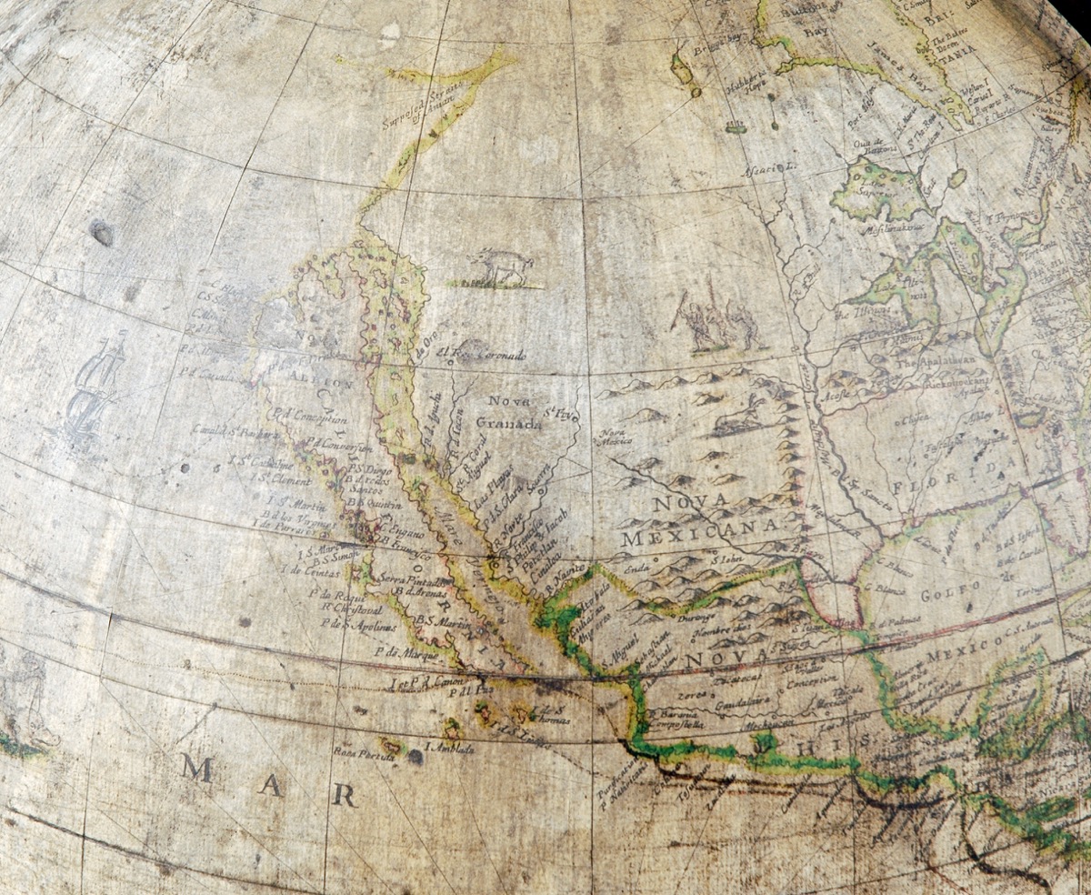
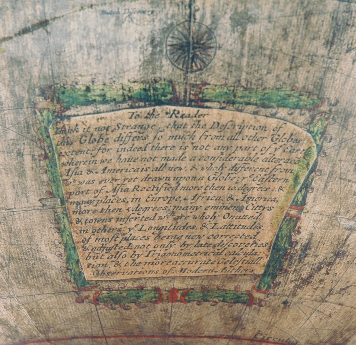
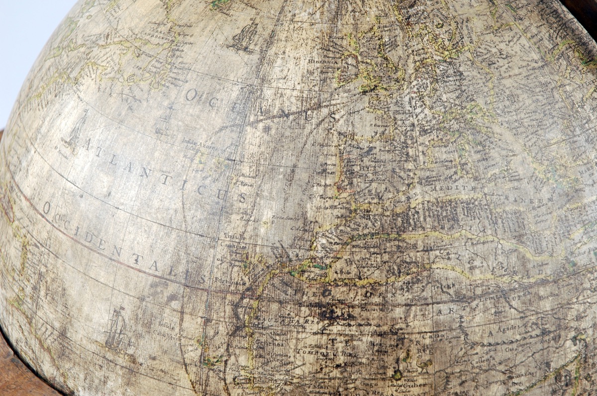
12 engraved and hand-coloured gores, with separate calottes (pole pieces). Cartouche for dedication and note ‘to the reader’ on separate pieces. Iron axis. Brass complete meridian circle divided from the poles 0 - 90˚ - 0 - 90˚ - 0, subdivided to 1˚. Marks routes of Sir Francis Drake and Sir Thomas Cavendish. Horizon circle with groove for meridian circle. Engraved paper surface with 32 compass points; signs of the zodiac, months, divided into days for Julian and Gregorian calendars. Grooves in meridian circle at pole (? for hour circle now missing). Mounted on 6 spiral turned legs and turned mahogany base.
References
Emma Perkins; 'A celebration of navigation: famous voyages depicted on a globe'; Explore Whipple Collections online article; Whipple Museum of the History of Science; University of Cambridge; 2009: https://www.whipplemuseum.cam.ac.uk/explore-whipple-collections/globes/celebration-navigation-famous-voyages-depicted-globe
Events
Description
Robert Morden (c.1650–1703), William Berry (1639–1718) and Philip Lea were globe makers who worked both as individuals and as a partnership, and had each apprenticed with Joseph Moxton (1667–1691). The famous diarist Samuel Pepys (1633–1703) and microscopist Robert Hooke (1635–1703) were both customers of the partnership and Lea was employed by Pepys to stain and colour his collection of maps. This terrestrial globe is constructed of wood and covered in twelve paper gores (tapered shapes designed to fit the surface of the sphere) and two polar calottes (circular caps). The gores have been printed from copper engravings and hand-tinted. Another example of this globe design exists at the National Maritime Museum, Greenwich.
Having been used as aids for sea merchants since the twelfth century, the role of maps in navigation practices had been well established by the seventeenth century; however, the use of the globe for this purpose diminished during this later period for three reasons: the difficulty of making accurate measurements around a curved surface, the small scale of the map that infringed on cartographic detail and the fragile nature of the object. This globe by Morden depicts the circumnavigation of Sir Francis Drake (1540–1596) and Thomas Cavendish (1560–1592), which suggests that the object was intended to encourage others to explore and expand commercial enterprises. It is also possible that this globe was a reference tool used to plan and visualize trade routes and the location of ships enroute. The politics of the spice trade meant that the English were seeking more convenient routes to Asia that circumvented the high taxes required for crossing overland routes through Arabic Empires and the long route around Cape Horn. As the Morden globe included navigational illustrations such as ships, compass points and rhumb lines, in addition to the celebrated English voyages outlined above, this object demonstrated the importance of global exploration in the late seventeenth century and reflects an intellectual trend that stressed up-to-date observations brought back from explorers.
14/01/2014
Created by: Allison Ksiazkiewicz on 14/01/2014
FM:43172
Images (Click to view full size):