Accession No
0457
Brief Description
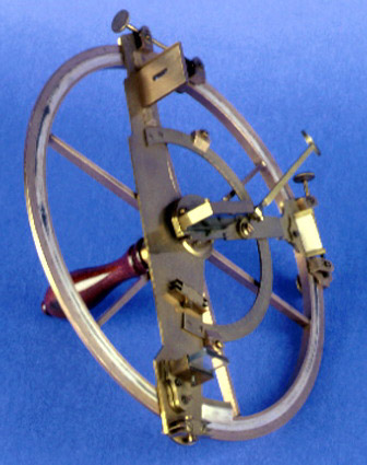
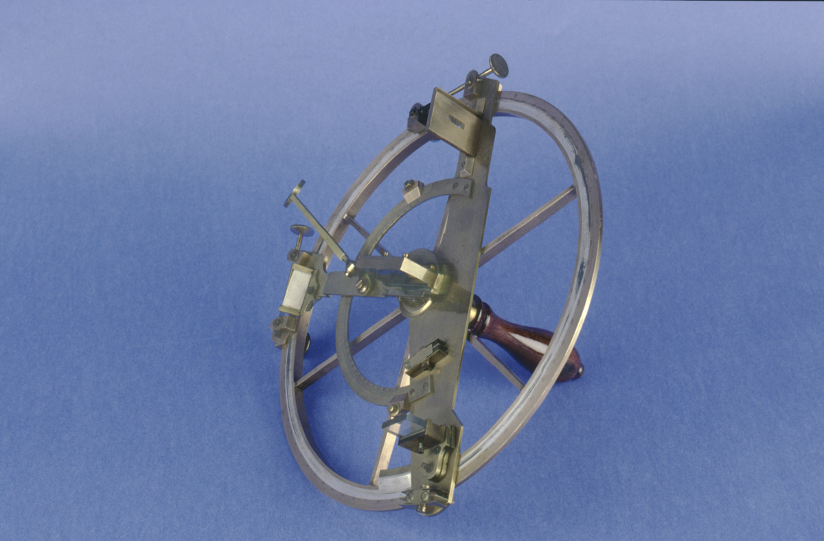
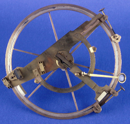
Borda-type repeating reflecting circle, Henri-Prudence Gambey, French, 1825 (c)
Origin
France; Paris
Maker
Gambey, Henri-Prudence
Class
navigation; astronomy
Earliest Date
1825
Latest Date
1825
Inscription Date
Material
metal (brass, silver); glass; ivory; wood
Dimensions
diameter 270mm; height 185mm
Special Collection
Robert Whipple collection
Provenance
Purchased from T.H. Court on 05/03/1929.
Inscription
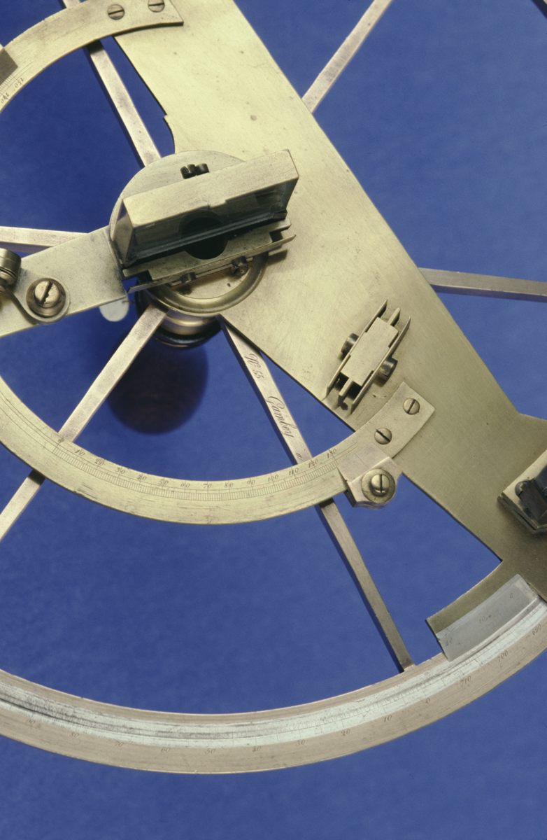
‘No. 55 Gambey a Paris.’
Description Notes
Borda-type repeating reflecting circle, Gambey, France, c. 1825, brass.
Index mirror. Brass index arm, reading glass on hinged subsidiary arm, ivory shade for reading vernier, type-B vernier on silver, clamp and tangent screws. Brass arm carries horizon glass, type-B vernier on silver, inner arc divided on brass by degrees 150 - 0, 0 - 130 with 2 brass cursors, mounts for telescope (missing) and two shades (missing), clamp and tangent screws. Silver outer 720˚ scale, divided by degrees, subdivided to 20’, and numbered 0 - 710 by 10˚. Limb supported by radial spokes. Wooden handle screws into threaded mount on reverse.
References
Events
Description
The reflecting circle was a navigation instrument used to establish a ship’s longitude at sea. It did this by measuring the distance between the moon and certain stars, a technique known as the lunar distance method.
The moon changes position relative to the fixed stars in a predictable (though complex) manner. If you had accurate tables of the moon’s motion, then you could use the moon’s position against the stars as a type of clock. A navigator could use the reflecting circle to measure the height of a particular star and of the moon, and then the angle between the moon and the star. He would then look up the time at Greenwich that these measurements corresponded to. By comparing the time at Greenwich with the local time (which could be found by measuring noon from the sun’s highest position), the navigator could calculate how far he was from Greenwich in degrees of longitude.
The lunar distance method had been proposed since the seventeenth century, but it did not become feasible until the mid eighteenth century because astronomers lacked a theory to describe the complicated motions of the moon, and also because there were no instruments precise enough to use at sea. However, the calculations needed to establish longitude from lunar distance were still difficult and time-consuming. It was easier to find the longitude by taking an accurate chronometer set to Greenwich time and comparing it to local time, and this was the method which was eventually adopted by most navigators.
02/05/2008
Created by: Dr. Jenny Downes on 02/05/2008
FM:43398
Images (Click to view full size):