Accession No
1604
Brief Description
5.5-inch celestial ‘Starfinder’ globe in wooden case, by Cary and Company, English, 1925 (c)
Origin
England; London; 7 Pall Mall
Maker
Cary and Company
Class
astronomy
Earliest Date
1925
Latest Date
1925
Inscription Date
Material
paper; metal (brass); wood
Dimensions
box height 212mm; breadth 200mm; depth 203mm
Special Collection
Provenance
Purchased from J. Bell Ltd., Bridge Street, Aberdeen, Scotland, in 12/1971.
Inscription
‘CARY & CO
Makers to the Admiralty
7, PALL MALL
LONDON’ (cartouche)
‘CARY LONDON Patn No 2154o’ (horizon circle)
Description Notes
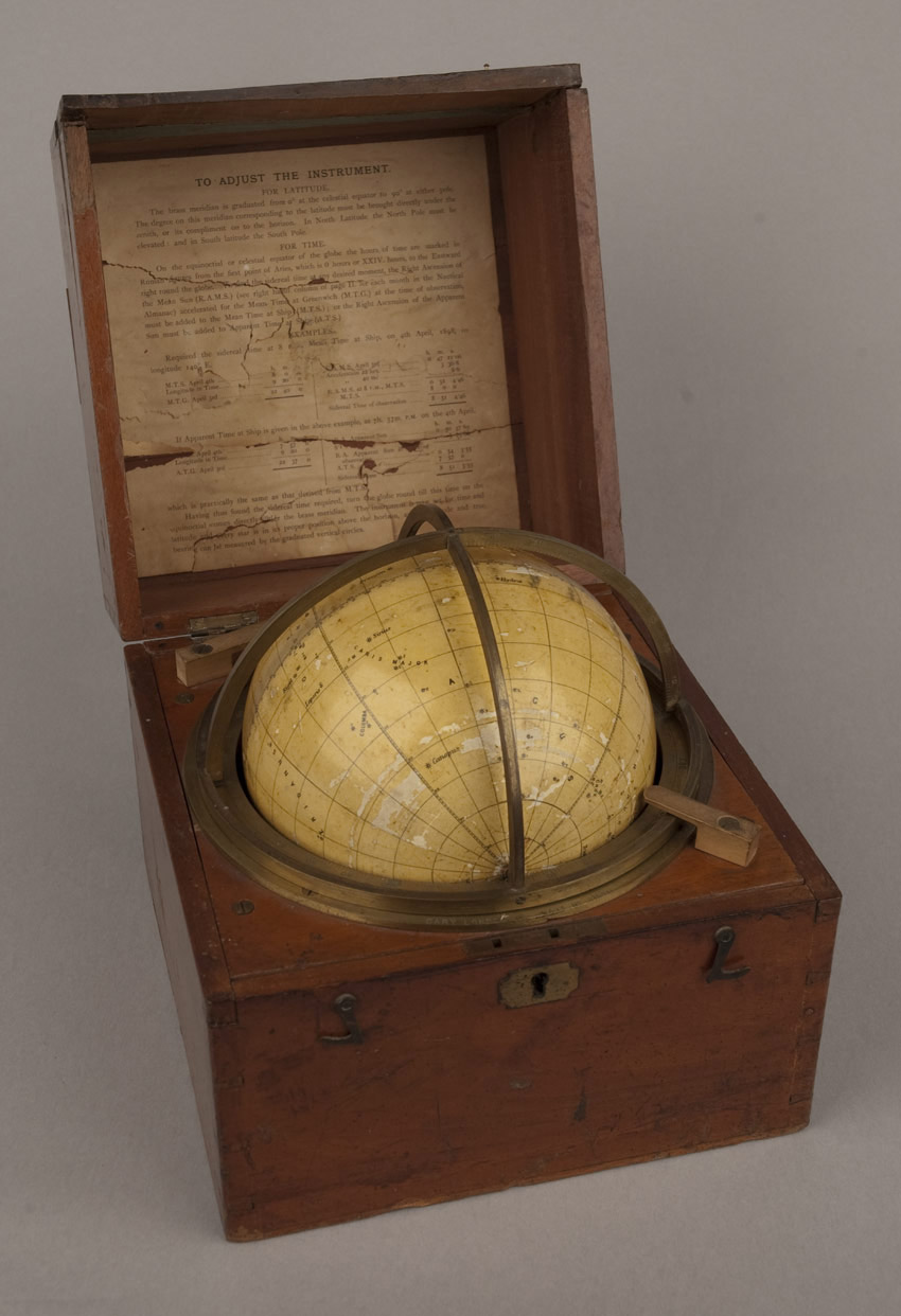
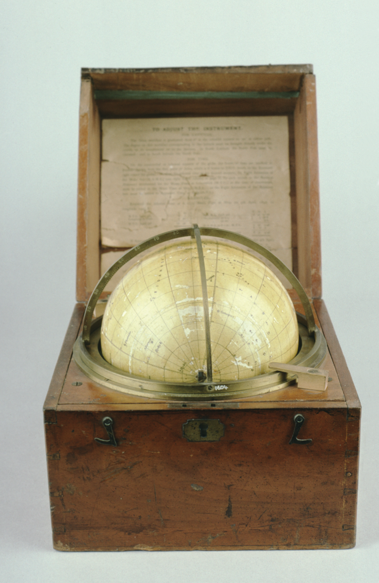
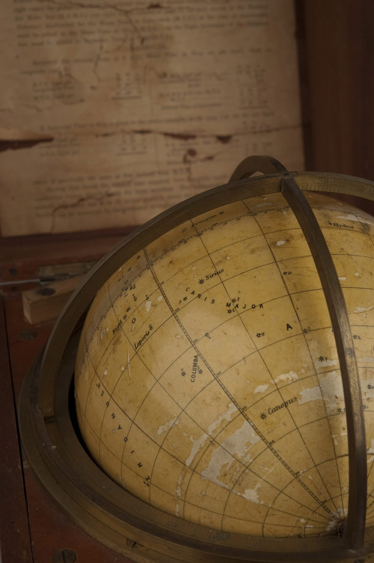
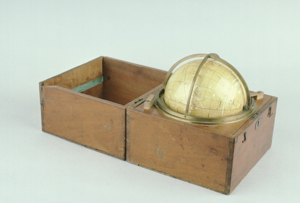
5.5-inch celestial globe in wooden case, by Cary & Co., London, c. 1925. Plaster sphere with printed paper gores.
12 engraved paper gores with pole pieces. Varnished (varnish flaking). Major constellations and navigational stars to 5th magnitude (key to magnitudes in cartouche). Celestial equator marked with hours I - XXIV. Brass meridian semi-circle, supports globe in fitted box. Brass horizon circle in box, divided 0 - 90˚ - 0 - 90˚ - 0, numbered by 10˚, subdivided to 1˚; 16 compass points. Brass meridian quadrants divided 0 - 90˚ on limbs (? original).
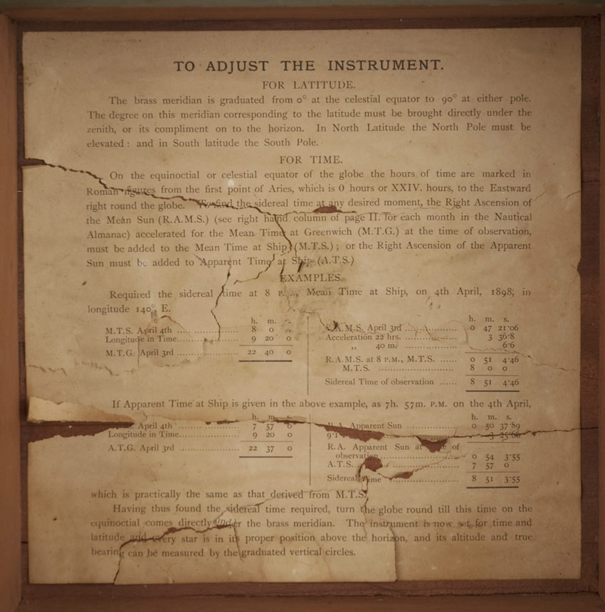
Label of instructions in lid.
References
Katie Taylor; 'Identifying stars at sea'; Explore Whipple Collections online article; Whipple Museum of the History of Science; University of Cambridge; 2009: https://www.whipplemuseum.cam.ac.uk/explore-whipple-collections/globes/identifying-stars-sea
Events
Description
This globe, designed by a Lieutenant English, was intended to aid with the identification of stars for use in navigation at sea. Only the most important navigational stars that are visible to the naked human eye are shown, and the globe is fitted in a small box to protect the delicate plaster sphere from damage in rough seas. Celestial globes modelled the heavens and the location of stars in relation to one another. Used to chart the location of the Earth in the universe and for geodesic calculations, these globes were useful in solving navigational and astronomical problems. The introduction of new printing technologies into the map-making industry rendered globes more widely available than earlier periods.
14/01/2014
Created by: Allison Ksiazkiewicz on 14/01/2014
FM:43519
Images (Click to view full size):