Accession No
2969
Brief Description
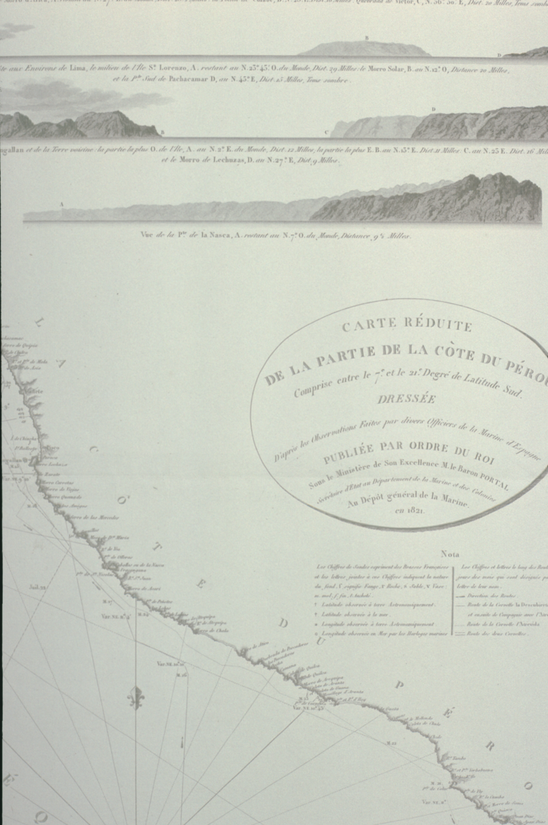
sea chart, coast of Peru, by J. Walker, English, 1820
Origin
Maker
Vicq [map engraver] Walker, J. [sea chart engraver]
Class
prints; cartography
Earliest Date
1820
Latest Date
1820
Inscription Date
1820
Material
Dimensions
map (mounted) breadth 720mm; height 1020mm; sea chart height 965mm; breadth 717mm
Special Collection
Provenance
Purchased from Robert Douwma Prints & Maps Ltd, Covent Garden, London, 21/09/1984.
Inscription
‘A
Chart
of the
COAST OF PERU
from
POINT PASAMAYO to POINT NEGRA
including the
ROAD CALLAO
Taken from the Spanish Surveys Published in the
Hydrographical Office
MADRID
in
1811.’ (title)
‘Published according to Act of Parliament by Capt. Hurd R.N. Hydrographer to the Admiralty June 12th 1820.’ (bottom centre)
‘J. Walker Sculpt.’ (bottom right)
Description Notes
Chart; printed black and white; shows the coast of Peru from Point Pasamayo to Point Negra; mounted.
Condition: good; complete.
References
Events
FM:45155
Images (Click to view full size):