Accession No
6157
Brief Description
cartographic fire screens, by Jean Lattré, French, 1775 (c)
Origin
France
Maker
Lattré, Jean
Class
cartography
Earliest Date
1775
Latest Date
1775
Inscription Date
Material
paper (card); wood (walnut)
Dimensions
Length 450mm; width 244mm; height 10mm
Special Collection
Provenance
Purchased from Tesseract, Box 151, Hastings-on-Hudson, New York 10706, on or before 14/08/2007.
Inscription
‘A Paris chez Lattré rue St Jacques à la Tille de Bordeaux
Avec Privilege du Roi’ (bottom of map of Africa)
‘A Paris ches Lattré Graveur, rue S. Jacques près la fontaine S. Séverin, à la Tille de Bordeaux, Avec Priv. du Roi’ (bottom of map of Europe)
Description Notes
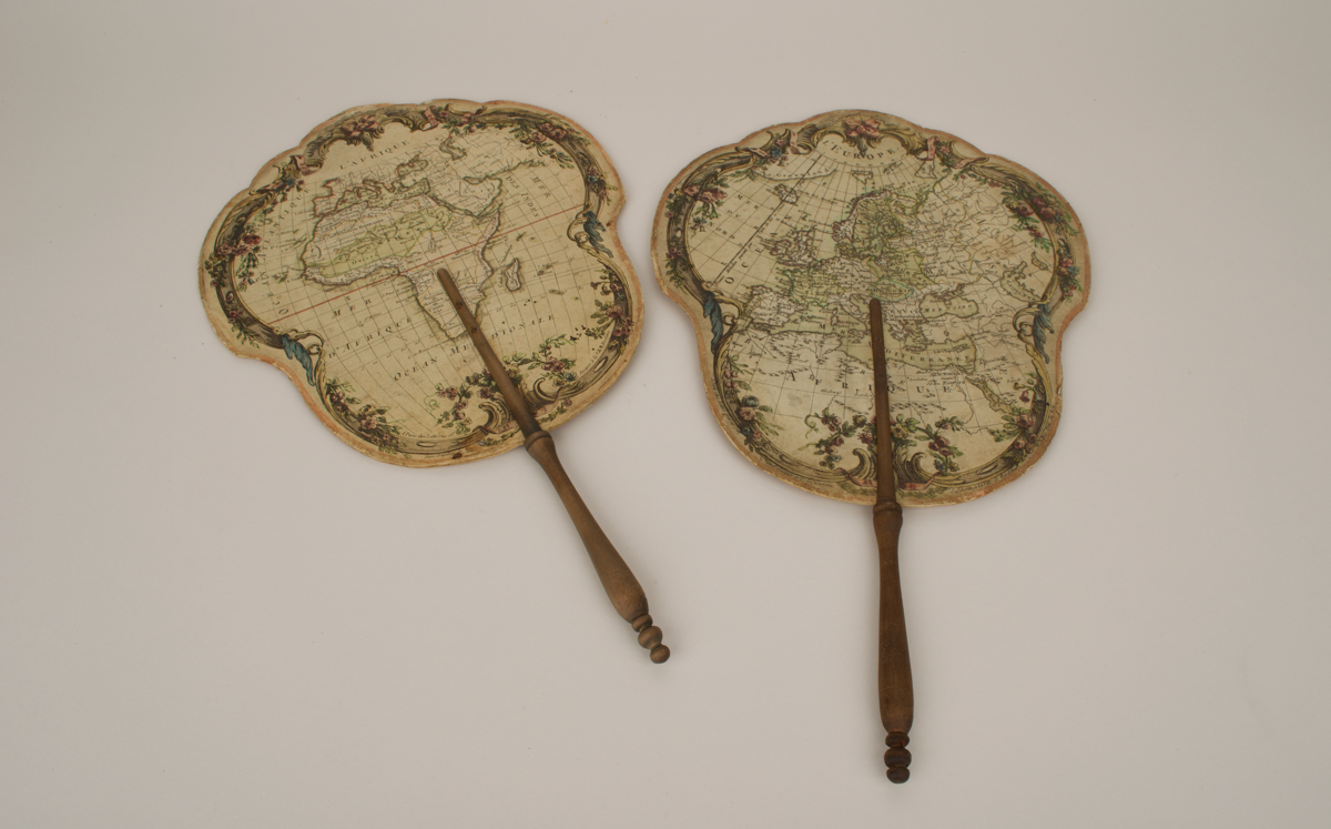
2 cartographic fire screens, French, 1755 (c).
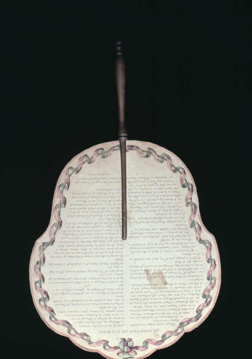
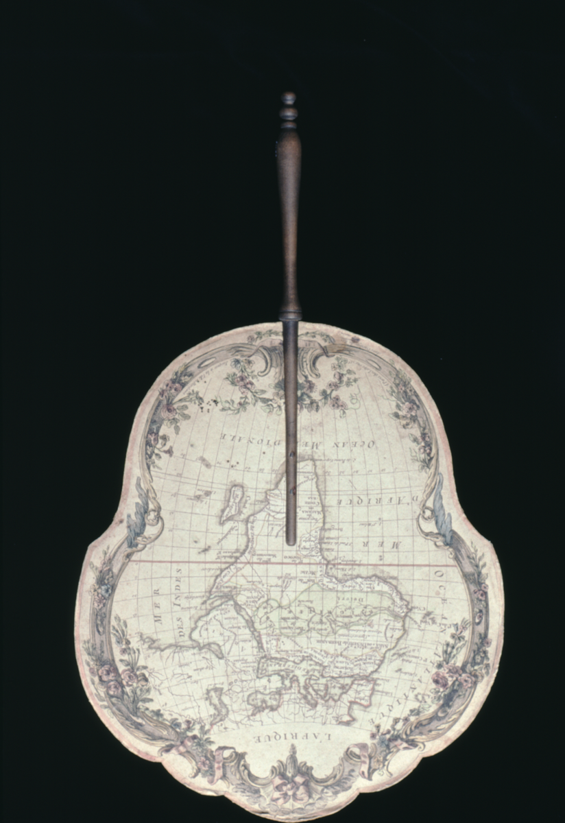
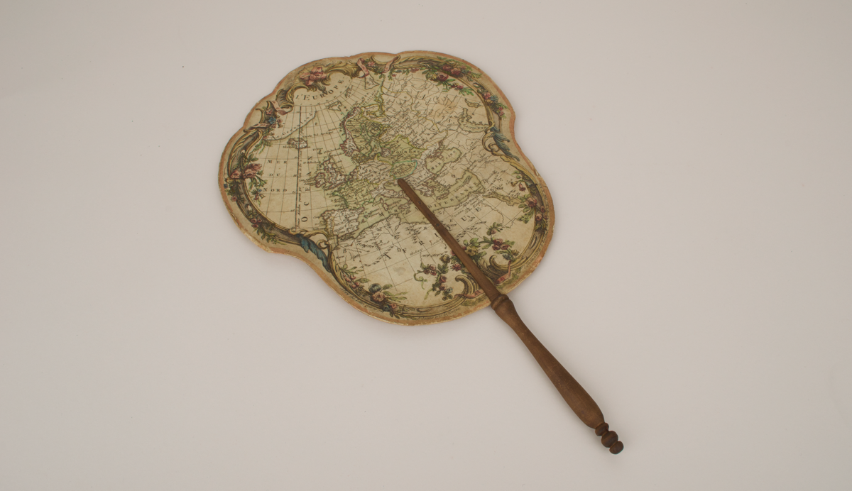
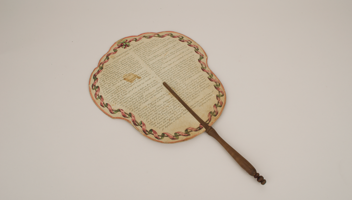
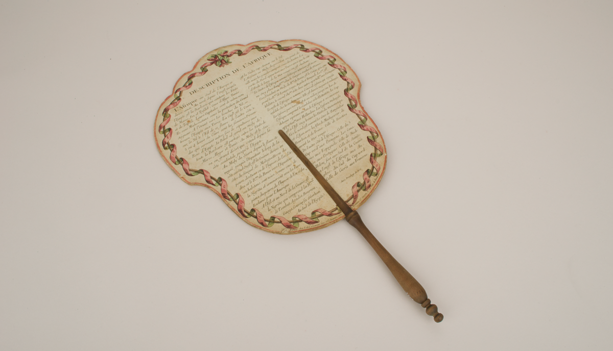
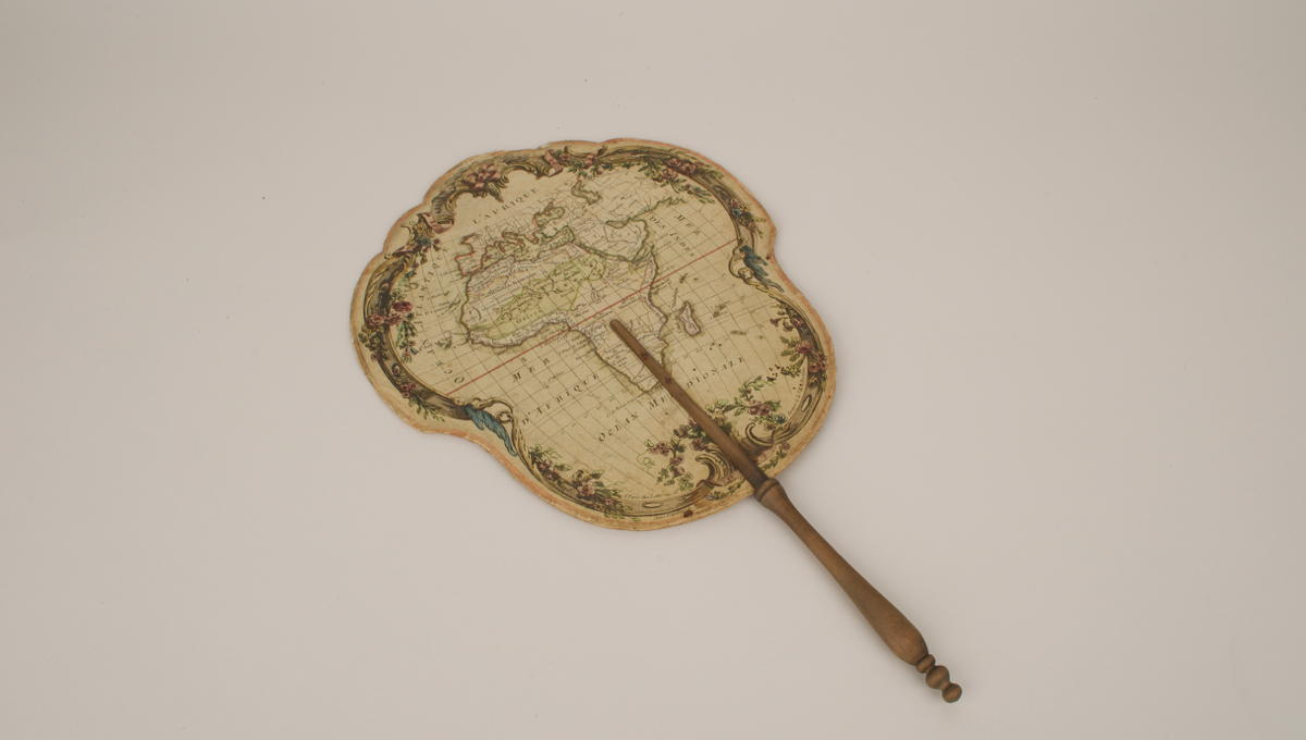
Both screens have a map on one side (one of Europe and one of Africa) and a description of that continent on the reverse. Hand coloured. Mounted with a turned wood handle.
The maps have many political and some geographic features labelled in French, surrounded by borders of flowers and ribbons.
6157.1: Map of Europe. On the reverse, Europe is described as divided into 10 large regions: three to the North (the British Isles, Scandinavia and Russia); four in the middle (Hungary, Poland, Germany and France); and a final three (Spain, Italy and Turky). The areas are then descibed in terms of their smaller elements (in the case of e.g. the British Isles), where their capitals are positioned and what river they are on, and some additional information, for example the residency of the Pope in Rome.
6157.2: Map of Africa. The description on the reverse has more colourful details than the European, e.g. on the pyramids. The people and commerce of West Africa are described: ‘..ses habitants sont noirs comme ceux de la Nigritie et commercent avec les Européen, du poivre, de l’hyvoir, de l’or et des Esclaves pour l’Amerique’. Details are also given of which areas belong to which European countries.
Jean Lattré was at times engraver to the King and to Monsieur le Dauphin, and produced many maps with the cartographer Rigobert Bonne. His name is on maps from 1762 to 1791.
Good/fair condition.
On both screens there are several points where the paper around the edge is peeling.
References
Events
Description
Fire screens like this one would be held in front of the face whilst sitting by the fire. This was especially the case for ladies, to prevent the heat from ruining their makeup.
FM:46620
Images (Click to view full size):