Accession No
6212
Brief Description
4 French cartographic puzzles, with the original box cover; circa 1870
Origin
Paris; France
Maker
Jullien
Class
cartography; games
Earliest Date
Latest Date
Inscription Date
Material
Paper; wood
Dimensions
300mm x 215
Special Collection
Provenance
Purchased from an individual on or before 17/03/2008. The set was purchased at the Marché du Livre Ancien, Parc Georges Brassens, Paris.
Inscription
Jullien, Éditeur
Paris
Description Notes
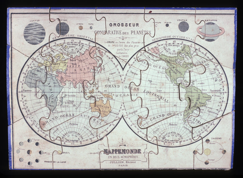
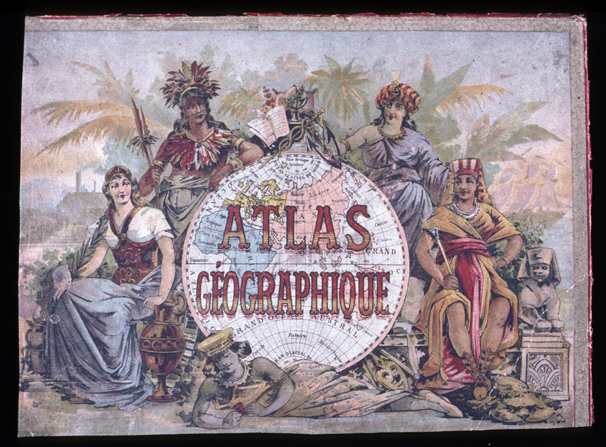
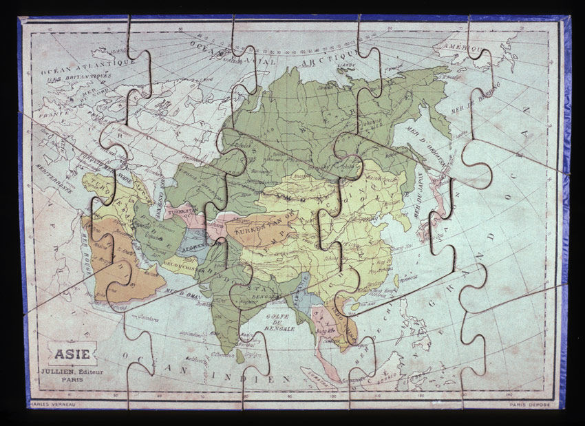
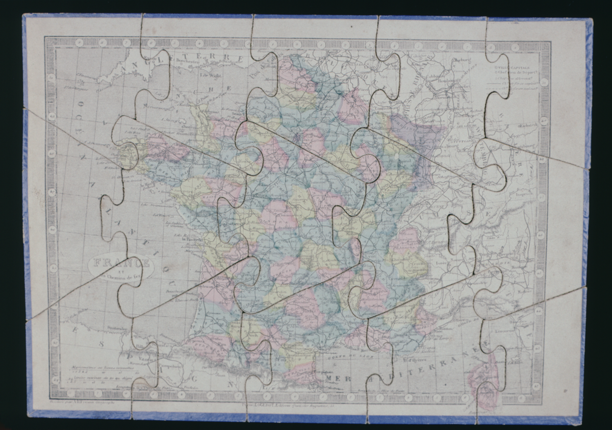
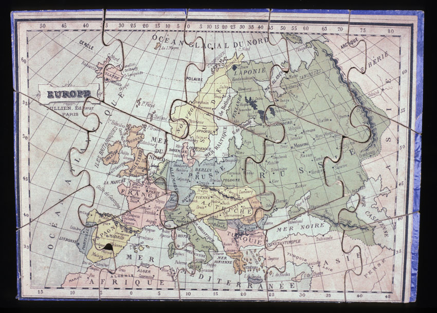
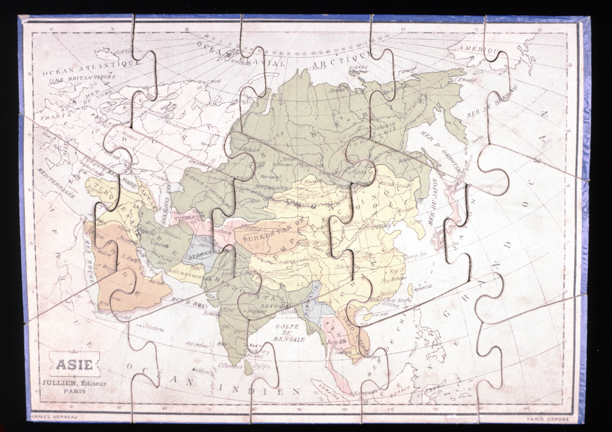
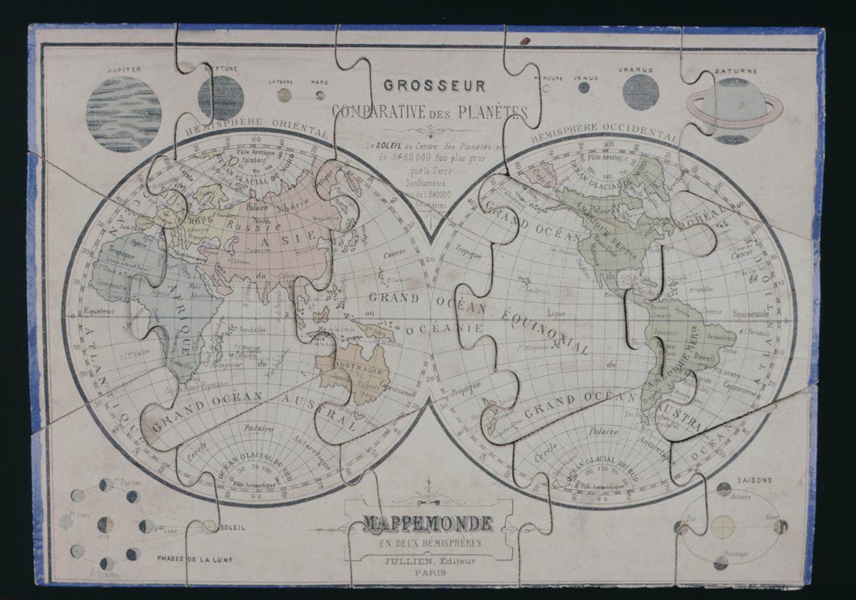
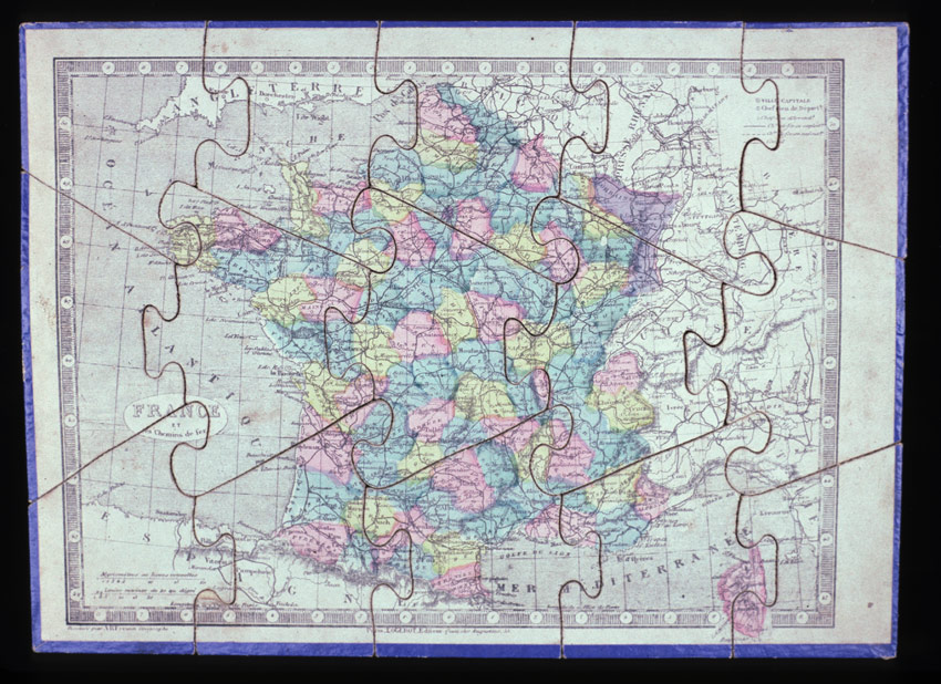
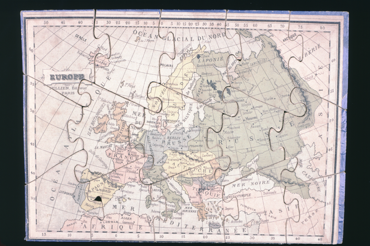
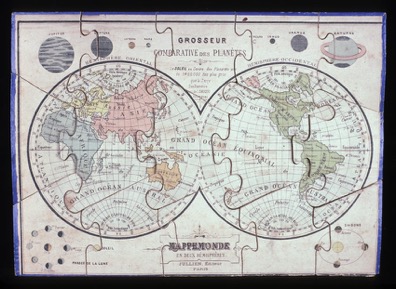
Box cover title: “Atlas Géographique”. Four maps: “Asie”, “Mappemonde, en deux hémisphères”, “Europe”, and “France, et de chemin de fer”. Each map consists of 15 pieces; paper covered wood, with a blue border. “Asie” has the additional inscription “Charles Verneau” in the bottom-left corner. The “mappemonde” has a comparison of the planets, and diagrams illustrating the phases of the moon and the seasons.
Jullien published, in 1867, a larger puzzle map of Europe, one example of which is held at the British Library. The division of countries on these maps is consistent with roughly that date.
Condition: acceptable. The cover has been removed from the box, and the set is doubtless incomplete; in addition, the maps have become badly warped, especially the “mappemonde”.
References
Events
Description
This wooden puzzle map is part of a set made in France towards the end of the nineteenth century. Although the map bears no date, the inclusion of Bosnia, Serbia, and Romania (which only gained independence after the 1878 Treaty of Berlin), and the absence of Luxembourg (which gained independent from Belgium in 1890) suggests the map was produced between these dates.
FM:46683
Images (Click to view full size):