Accession No
6360
Brief Description
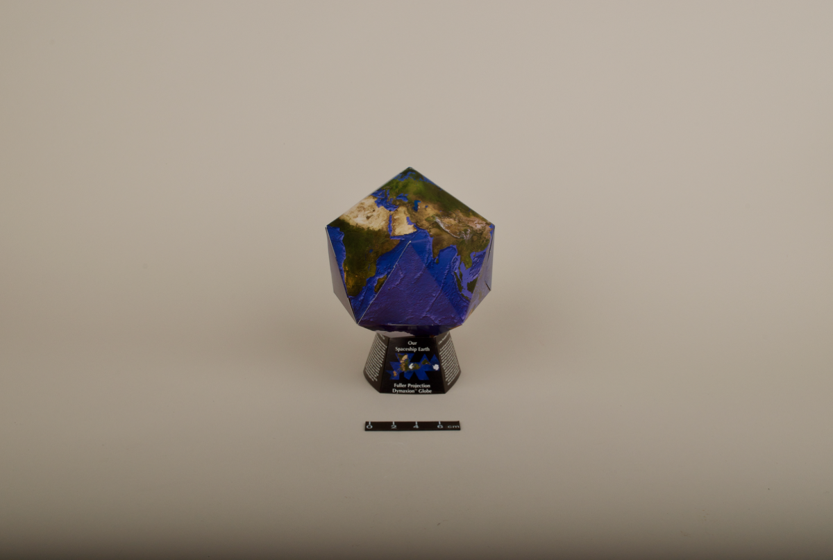
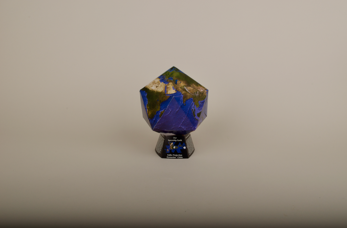
Dymaxion terrestrial globe kit, including two maps, ‘OUR SPACESHIP EARTH’, designed according to Buckminster Fuller’s 1946 Dymaxion projection, by Jim Knighton, Clear Light Image Products, U.S.A., 2002
Origin
U.S.A.; California; Verdugo City
Maker
Knighton, Jim Clear Light Image Products Buckminster Fuller Institute
Class
cartography; demonstration
Earliest Date
2002
Latest Date
2002
Inscription Date
2002
Material
Colour printed recycled card
Dimensions
[card] 360mm x 590mm [plastic envelope] 650mm x 520mm
Special Collection
Provenance
Purchased from the Whitney Museum, U.S.A., on or before 13/08/2008.
Inscription
[title] OUR SPACESHIP EARTH
[on tab of globe map] (c) 2002 Buckminster Fuller
Institute and Jim Knighton
[in lower left] INSTRUCTIONS FOR ASSEMBLY [instructions follow]
[on base card] Our Spaceship Earth
Fuller Projection Dymaxion TM Globe [text follows]
[on right of base card] Our Spaceship Earth Dymaxion TM Globe is published by the Buckminster Fuller Institute . (c) 2002 Buckminster Fuller Institute and Jim Knighton. All Rights Reserved.
Image created by Jim Knighton, Clear Light Image Products, Box 513, Verdugo City, CA 91046; Coordinate transformation software written by Robert W. Gray and modified by Jim Knighton.
The word Dymaxion and the Dymaxion map design are trademarks of the Buckminster Fuller Institute. R. Buckminster Fuller and the Shoki Sadao Cartographers.
For more information on the Fuller Projection of the work of Buckminster Fuller contact: Buckminster Fuller Institute, www.bfi.com, 800-967-6277, info@bfi.org.
Dymaxion = Dynamic + Maximum + Tension
Description Notes
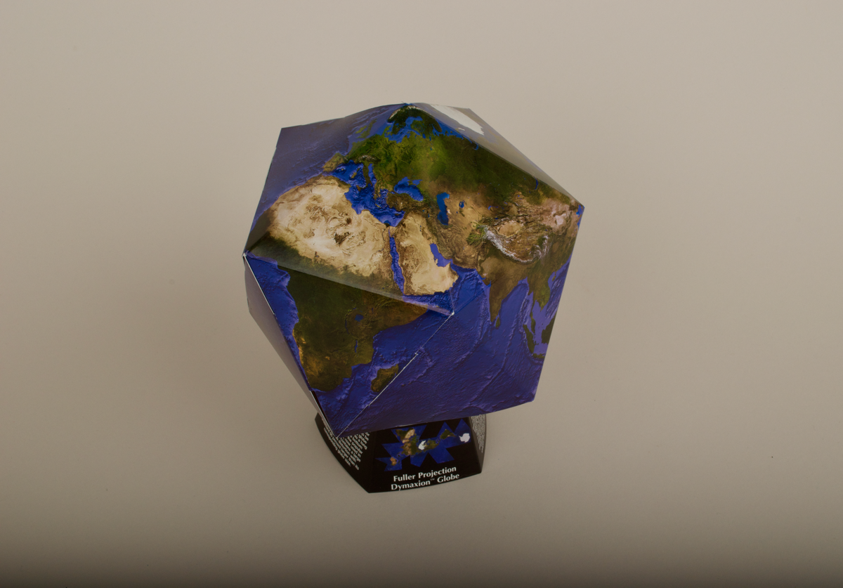
Dymaxion globe kit, ‘OUR SPACESHIP EARTH’, designed according to Buckminster Fuller’s 1946 Dymaxion projection, 2002, USA.
The kit comprises a plastic envelope containing a sheet of white card printed with a colour projection of the earth scored into around 22 triangular scored sections which can be detached and folded to form a ‘Dymaxion’ (i.e. projected onto a modified icosahedron with minimal distortion) globe. The card also has a fold-out base, which has panels bearing inscriptions explaining the projection, Buckminster Fuller’s aims, and the map’s and globe’s copyright.
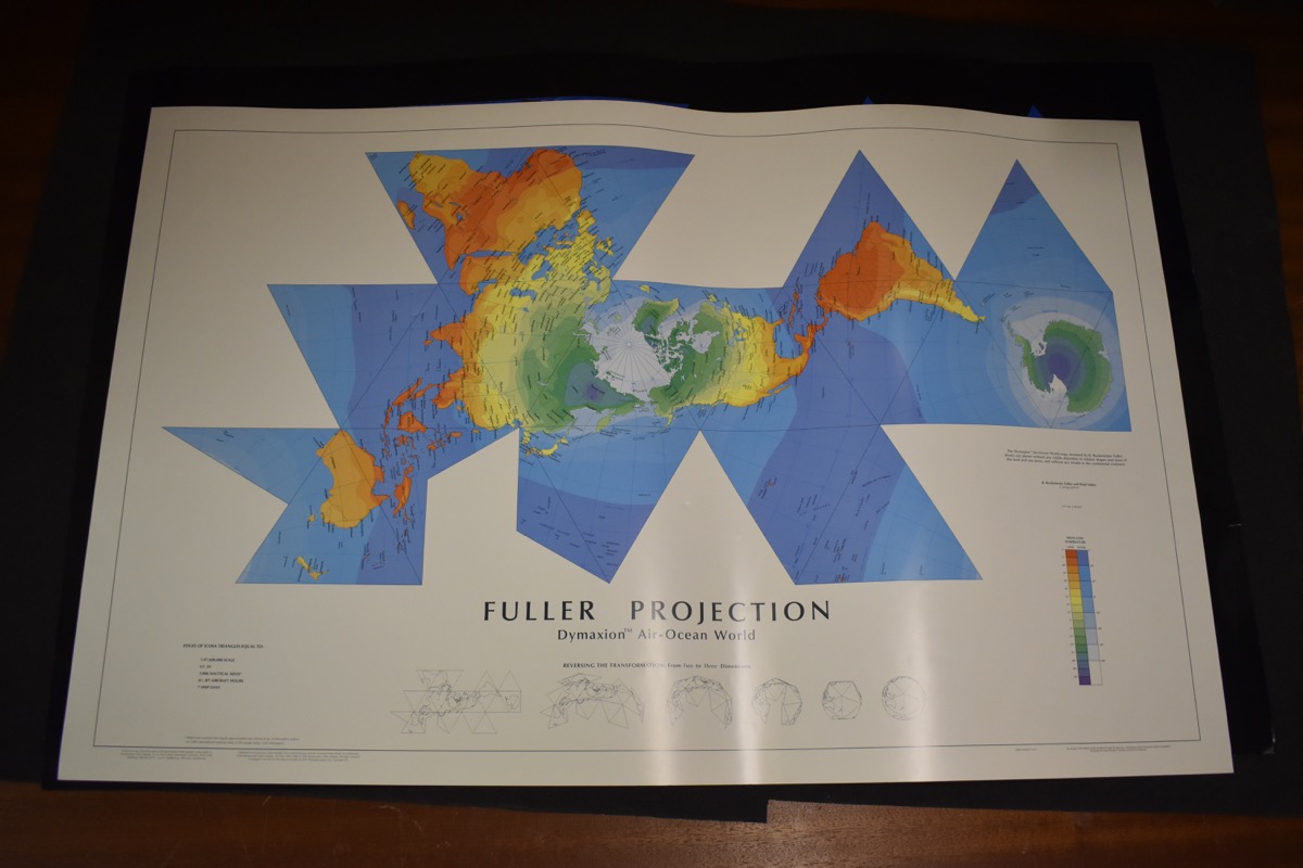
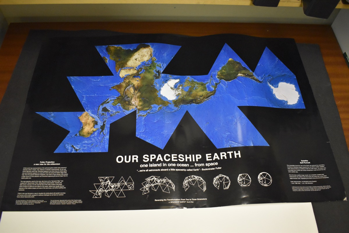
Two posters entitled 'Fuller Projection/DymaxionTM Air-Ocean World' and 'Our Spaceship Earth/one island in one ocean...from space' are included in the lot.
Copyright 2002 Buckminster Fuller Institute and John Knighton. Bought from the Whitney Museum, USA.
References
Events
Description
In 1946 the inventor, architect and author Buckminster Fuller patented a new map projection called the Dymaxion map, which projects the surface of the earth onto a series of interconnected triangles. The resulting network of triangles can be folded up to form the polyhedral globe. Fuller’s map projection has the advantage of avoiding much of the distortion that results when the spherical surface of the Earth is projected to make a rectangular map. Fuller also argued that, by having no ‘right’ or ‘wrong’ way up, and by showing continental land-masses without artificial splits, his projection provided a more realistic image of the Earth’s surface than traditional maps. The globe kit comprises a plastic envelope containing a sheet of white card printed with a colour projection of the Earth. The card is scored into around 22 triangular scored sections, which can be detached and folded to form a Dymaxion map.
14/01/2014
Created by: Allison Ksiazkiewicz on 14/01/2014
FM:46841
Images (Click to view full size):