Accession No
6369
Brief Description
compensating polar planimeter in green box, by Keuffel and Esser Company, U.S.A., c. 1938
Origin
U.S.A.
Maker
Keuffel and Esser Company
Class
cartography; earth sciences; surveying; calculating; drawing
Earliest Date
1938
Latest Date
1962
Inscription Date
Material
metal (steel, other); wood; paper (card, cardboard, other); cloth (baise); plastic.
Dimensions
Box: height 50 mm; width 235 mm; depth 95 mm
Special Collection
Tjeerd Van Andel collection
Provenance
Donated by an individual from the Department of Earth Sciences, University of Cambridge, Downing Street, Cambridge, CB2 3EQ, 16/07/2009.
Inscription
‘97871’
(top surface of tracer arm)
KEUFFEL & ESSER CO. N.Y.
4236’
(top surface of fitted case)
‘KEUFFEL & ESSER CO. N.Y. MADE IN USA’
(top side of pole arm)
‘10 [square] “ ’
(upper surface of testing rule)
Description Notes
Compensating polar planimeter in green box, Keuffel & Esser Co., c.1938, with fixed tracer arm, pole arm, testing rule, and instruction manual
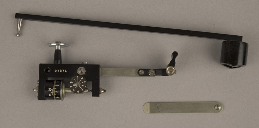
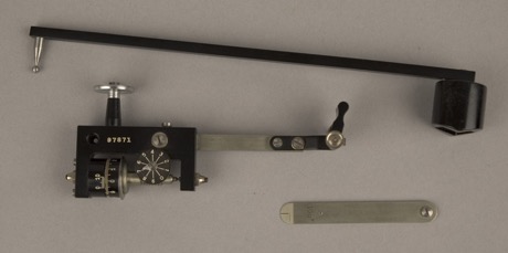
Pole arm consists of a black steel beam; one vertex has a cylindrical weight with a short anchoring spike on its underside; the other vertex has a silver steel spike mounted with a ball at its tip which forms a ball joint with the carriage of the tracer arm.
Fixed tracer arm: main black steel carriage contains a silver measuring roller with drumhead scale and vernier; attached to the measuring wheel is a black registering dial (reads from 0 to 9) with a silver pointer; carriage also contains several silver screws for adjustment and a socket that forms a ball joint with the pole arm; protruding from the top side of the carriage is a silver wheel to provide lateral support for measuring wheel; attached to the right of the carriage is a silver steel beam, at the end of which is a silver spike (tracer) and a black metal hinge.
Testing rule is a silver metal thin beam with the inscription ‘10 [square] “ ’ on its upper surface.
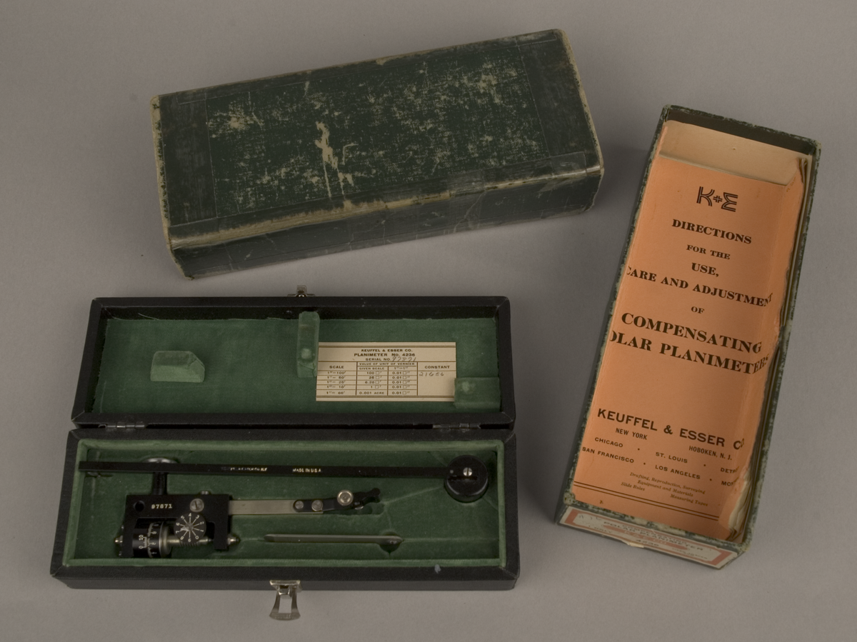
Leatherette-covered fitted wooden box lined with green baise; box contains a label on its inside with a unit conversion table for the cernier.
Outer green cardboard box; reinforced with sellotape; sticker on side of box reads:
‘#16 (written in pen) COMPENSATING
POLAR PLANIMETER
K&E CO.
Stanford (written in pencil)
1 ONLY 4236 FIXED TRACER ARM
MADE IN U.S.A. REG. U.S. PAT. OFF.’
Instruction manual is sixteen pages long, has an orange cover, and reads as follows on the front:
‘K+E
DIRECTIONS
FOR THE
USE,
CARE AND ADJUSTMENT
OF
COMPENSATING
POLAR PLANIMETERS
KEUFFEL & ESSERS CO.
NEW YORK HOBOKEN, N.J.
CHICAGO . ST. LOUIS . DETROIT
SAN FRANCISCO . LOS ANGELES . MONTREAL
Drafting, Reproduction, Surveying
Equipment and Materials
Slide Rules Measuring Tapes’
Condition: object good, box fair; complete; outer box is well worn; paint on some inscriptions has been lost.
References
Events
Description
Planimeters are mechanical instruments designed to measure the area bounded by a closed curve (i.e., the mathematical operation of integration). They were initially developed in Europe during the first half of the nineteenth century to improve the accuracy with which surveyors estimated areas of plots of land with irregular shapes. However, the design of planimeters became of interest to engineers, physicists (including James Clerk Maxwell), and mathematicians alike, and in the 1850s Jakob Amsler developed the polar planimeter. Amsler’s planimeter had a more elegant design than it’s predecessors, utilising two pivoted metal rods in place of more complicated arrangements of rotating discs or cones. Amsler’s design has undergone several modifications since its initial conception - for instance, in the 1880s, Gottlieb Coradi added a smooth wheel that rolls across the surface being measured, allowing uneven surfaces to be measured more accurately - and Amsler’s business continued to produce different variants of his planimeter until his death in 1912.
This particular instrument was sold by Keuffel & Esser Co. and used by Professor Tjeerd Van Andel (Department of Earth Science, University of Cambridge) as an instrument in the production and reading of geological maps.
18/08/2009
Created by: Coxhead, M.A. on 18/08/2009
FM:46882
Images (Click to view full size):