Accession No
6501
Brief Description
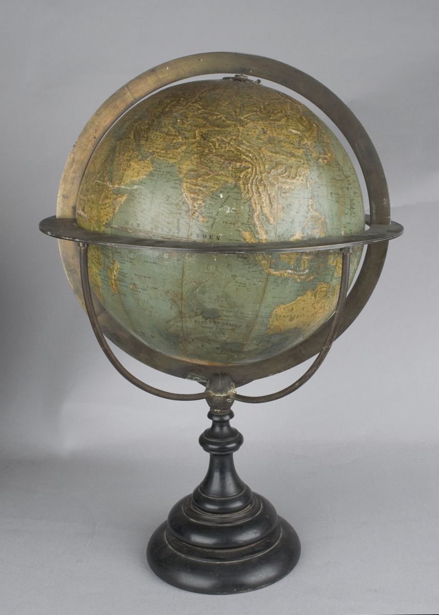
12-inch terrestrial topographical (relief) globe, by Thury and Belnet, French, 1860
Origin
France; Dijon
Maker
Thury and Belnet
Class
cartography
Earliest Date
1860
Latest Date
1860
Inscription Date
1855
Material
metal (brass, cast-bronze); wood (ebonized), plaster (?); paper
Dimensions
height 580mm; maximum diameter 430mm
Special Collection
Provenance
Purchased from Christie's South Kensington, 85 Old Brompton Road, London, SW7 3LD on or before 13/01/2012.
Inscription
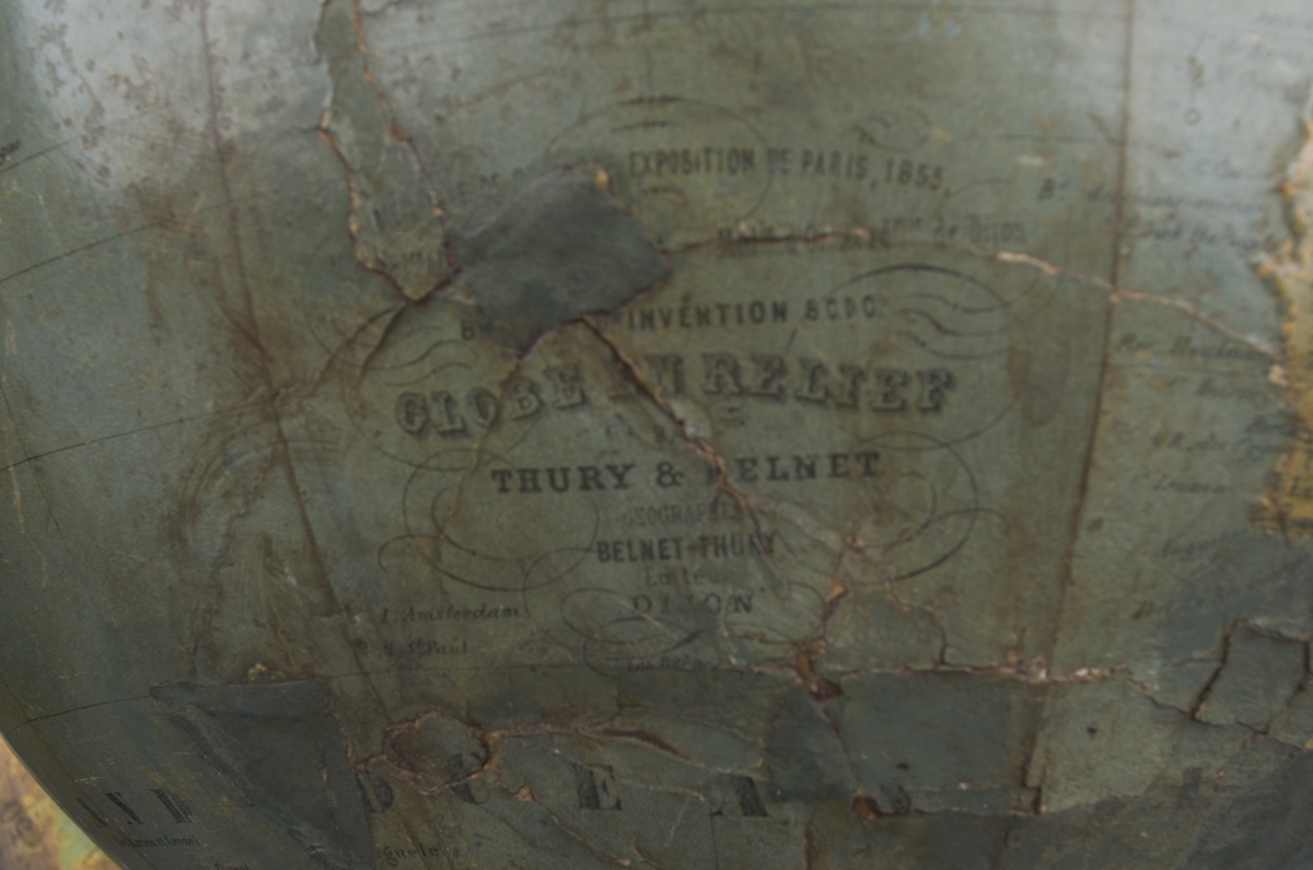
MéDAILLE [DE 2é CLASSE] EXPOSITION DE PARIS, 1855
[Mèd.le de 1re Classe, Expon de Dijon 1858.]
- Méd.le d'Or Acad.mie de Dijon
BREVET D'INVENTION S.C.D.C.
GLOBE EN RELIEF
PAR
THURY & BELNET
GÉOGRAPHES
BELNET-THURY
ÉDITEURS
DIJON
Description Notes
12-inch terrestrial topographical (relief) globe, by Thury and Belnet, French, 1860.
Plaster (?) sphere with two sets of twelve chromolithographed raised gores and two polar calottes. The equatorial has divisions for degrees but is unlabelled; the meridian of Paris is similarly shown. Land is coloured yellow, oceans coloured green. Topographical variation is shown in relief. Nomenclature is in French.
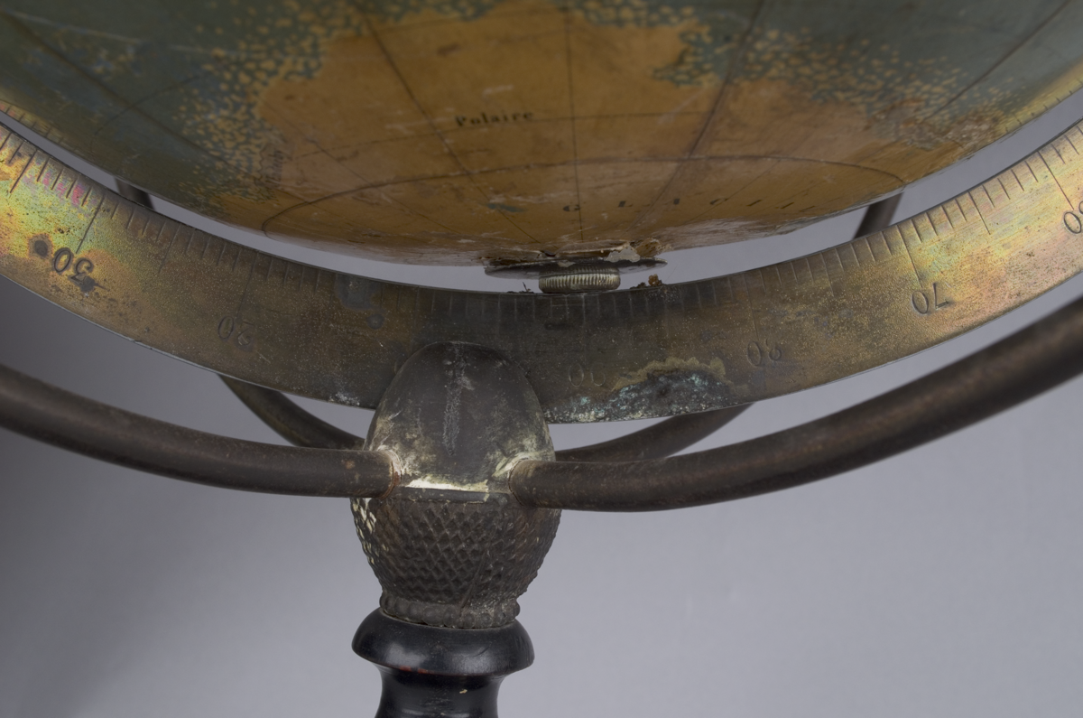
Brass hour dial at the North Pole; tapering cast-bronze support; ebonised and turned column; stepped circular plinth base.
Complete.
References
Events
Description
This terrestrial globe is unique for the representation of the relative height of the Earth’s topography using a relief technique. Its inscription states that this globe won prizes in the Paris Exposition in 1855 and Dijon Exposition in 1859. Produced by the French globe-makers Thury and Belnet, this plaster sphere is covered with two sets of chromolithographed gores and two polar calottes. The nomenclature is in French and the meridian of Paris is shown. Terrestrial globes modelled the Earth’s movements in relation to the stars, Sun and Moon, and promoted interest in exploration and charting the surface of the globe. Having been used as aids for sea merchants since the twelfth century, the role of maps in navigation practices had been well established by the seventeenth century; however, by the end of early modern period the use of globes as navigational tools diminished. In the nineteenth century, the role of the globe turned from astronomical to geographical study as the importance of the Earth’s surface was increasingly emphasized. During this period, terrestrial globes were used increasingly as teaching aids for geography lessons.
14/01/2014
Created by: Allison Ksiazkiewicz on 14/01/2014
FM:47011
Images (Click to view full size):