Accession No
6632
Brief Description
teaching diagrams and related science ephemera, by James Reynolds and Sons, English, mid-19th Century
Origin
England; London
Maker
James Reynolds and Sons
Class
ephemera; demonstration; astronomy; geography; natural history; dials;
Earliest Date
1849
Latest Date
1889
Inscription Date
Material
paper (paper, card); cotton (string); metal (brass, steel?)
Dimensions
6632.1: 285mm (width) x 230mm (height) 6632.2: 230mm (width) x 285mm (height) 6632.3: 230mm (width) x 285mm (height) 6632.4: 230mm (width) x 285mm (height) 6632.5: 285mm (width) x 220mm (height) 6632.6: 220mm (width) x 280mm (height) 6632.7: [folded] 217mm (width) x 282mm (height) 6632.8: 147mm (width) x 266mm (height) 6632.9: At the widest point - 230mm diameter 6632.10: 220mm (width) x 275mm (height) 6632.11: 140mm (width) x 215mm (height) 6632.12: 140mm (width) x 215mm (height) 6632.13: 140mm (width) x 215mm (height) 6632.14: 144mm (width) x 227mm (height) 6632.15: 142mm (width) x 223mm (height) 6632.16: 142mm (width) x 223mm (height) 6632.17: 140mm (width) x 208mm (height) 6632.18: 130mm (width) x 200mm (height) 6632.19: 64mm (width) x 104mm (height) 6632.20: 64mm (width) x 104mm (height) 6632.21: 75mm (width) x 122mm (height) 6632.22: 115mm (width) x 90mm (height) 6632.23: 100mm (width) x 65mm (height) 6632.24: 93mm (width) x 192mm (height)
Special Collection
Provenance
Purchased from an individual seller via www.fleaglass.com on or before 14/04/2016.
Inscription
6632.25: 164mm (width) x 203mm (height)
Description Notes
Teaching diagrams and related science ephemera, by James Reynolds & Sons, English, mid 19th century.
In good/fair condition.
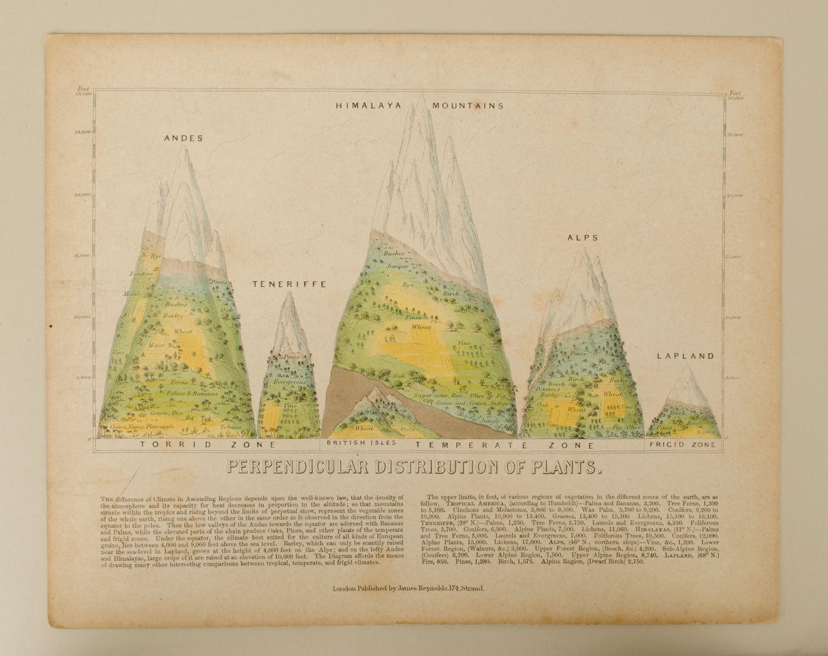
6632.1: Teaching diagram in card, 'Perpendicular Distribution of Plants.' Lithograph demonstrates a comparison between the differences in climate, plant growth, and altitude in mountain ranges in the Andes, Tenerife, the Himalayas, the Alps and Lapland.
In good/fair condition. Complete.
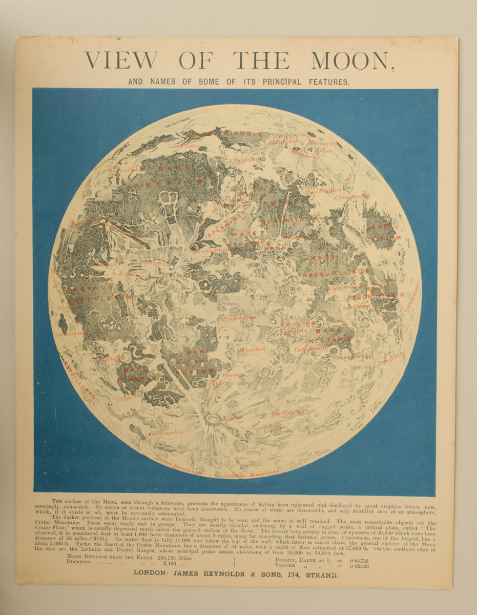
6632.2: Teaching diagram in card, 'View of the Moon, and Names of Some of its Principal Features.' Lithograph illustrates the features of the Moon with their names in red with some explanation below with sizes of the features.
In good condition. Complete.
6632.3: Teaching diagram in card, 'Magna Charta.' Copy of the text from the Magna Carta, accompanied by crests around edge.
In good condition. Complete.
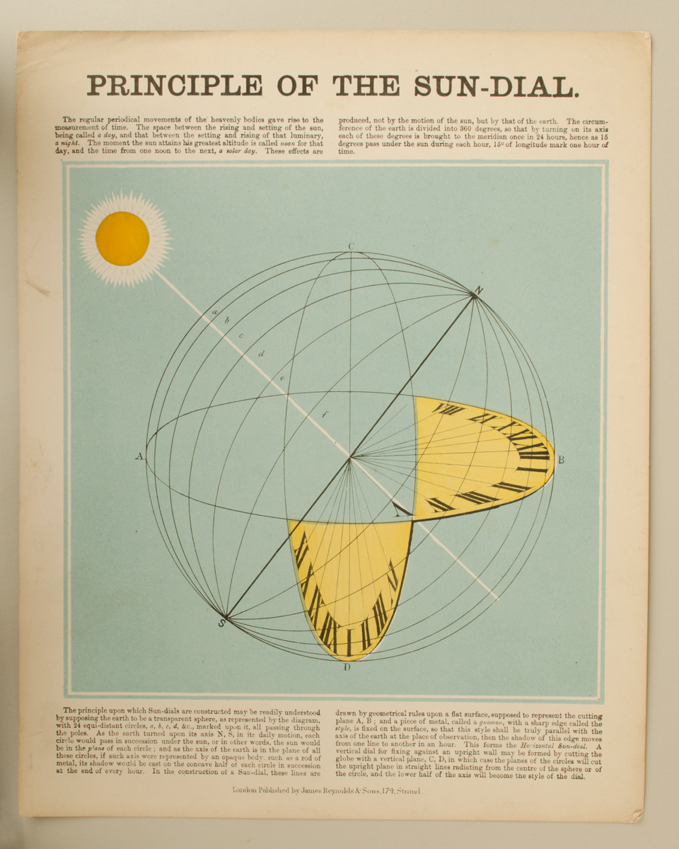
6632.4: Teaching diagram in card, 'Principle of the Sun-Dial.' Lithograph diagram showing the principle of the construction of the sundial, in which the Earth is a transparent sphere. Text explains relationship between time and the movement of celestial bodies as well as the principle.
In good condition. Complete.
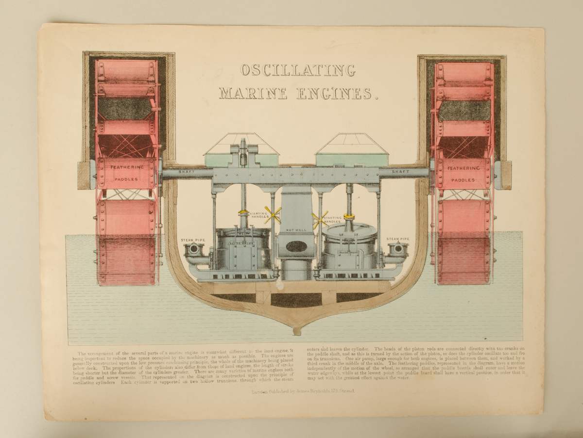
6632.5: Teaching diagram in paper, 'Oscillating Marine Engines.' Lithograph showing cross section of oscillating marine engines with text explaining further.
In good condition. Complete.
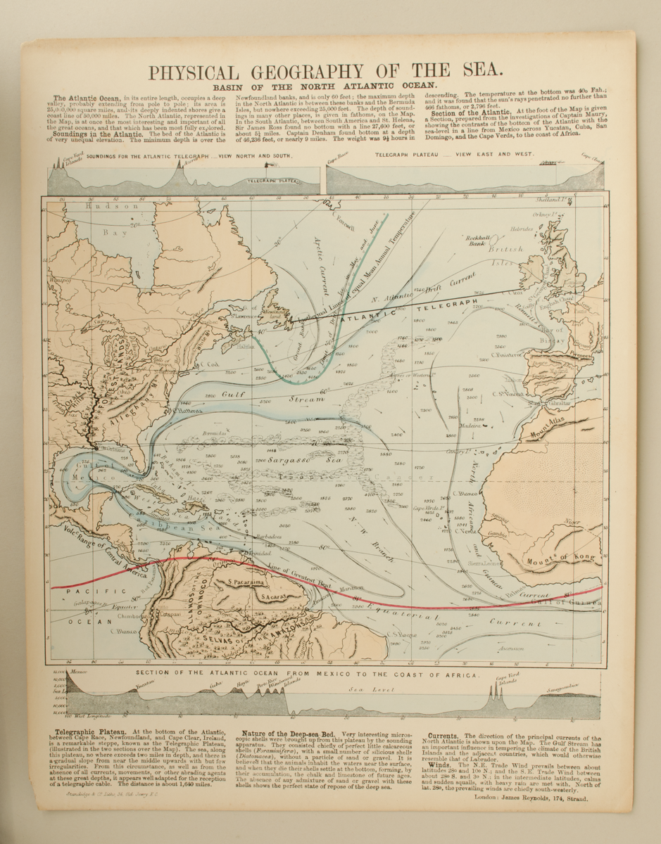
6632.6: Teaching diagram in paper, 'Physical Geography of the Sea. Basin of the North Atlantic Ocean.' Lithograph shows map of the Atlantic Ocean with directions of currents, winds, and gulfs. Above the map are diagrams of soundings for the Atlantic Telegraph and Telegraph Plateau and below is a cross section of the Atlantic Ocean from Mexico to the Coast of Africa. Text explains some statistics pertaining to the Ocean: its depth at different points, information relating to the Soundings in the Atlantic, and the nature of the deep-sea bed.
In good condition. Complete.
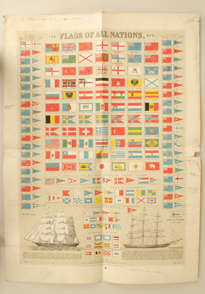
6632.7: Large draft teaching diagram in thin card, 'The Flags of All Nations', annotated with notes for improvements, c. 1881. Includes the flags of the British Yacht Clubs; flags of principal Foreign Yacht Clubs; flags of the Commercial Code of Signals; flags of the Marryat's Code and Signals for pilots. At the bottom on the left is an illustration of 'A Ship's Sails' and on the right 'Spars & Riggings of A Ship'. Lithograph by Ralph Welland. Notes on how to improve the colour handwritten around the edges.
In fair condition. Complete.
6632.8: Folded teaching diagram in paper in green cover, 'The Stream of History, Showing at One View The Rise, Progress, and Fall of Empires, Nations, and States, From The Earliest Known Period to the Present Time.' Cost One Shilling. C. 1885. Lithographic illustration showing the birth of civilisation by the Anno Mundi calendar as it was created, beginning with Italians, Greens, Asia Minor, the Assyrians, Syrians, Phoenicians, Jews, Egyptians and Chinese. Folds out from cover.
In good condition. Complete.
6632.9: Part of a 'Movable Horizon arranged for The Chart of the Heavens.'
In good condition. Incomplete.
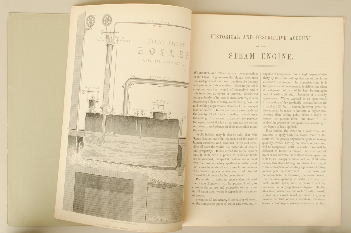
6632.10: 'Historical and Descriptive Account of The Steam Engine, Designed to Convey A Popular Idea of its Principle and Mode of Action.' Designed to assist understanding with 'A Companion to Reynold's Large Diagrams of the Condensing and Locomotive Engines. Eight pages.
In good condition. Complete.
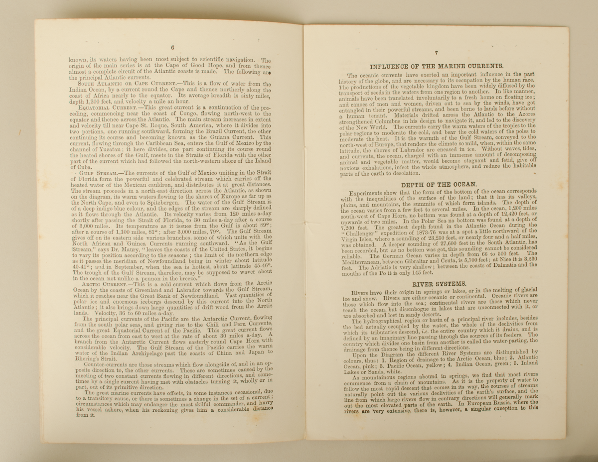
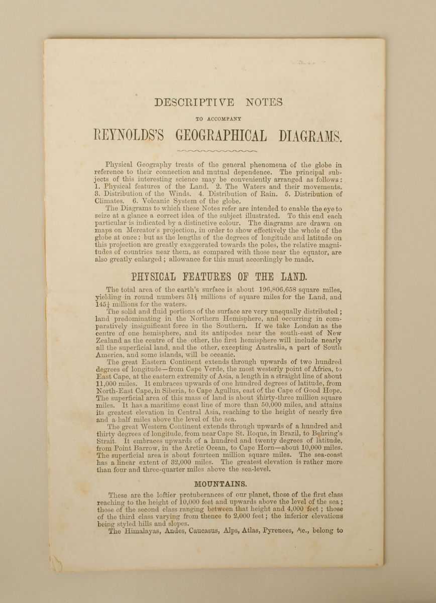
6632.11: Educational booklet in paper. 'Descriptive Notes to Accompany Reynold's Geographical Diagrams'. Sixteen Pages. Outlines the physical features of the land, the waters and their movements, distribution of the winds, distribution of the rain, distribution of climates and the volcanic system of the globe.
In good condition. Complete.
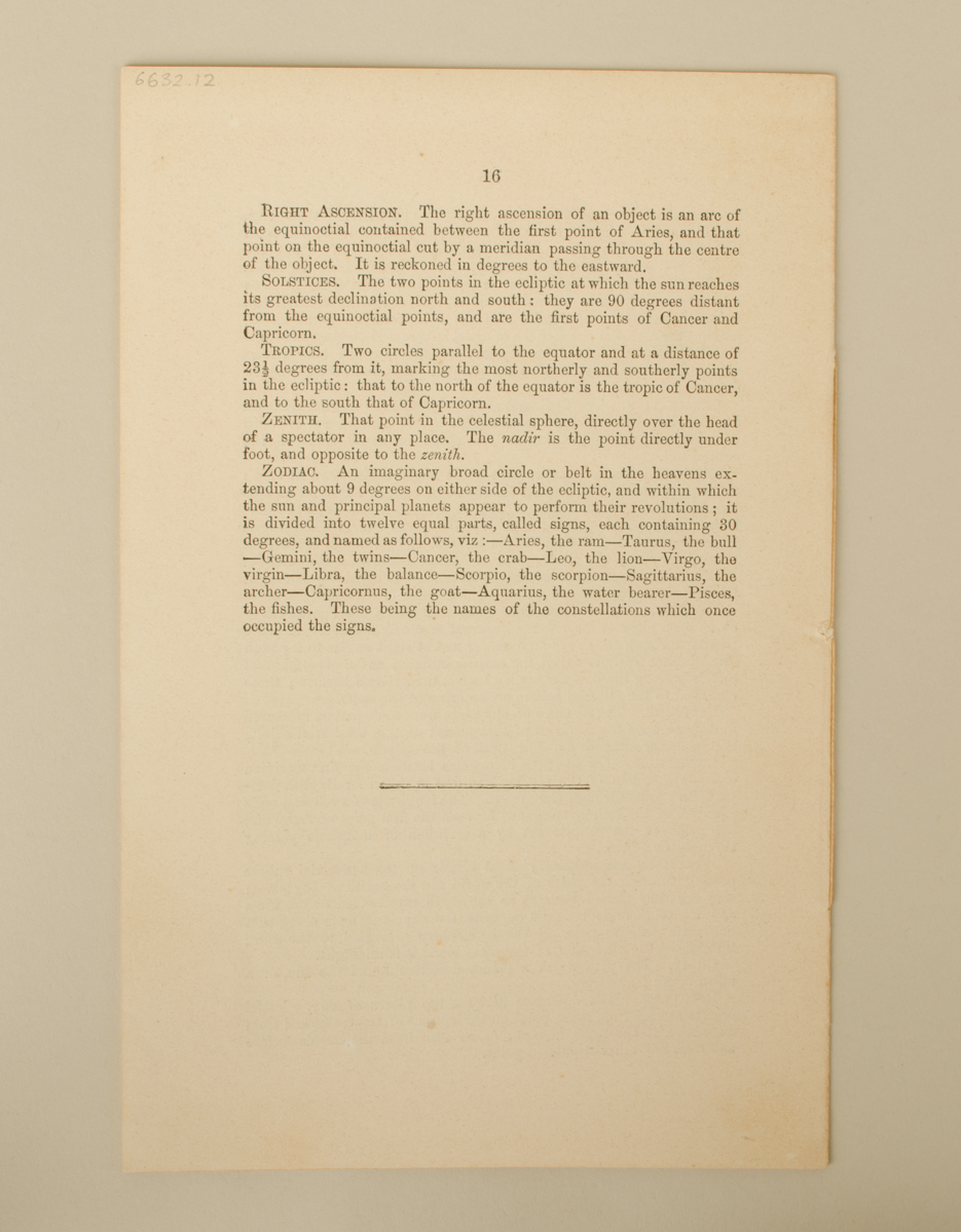
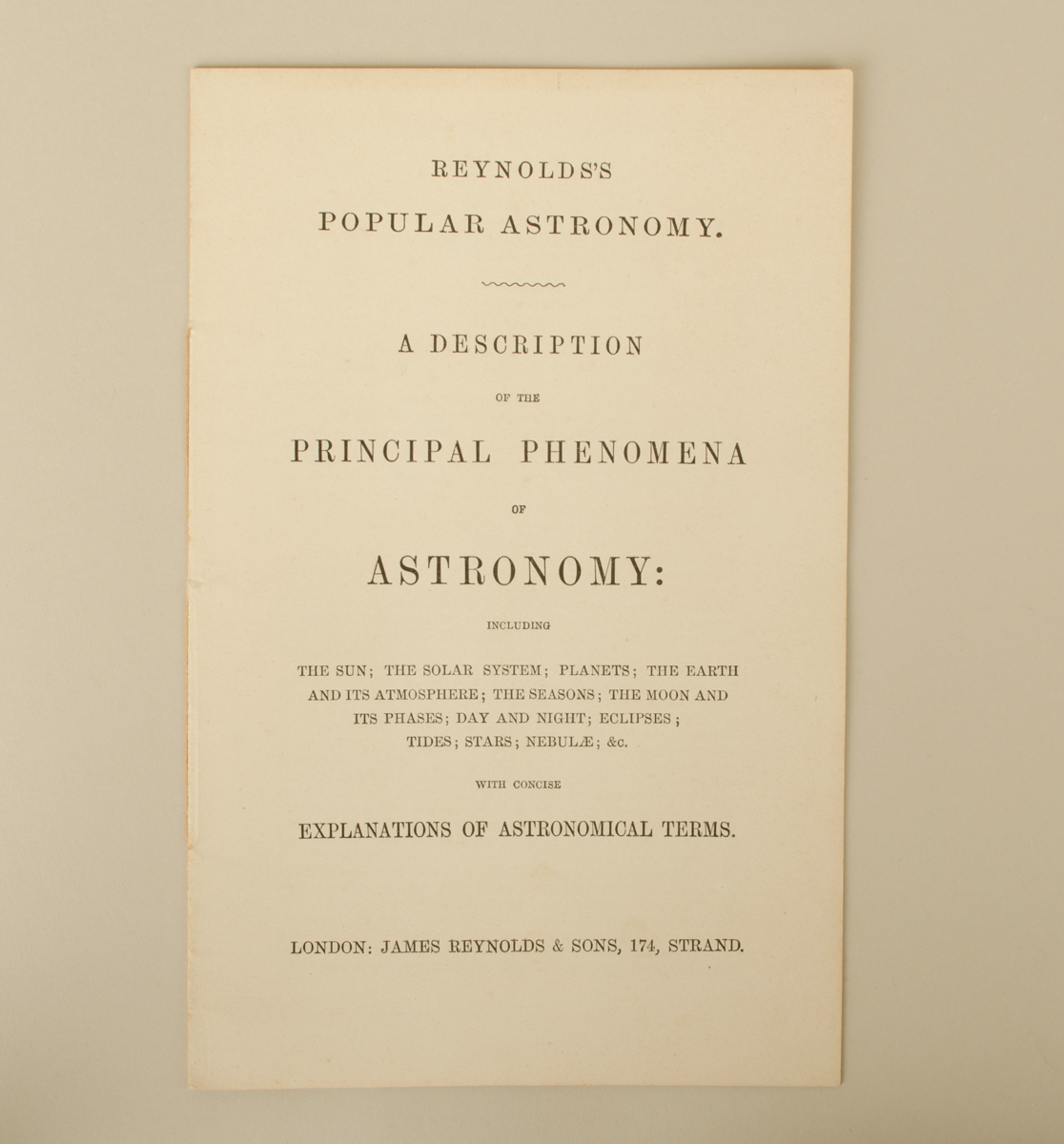
6632.12: Educational booklet in paper. 'Reynold's Popular Astronomy. A Description of the Principal Phenomena of Astronomy: Including The Sun; The Solar System; Planets; The Earth and its Atmosphere; The Seasons; The Moon and its Phases; Day and Night; Eclipses; Tides; Stars; Nebulae; &c. With Concise Explanations of Astronomical Terms.' Sixteen pages.
In good condition. Complete.
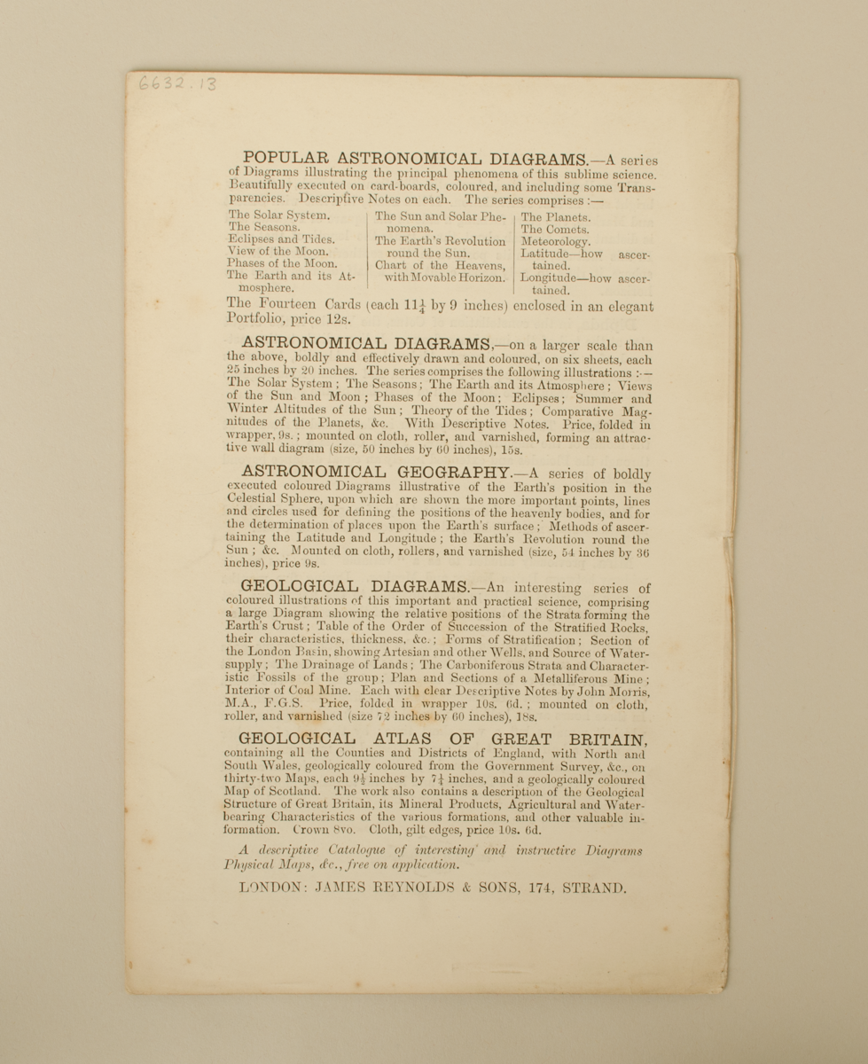
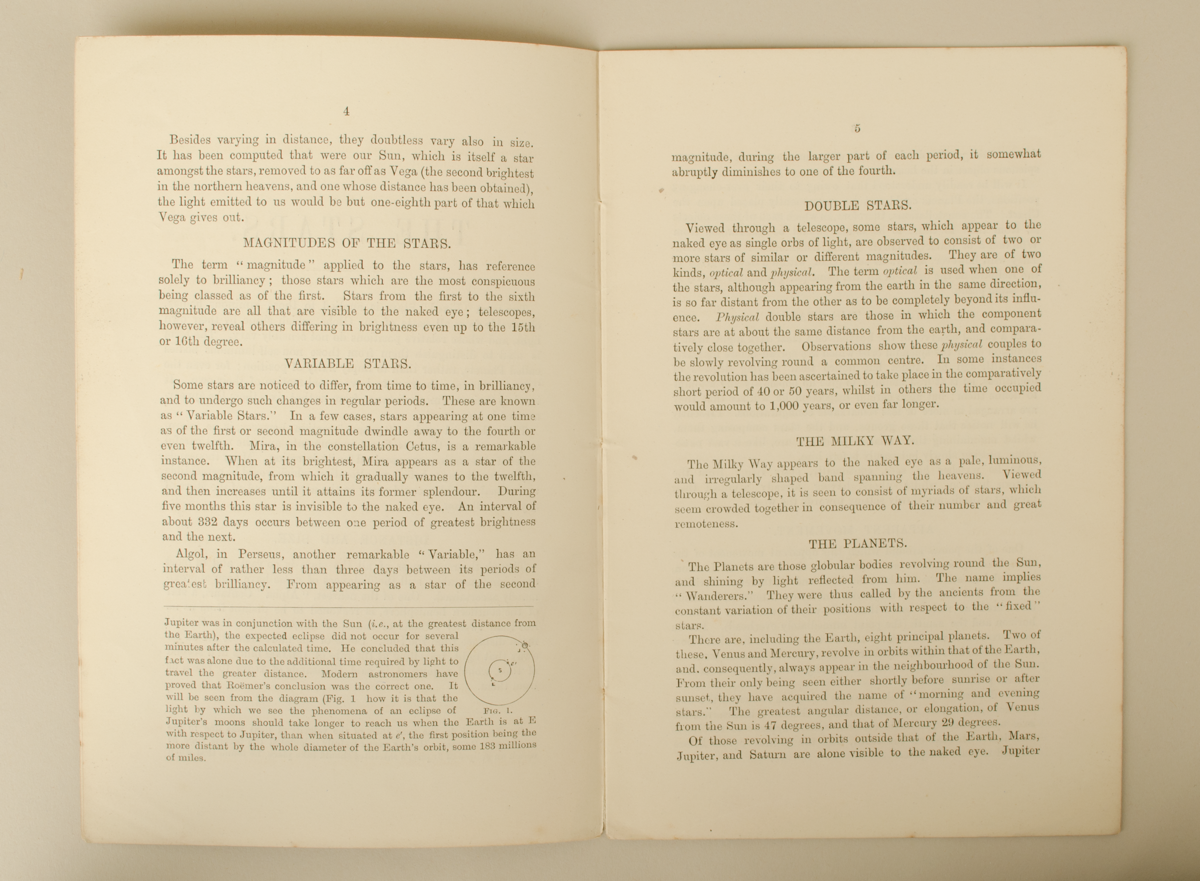
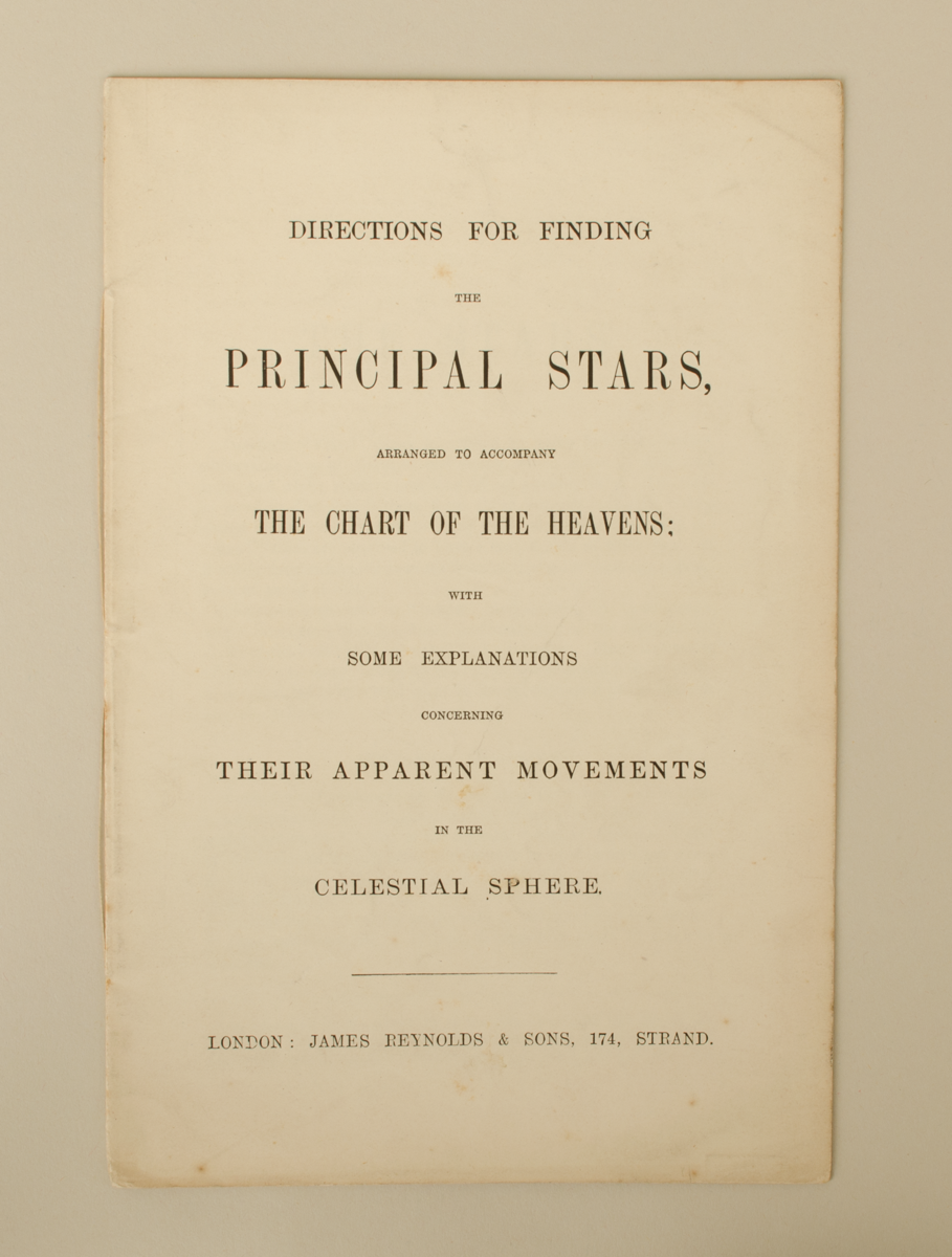
6632.13: Educational booklet in paper. 'Directions for Finding the Principal Stars, Arranged to Accompany the Chart of the Heavens; With Some Explanations Concerning Their Apparent Movements in the Celestial Sphere.' Sixteen pages.
In good condition. Complete.
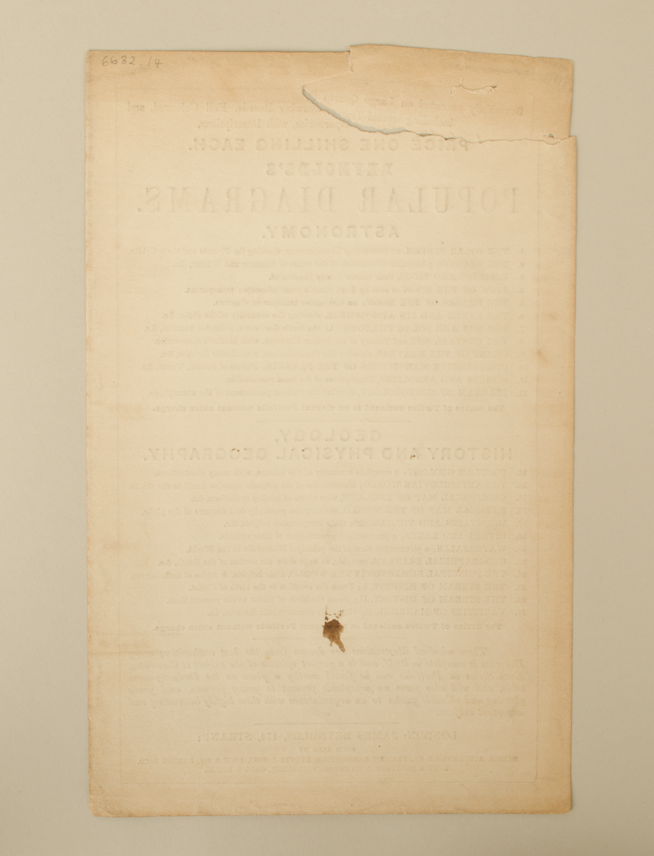
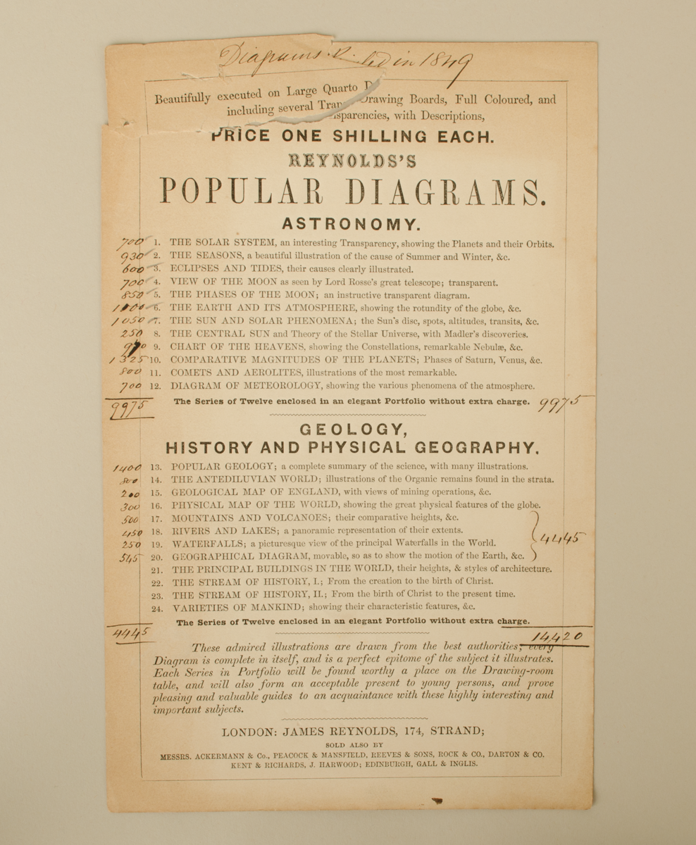
6632.14: Advertisement/list of 'Reynold's Popular Diagrams' in Astronomy (twelve diagrams) as well as Geology, History and Physical Geography (twelve diagrams), printed in 1849. One page, annotated with numbers in ink and pencil. List of sellers at the bottom of the list.
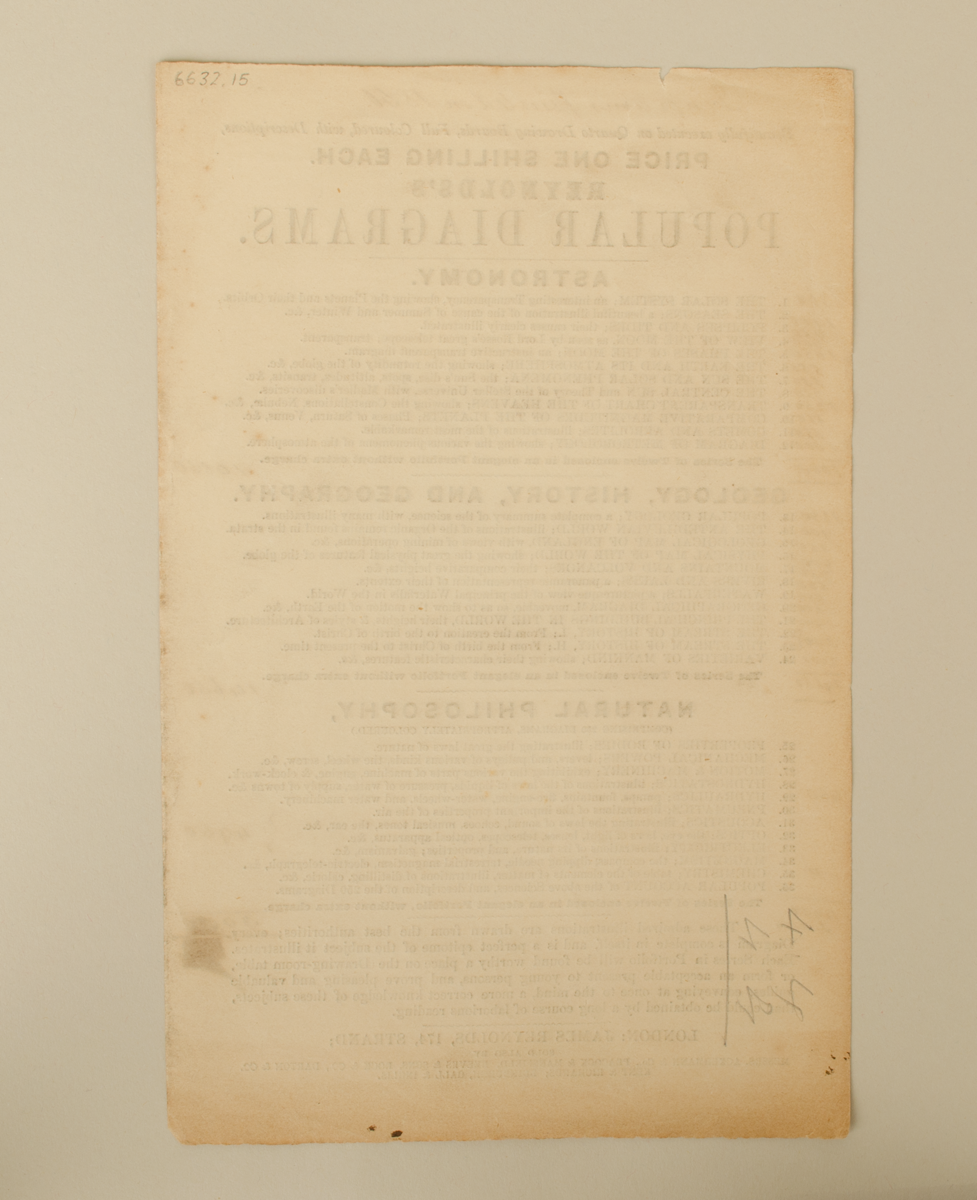
In fair/poor condition. Complete. Fragile, particularly in top right corner which is torn.
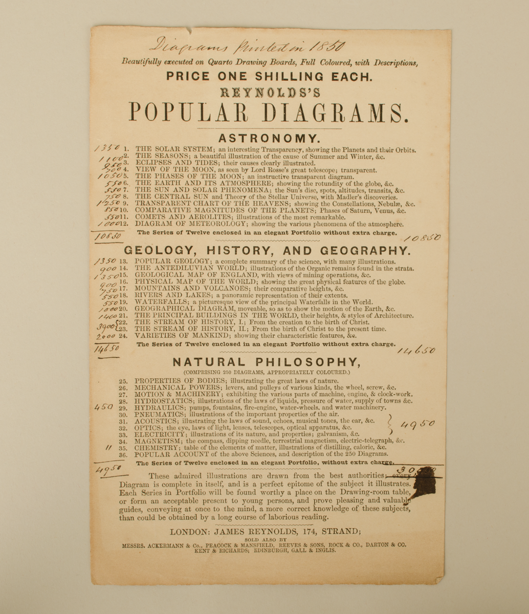
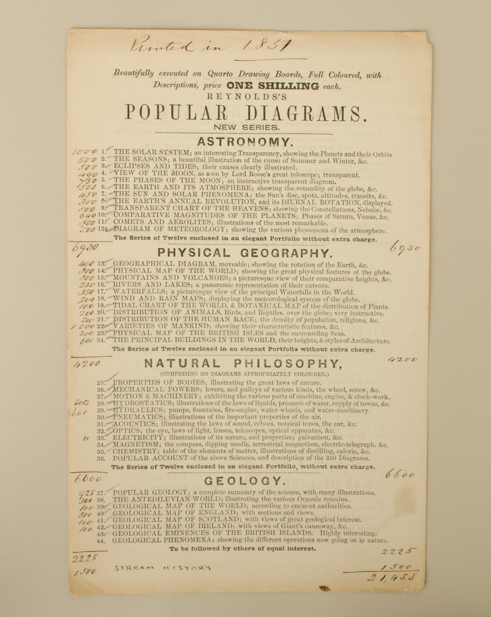
6632.15: Advertisement/list of 'Reynold's Popular Diagrams' in Astronomy (twelve diagrams); Geology, History and Physical Geography (twelve diagrams); and Natural Philosophy (twelve diagrams), printed in 1850. One page, annotated with numbers in ink. List of sellers at the bottom of the list.
In fair condition. Complete.
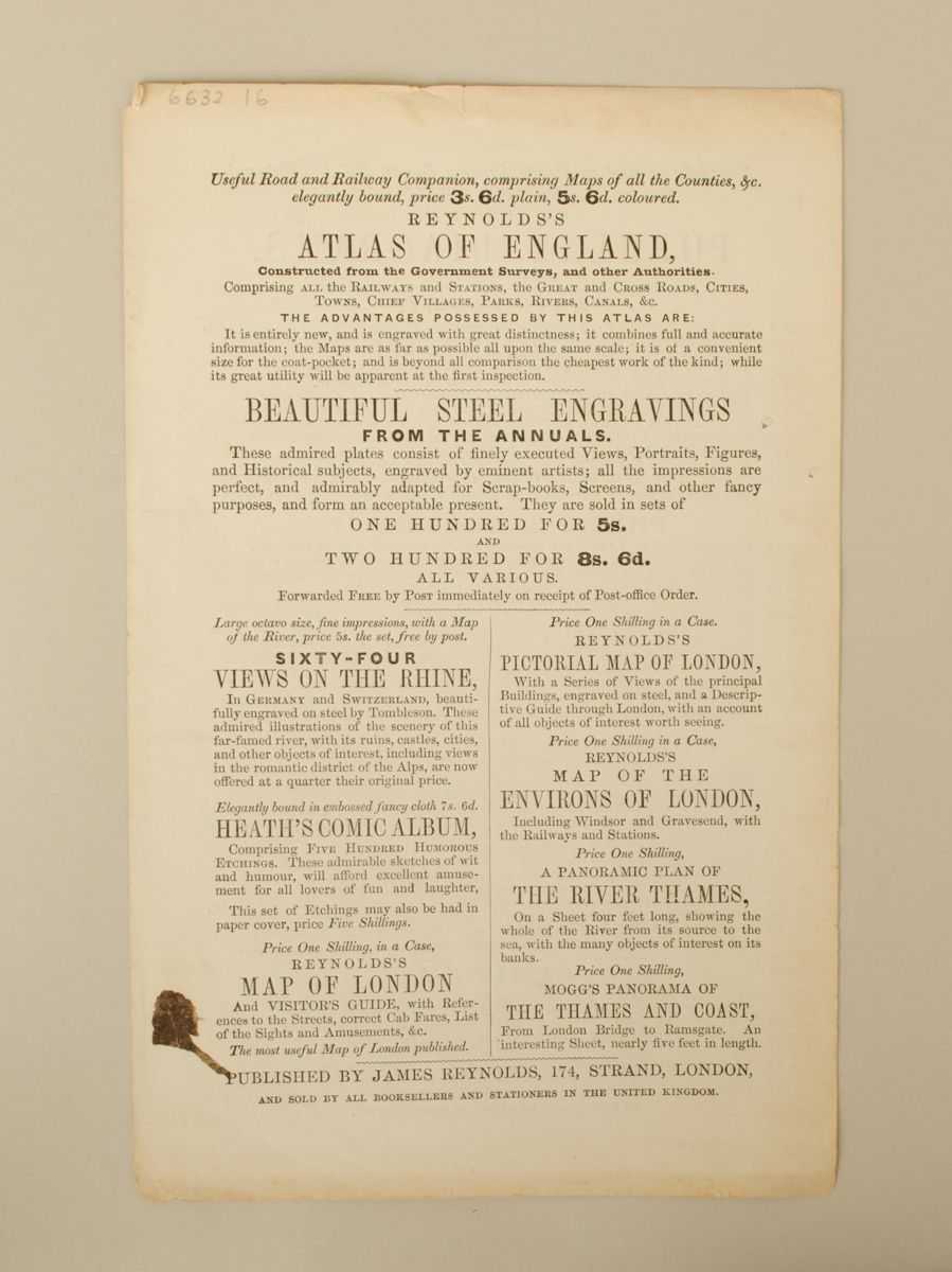
6632.16: Advertisement/list of 'Reynold's Popular Diagrams' in Astronomy (twelve diagrams); Physical Geography (twelve diagrams); Natural Philosophy (twelve diagrams); and Geology; printed in 1851. One page, double-sided, annotated with numbers in ink. The back page shows advertisements for specific educational materials created by Reynolds, including their Atlas of England, steel engravings, sixty-four views on the Rhine.
In good condition. Complete.
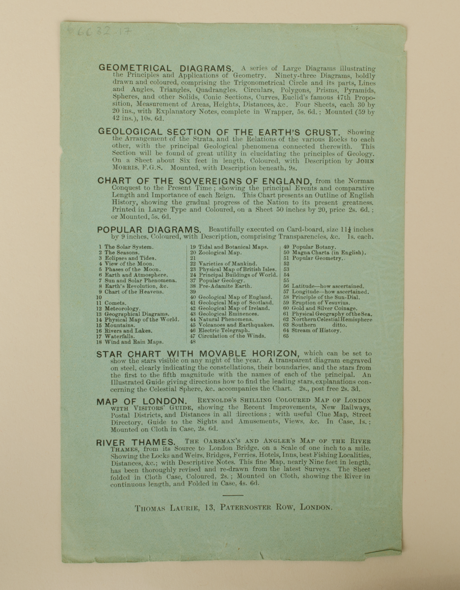
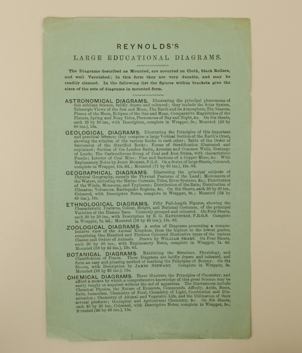
6632.17: Advertisement for 'Reynold's Large Educational Diagrams.'; astronomical, geological, geographical, ethnological, zoological, botanical, chemical, geometrical, geological Section of the Earth's crust, chart of the sovereigns of England, Popular diagrams (65 listed), star chart with movable horizon, map of London, River Thames. Address different from previous listed - 'Thomas Laurie, 13, Paternoster Row, London.' One page, double sided.
In good condition. Complete.
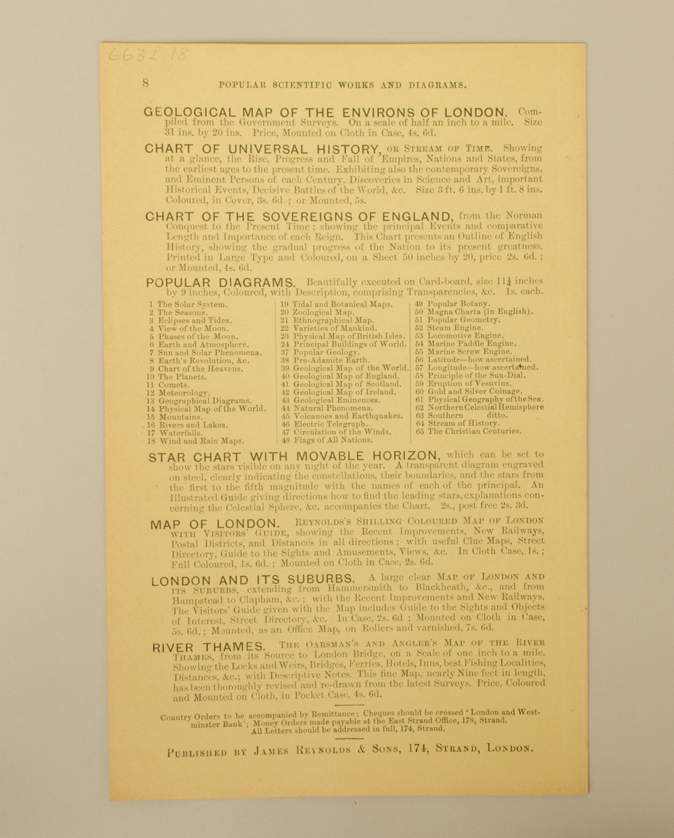
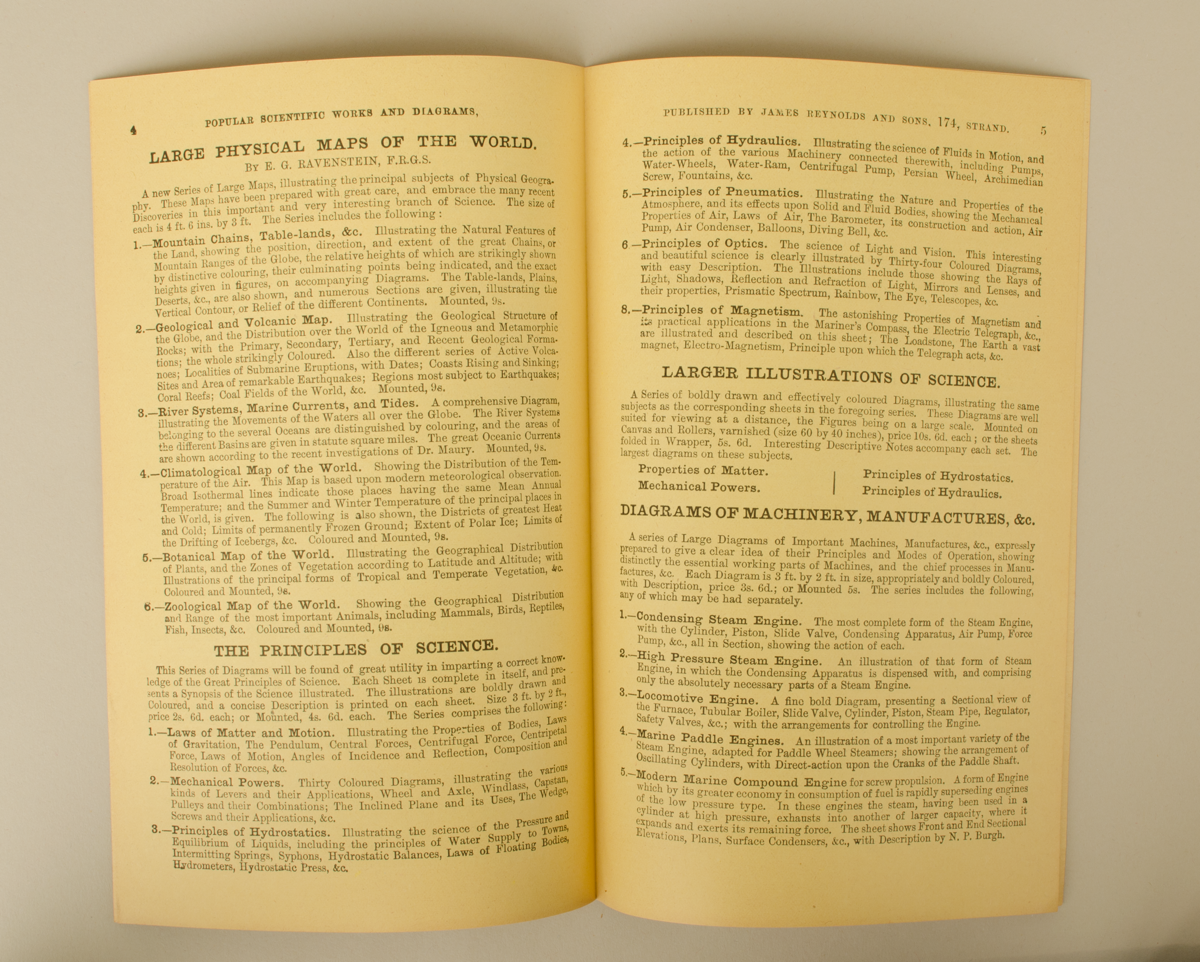
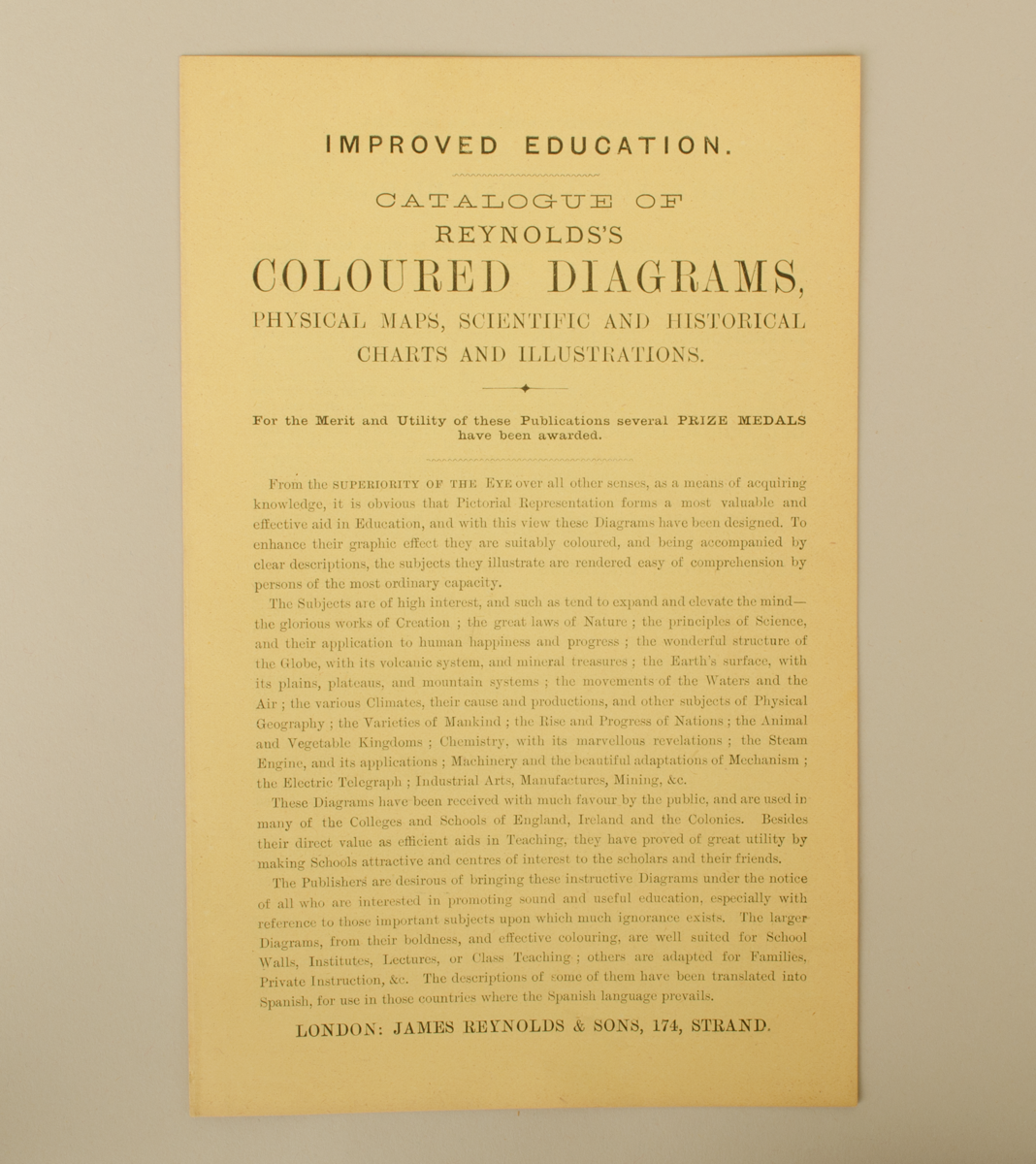
6632.18: Yellow, eight-page 'Catalogue of Reynolds's Coloured Diagrams, Physical Maps, Scientific and Historical Charts and Illustrations.' Lists large educational diagrams; large physical maps of the world; the principles of science; larger illustrations of science; diagrams of machinery, manufactures; portfolios of popular scientific diagrams; pictorial scientific atlases; geological map of the environs of London; charts of universal history; chart of the sovereigns of England; popular diagrams (65 listed); star chart with movable horizon, map of London; London and its suburbs; River Thames.
In good condition. Complete.
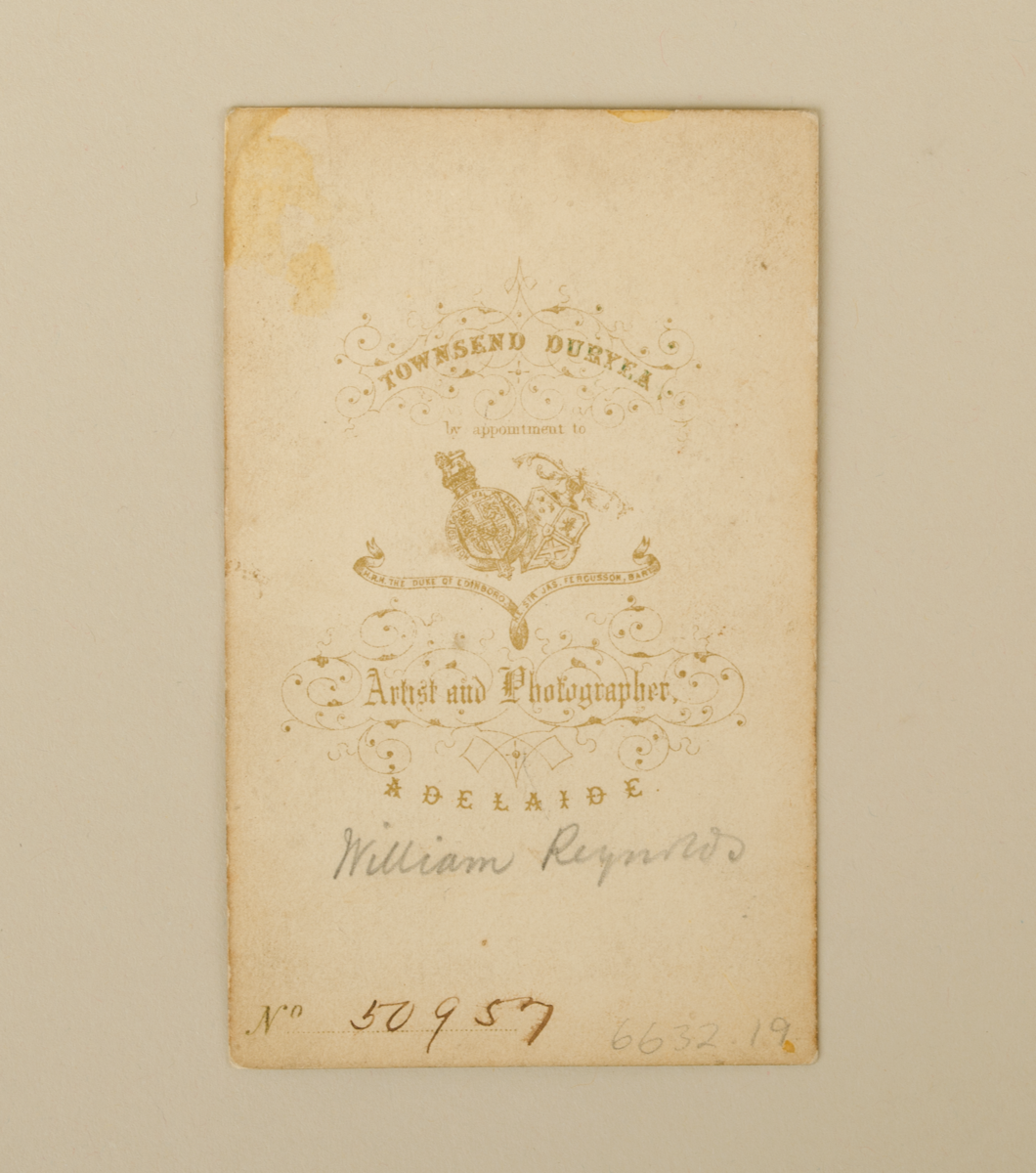
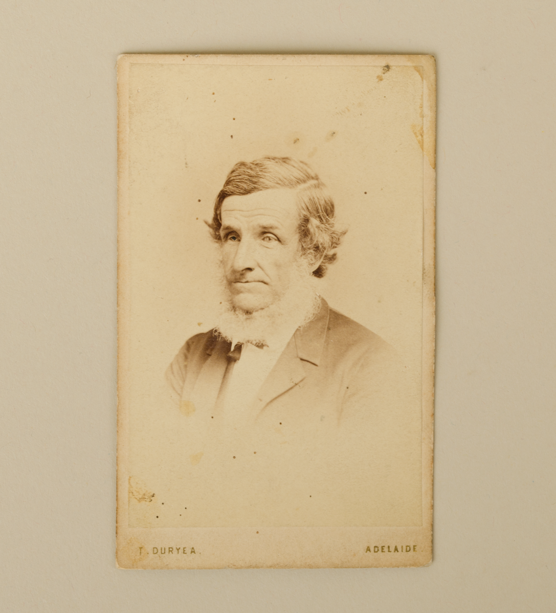
6632.19: Carte de visite, photograph of William Reynolds in pencil. No. 50957.
In good condition. Complete.
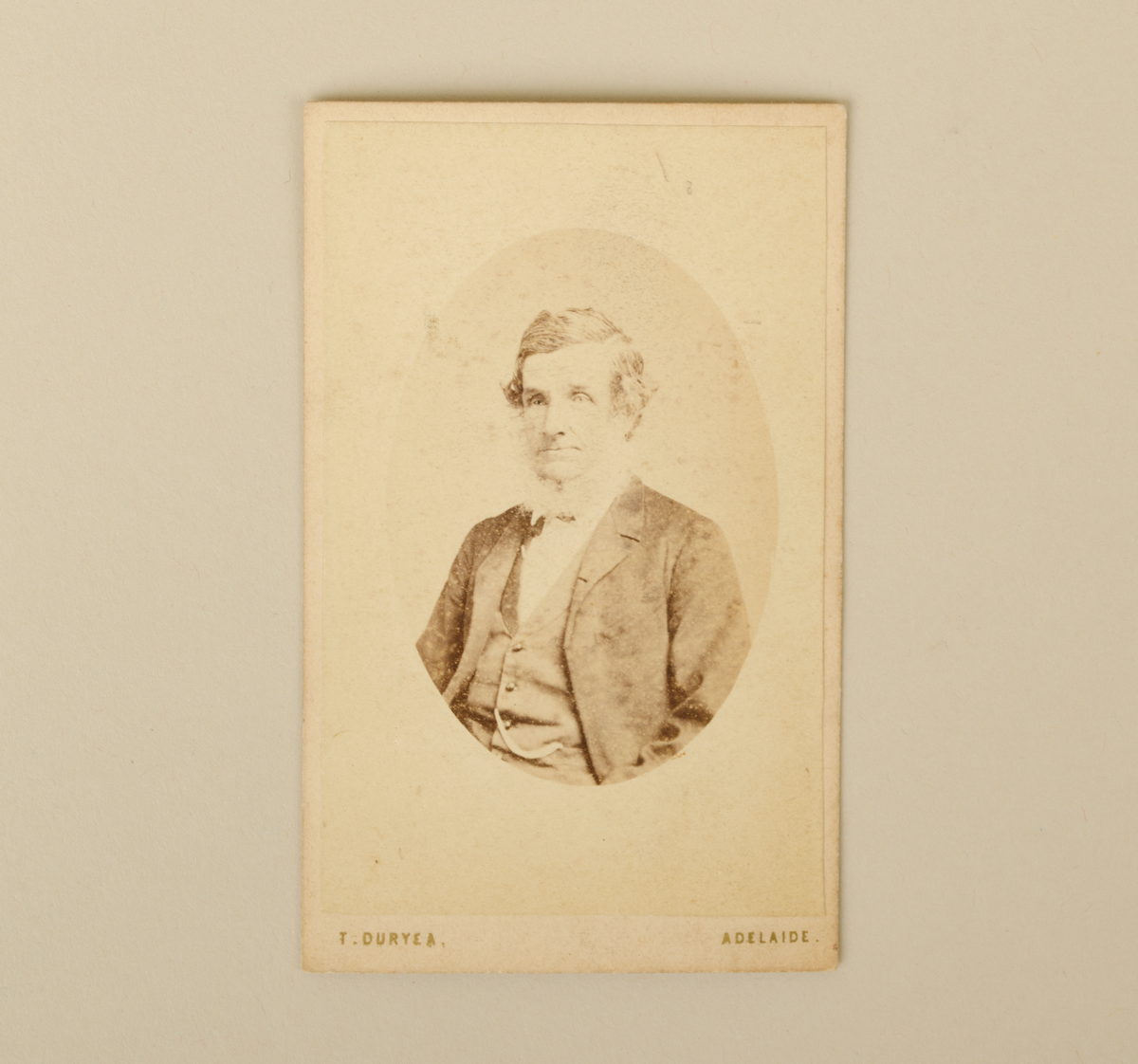
6632.20: Carte de visite, photograph of William Reynolds in pencil. No. 50958.
In good condition. Complete.
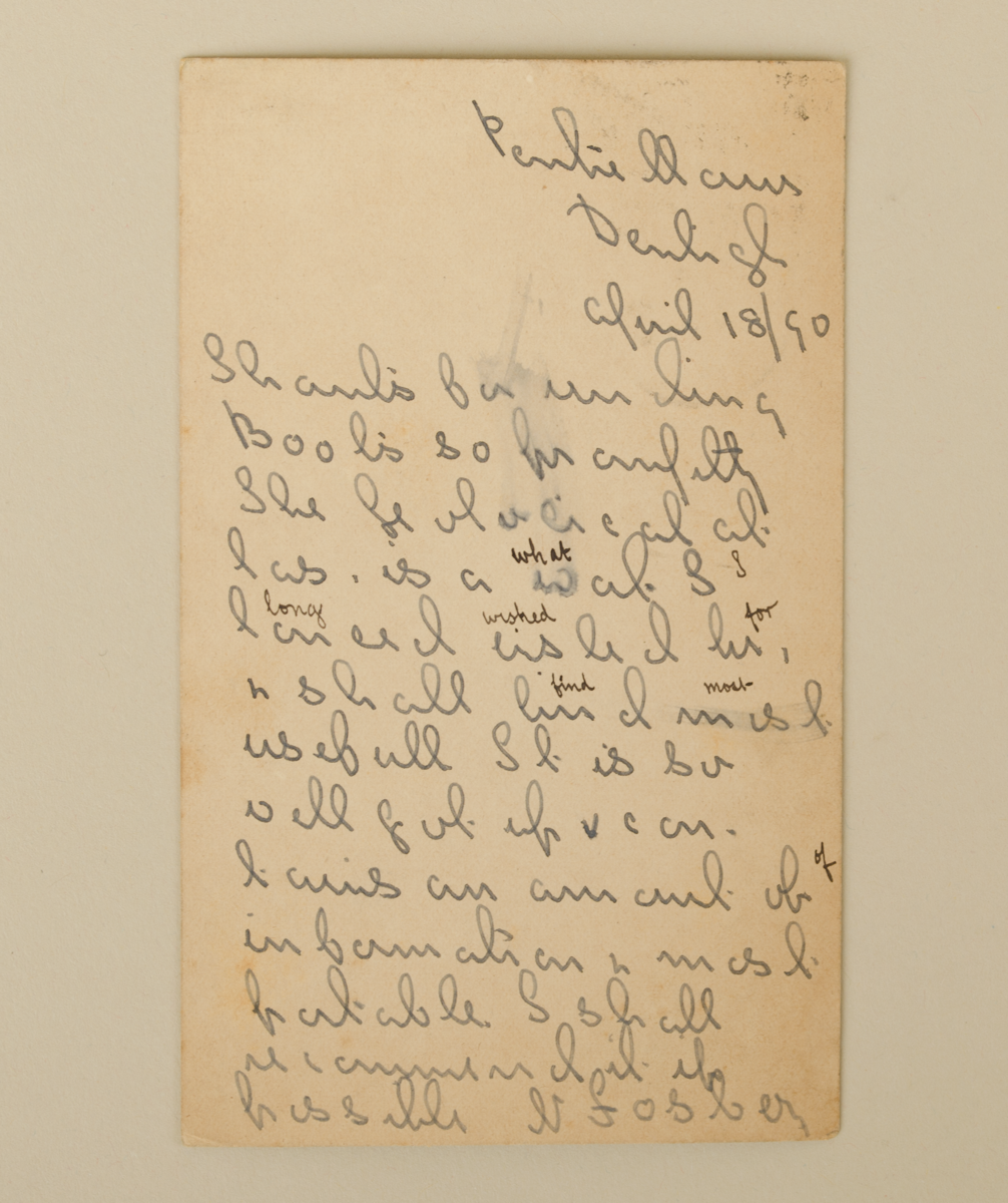
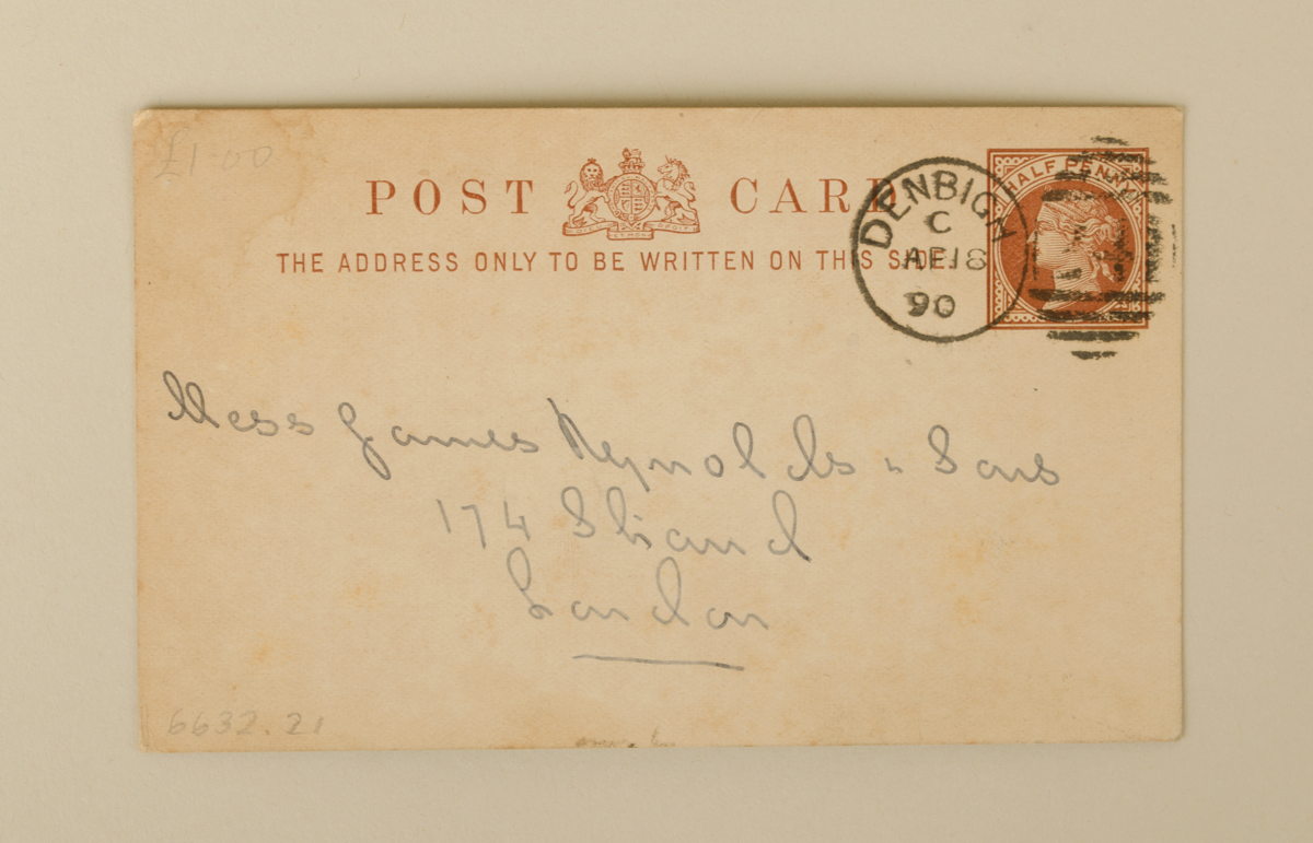
6632.21: Postcard addressed to Messers James Reynolds & Sons, dated 1890. Short note on the other side, in illegible script.
In good condition. Complete.
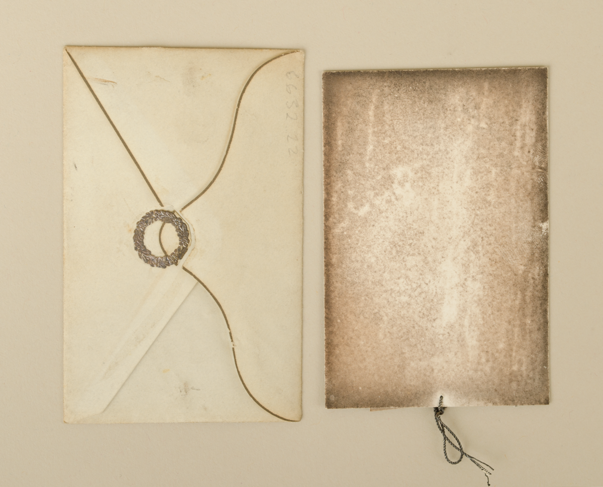
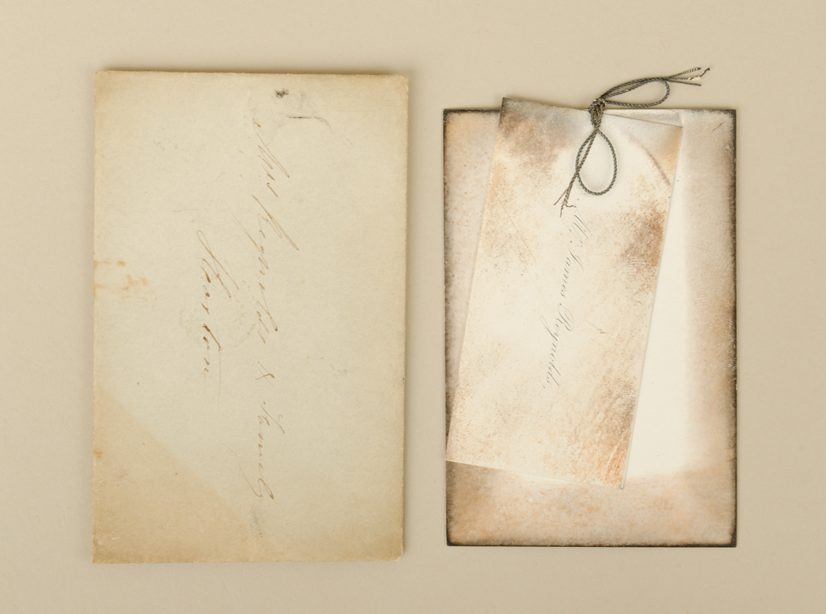
6632.22: Envelope, addressed to William or Mrs James Reynolds & Family, Hoxton. Inside is a label in card, two pieces of card tied with string. Is perhaps not original, or in very good condition (?)
In good/fair condition. Complete.
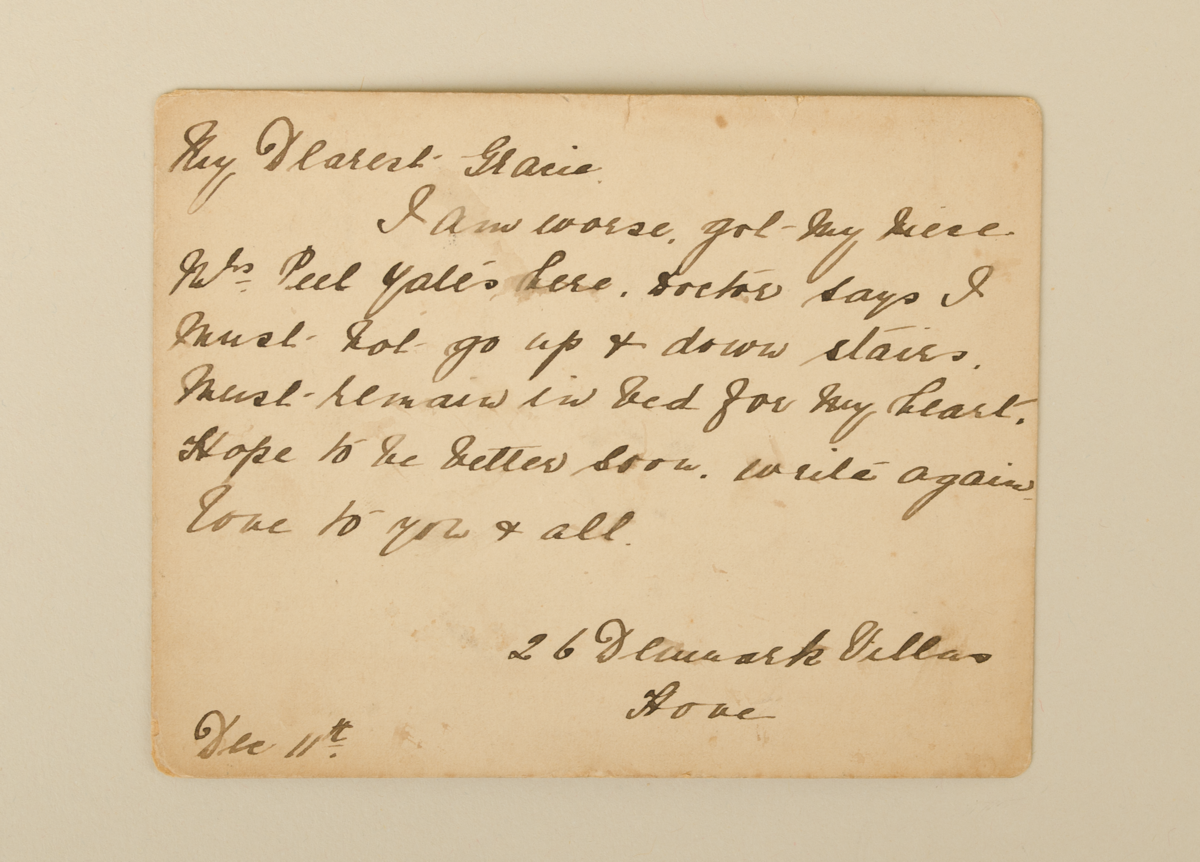
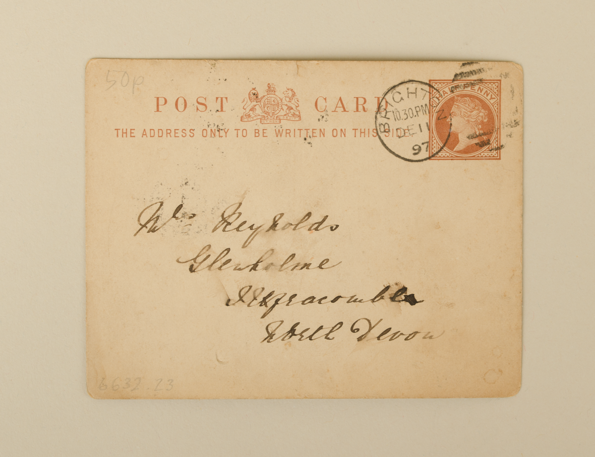
6632.23: Postcard, addressed to Mrs or William Reynolds, Glenholme, Ilfracombe, North Devon. Sent December 11th 1897.
In fair condition. Complete.
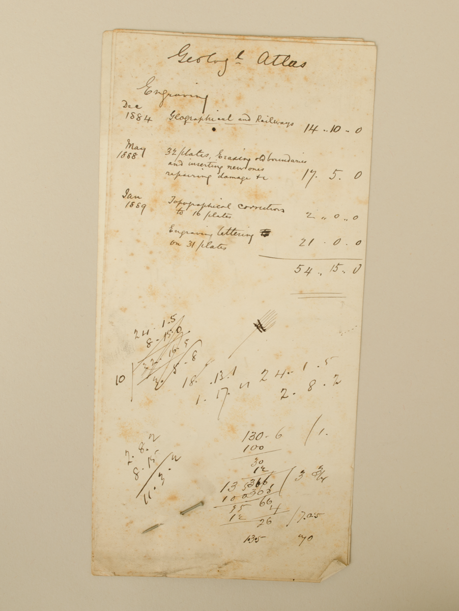
6632.24: Three pages with notes of costs of production, pertaining to Geological Atlas, pinned together at the bottom. Dating 1884 - 1889.
In good/fair condition. Complete.
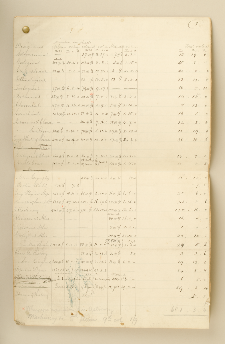
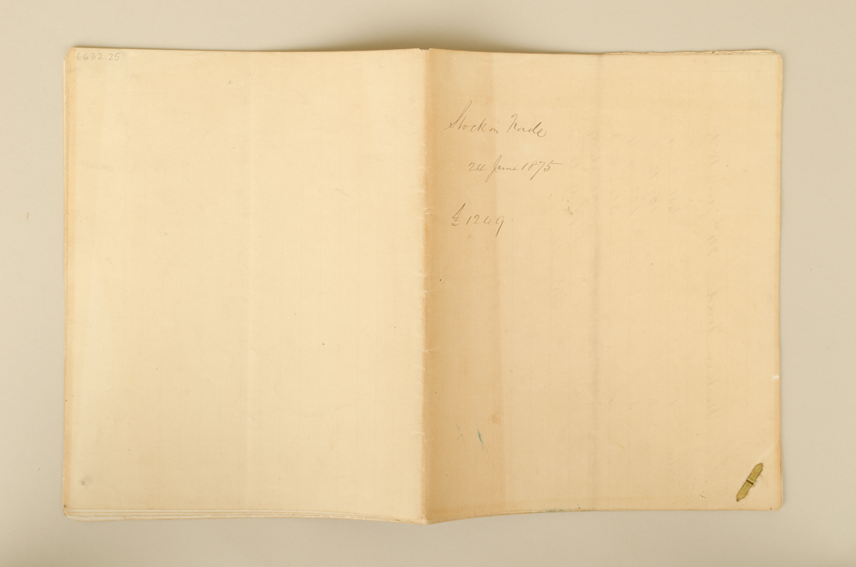
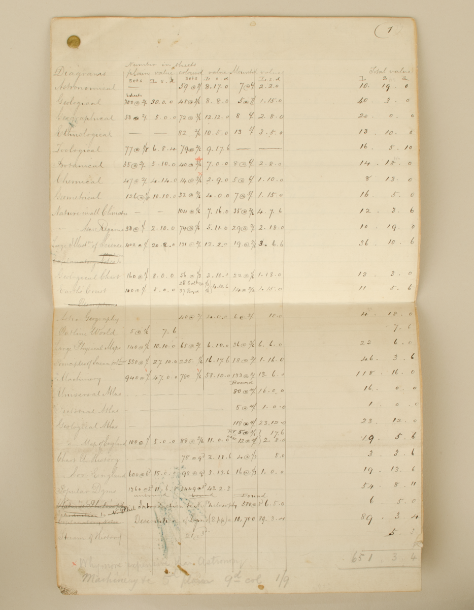
6632.25: Stock in trade, 24 June 1875. '£1249'. Six pages. Pinned at the corner with brass split pin.
In good condition. Complete.
References
Events
FM:47205
Images (Click to view full size):