Accession No
6750
Brief Description
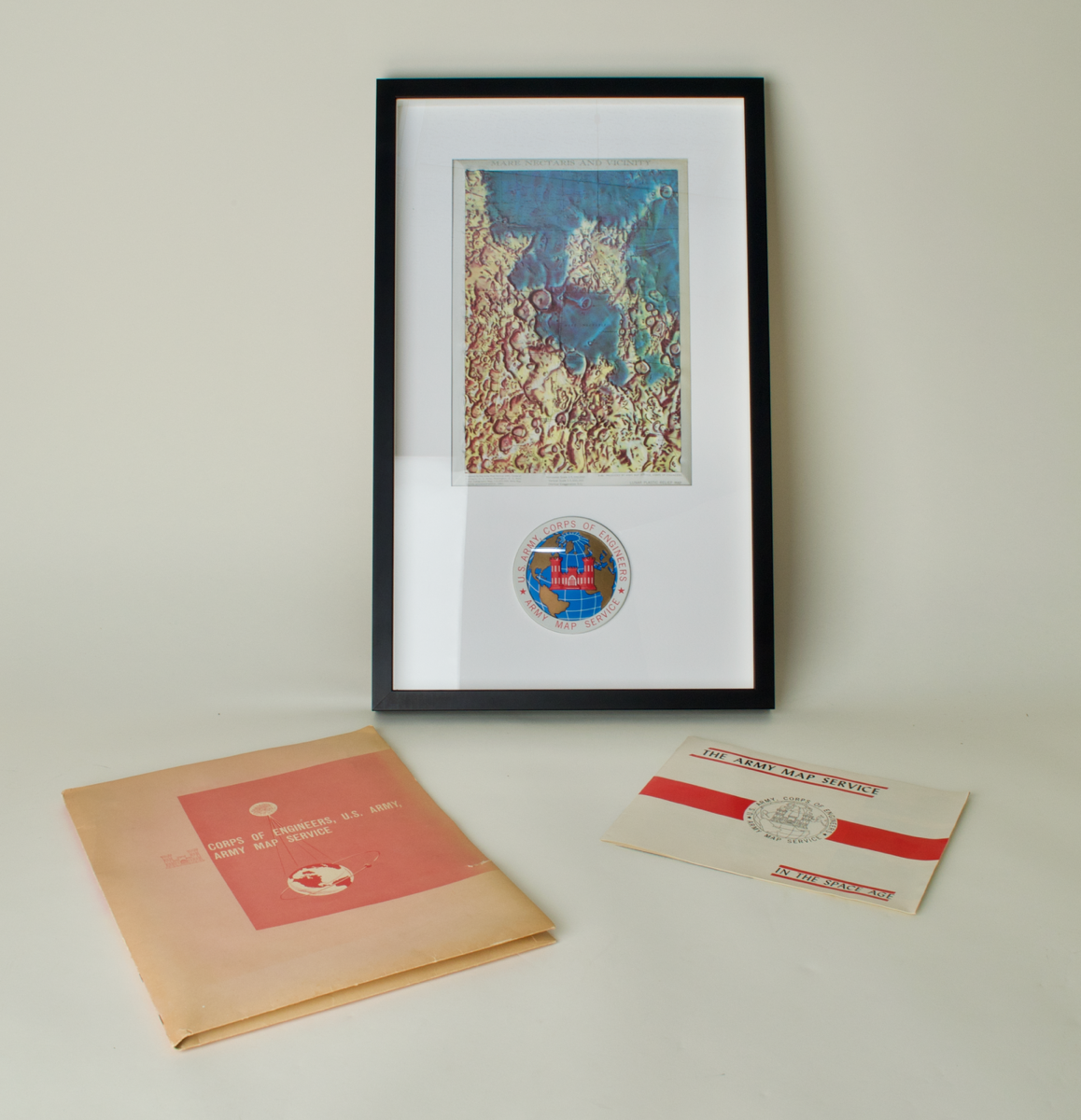
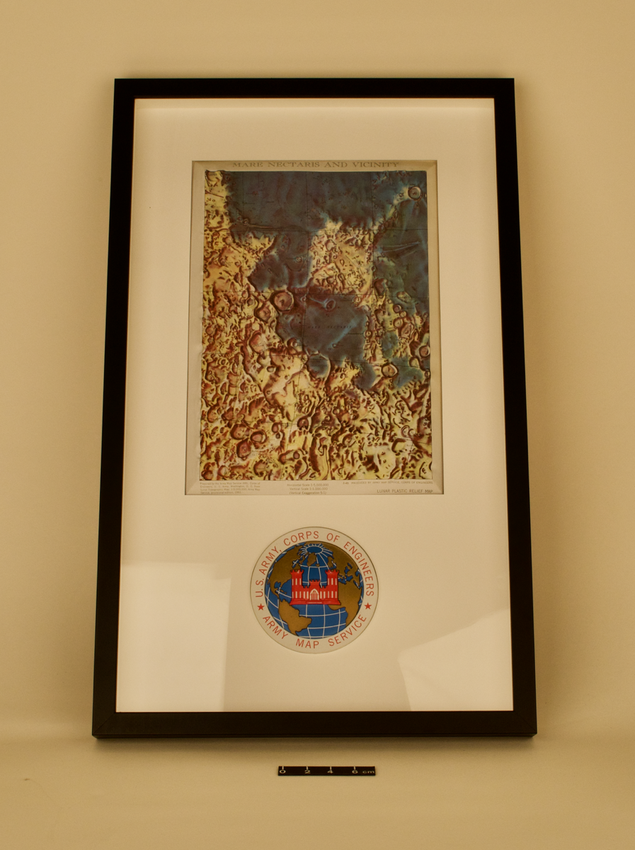
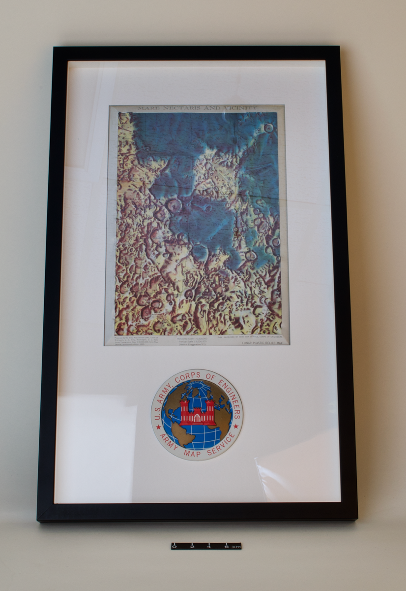
framed relief Map of the Moon: Mare Nectaris and Vicinity, by U. S. Army Map Service, American, 1965; plus U.S. Army Map Service information booklet and prints
Origin
United States; Washington D.C.
Maker
Army Map Service, U.S. Army, Corps of Engineers
Class
astronomy; drawing; engineering; cartography
Earliest Date
1965
Latest Date
1965
Inscription Date
Material
plastic (acrylic, other); paper (card)
Dimensions
386mm (width), 626mm (length), 35mm (depth)
Special Collection
Provenance
Purchased from The Map House, 2019
Inscription
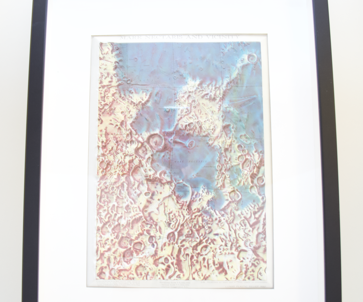
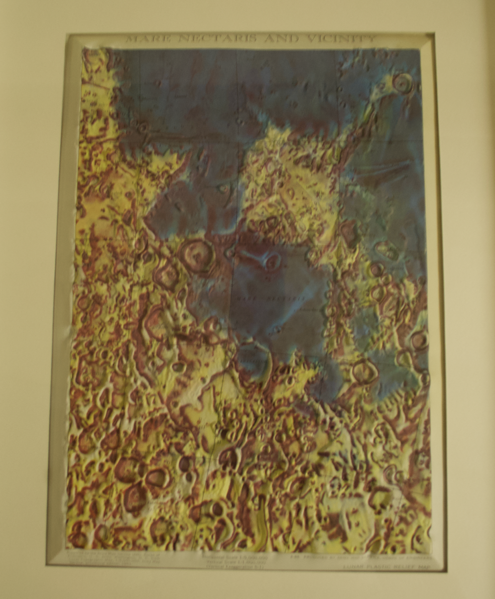
'MARE NECTARIS AND VICINITY'
[Title]
'Prepared by the Army Map Service (AM), Corps of
Engineers, U. S. Army, Washington, D. C. from
Lunar Topographic Map, 1: 5,000,000, Army Map
Service, provisional edition, 1961.'
[bottom left-side inscription beneath map]
'Horizontal Scale 1: 5,000,000
Vertical Scale 1: 1,000,000
(Vertical Exaggeration 5:1)'
[bottom middle inscription beneath map]
'2-65 PRODUCED BY ARMY MAP SERVICE, CORPS OF ENGINEERS'
'LUNAR PLASTIC RELIEF MAP'
[bottom right-side inscription beneath map]
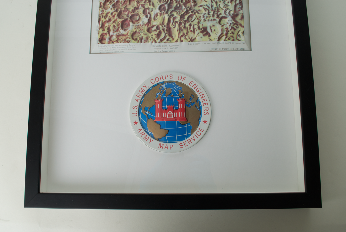
'U.S. ARMY CORPS OF ENGINEERS
ARMY MAP SERVICE'
[emblem]
'THE MAP HOUSE
U.S. Army/ MSC
The Moon
Published in Washington, D.C., c1970
Unusual relief map of the edge of the Sea of Tranquility and the Sea of Nectar covering the landing side of the Apollo 11 mission. Printed colour.
[label on the reverse]
Description Notes
Framed relief Map of the Moon: Mare Nectaris and Vicinity, by U. S. Army Map Service, American, 1965; plus U.S. Army Map Service information booklet and prints
Colourful and annotated raised relief map of the southern edge of the Sea of Tranquility (Mare Tranquilitatis) and the Sea of Nectar (Mare Nectaris) covering the landing site of the Apollo 11 mission, although this map was published in advance of this event. Printed colour shading has been used to further accentuate topographical details. This map is mounted on acid-free museum board and framed with UV-filtering acrylic. At the bottom is the U.S. Army Map Service Emblem, also with raised, 3D details.
An example of this map is displayed at the Kennedy Space Centre, Cape Canaveral in the Apollo/Saturn V Centre.
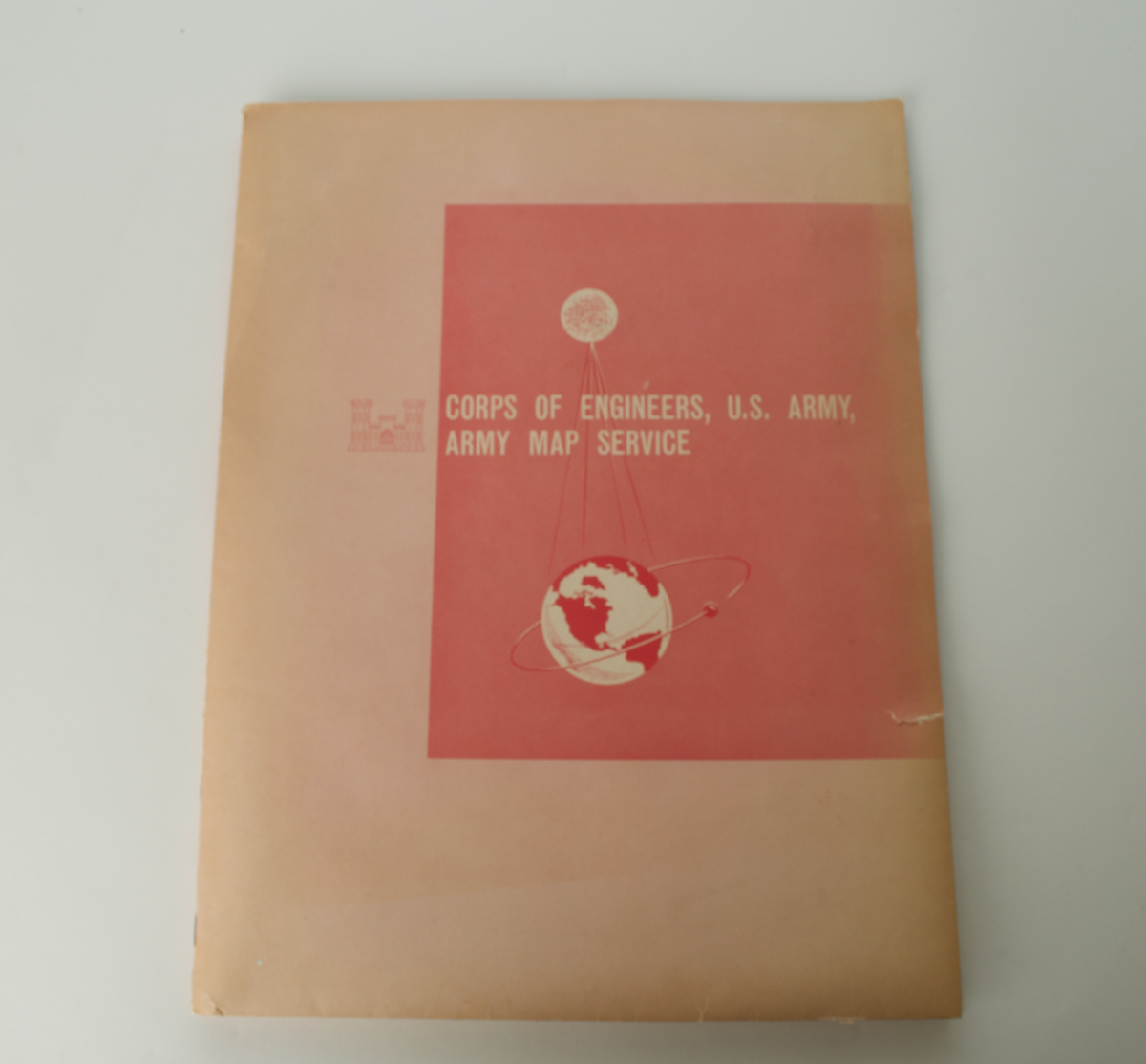
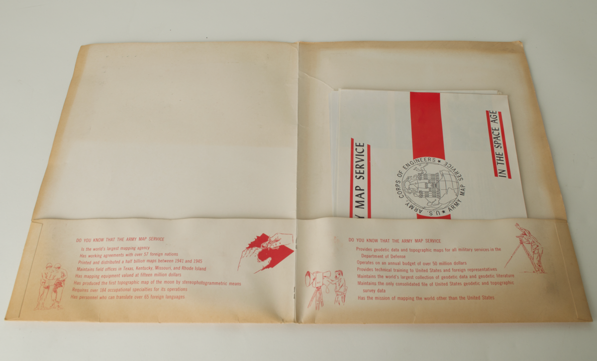
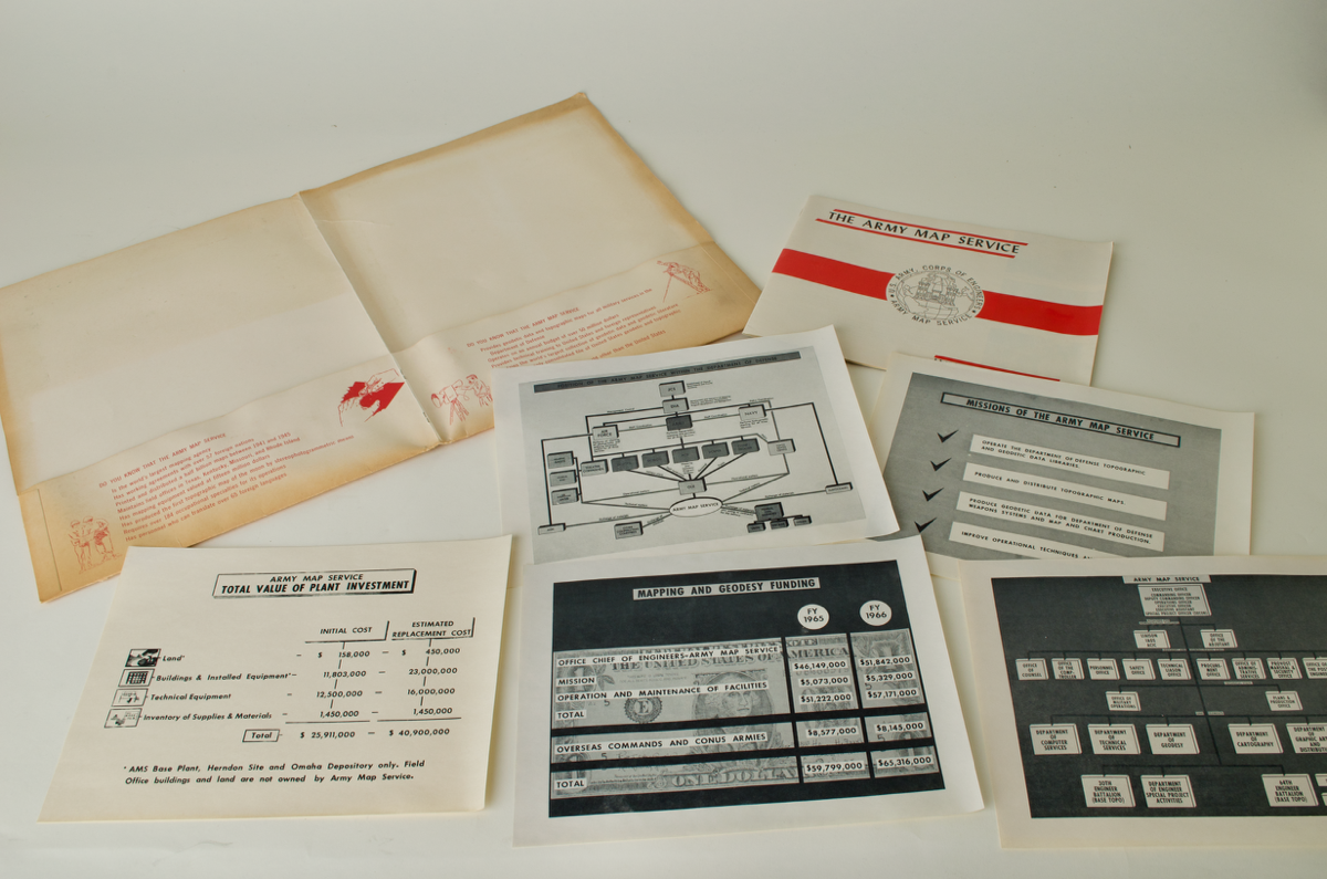
An information booklet on the Army Map Service in the Space Age, protective wallet, and related prints are also included with this object, which gives background to the work the U.S. Army Corps of Engineers, Map Service undertook.
References
Events
Description
The US Army Map Service was the military cartographic agency of the United States Department of Defence, from 1941-1968, subordinated to the United States Army Corps of Engineers. The organisation's main tasks comprised compiling, publicising, and distributing military topographic maps and related goods, primarily for use by US military forces. The Army Map Service was formed during WW2 from the consolidation of other bodies, due to the increased wartime demand for mapping. Between 1941-45, the Army Map Service printed and distributed a half billion maps - an unprecedented scale. 40,000 maps were prepared, covering 400,000 square miles of the earth. The Army Map Service was also integral to the Korean and Vietnam wars, distributing tens of millions of maps to US servicemen. 750,000 maps were distributed to services across the Korean peninsula in the first two weeks of the conflict.
In the Corps of Engineers Army Map Service booklet which accompanied this framed map there is lots of information about the organisation. At the time of production, the Army Map Service was the world's largest mapping agency, holding working agreements with over 57 foreign nations, and it had an annual budget of over 50 million dollars.
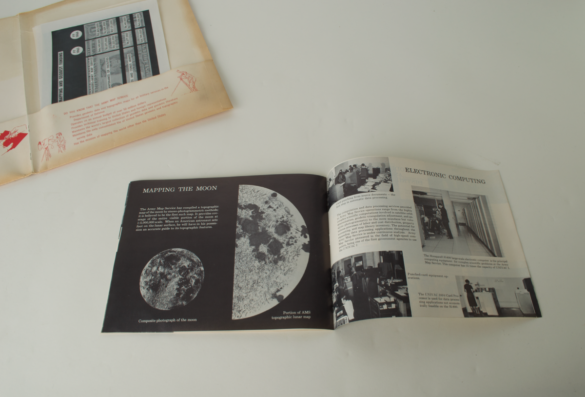
Whilst topographic maps served military concerns, the organisation also prepared extraterrestrial maps of satellite and planetary bodies, such as this one. Mapping the moon was a major interest, and the Army Map Service compiled the first topographic map of the moon by stereo-photogrammetric methods. Looking to the future, the booklet associated with this object stated "when an American astronaut sets foot on the lunar surface, he will have in his possession an accurate guide to its topographic features." The importance of these mapping processes is clear.
Against the backdrop of the Cold War Space Race between the US and USSR, the Corps of Engineers participated in the 'Vanguard satellite program', with the US Army Signal Corps and the US Navy. This aimed to obtain astronomic, geodetic and gravimetric observations, for the purpose of measuring the size and shape of the earth, gravity fields and intercontinental relationships.
The Army Map Service pioneered the production of plastic relief maps in quantity, such as this one. This helped us to see the face of the earth or moon in three-dimensions, as well as conventional map details.
29/07/2022
Created by: Eleanor Brittain on 29/07/2022
FM:47538
Images (Click to view full size):