Accession No
6756
Brief Description
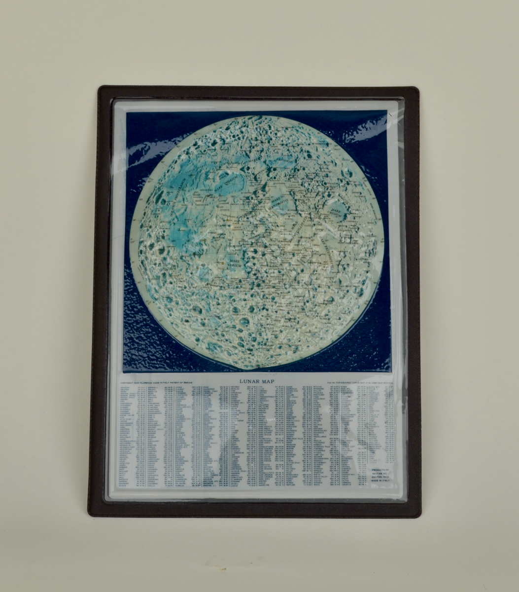
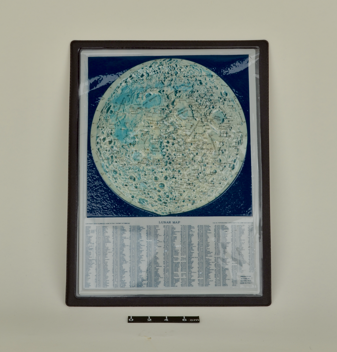
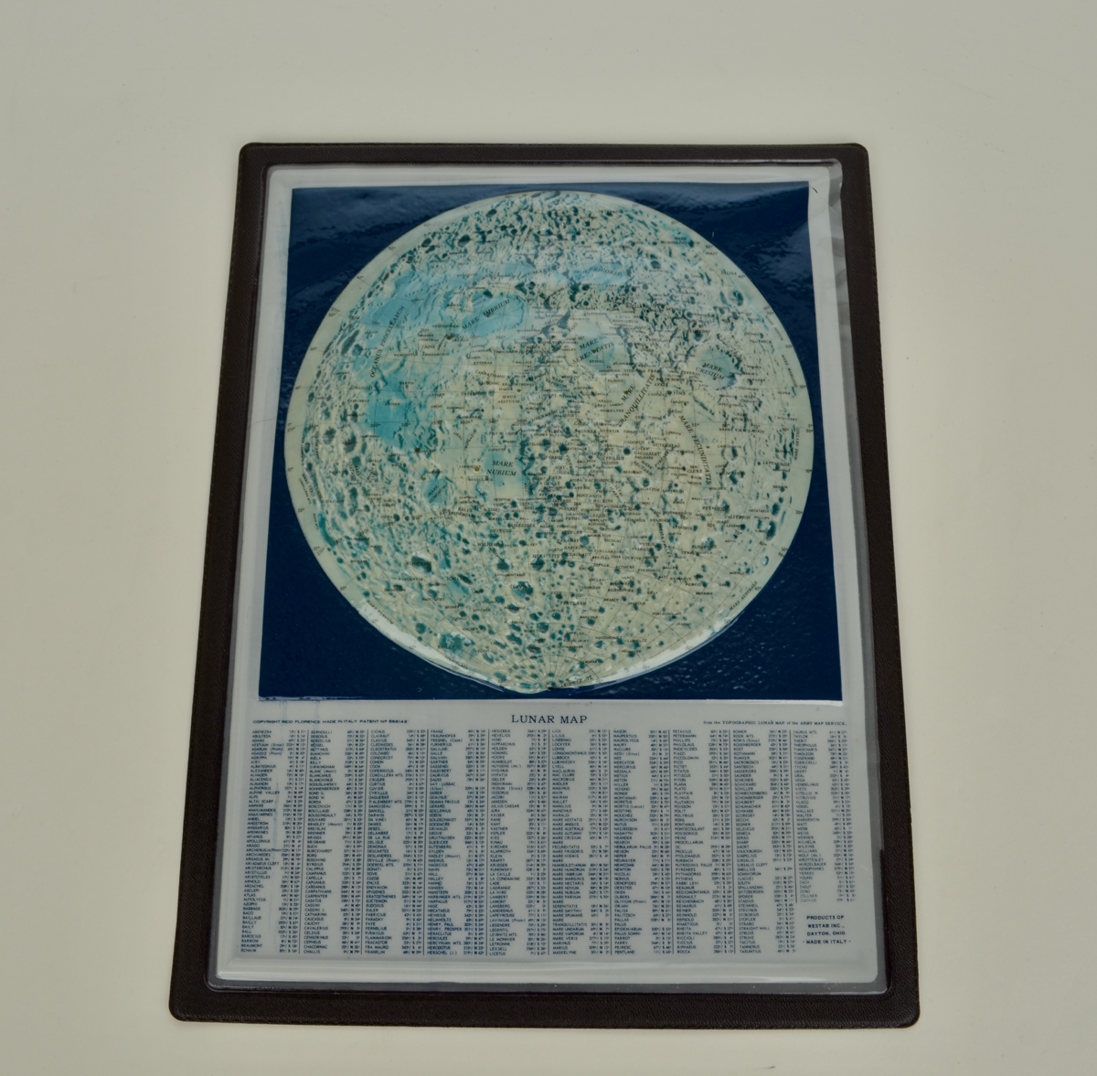
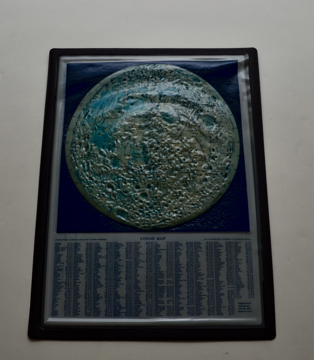
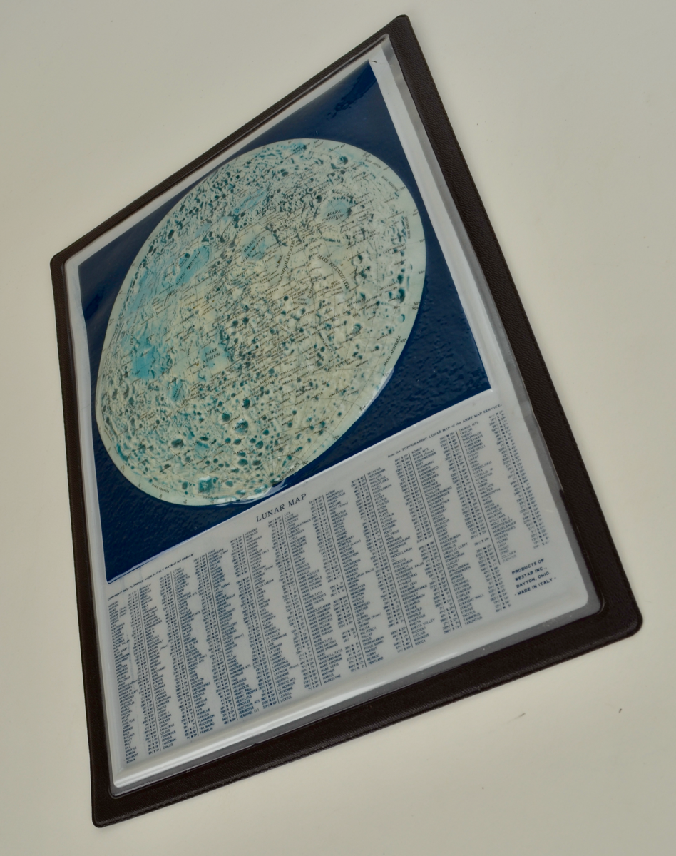
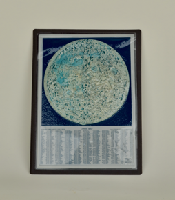
unframed, laminated raised relief map of the moon with table of lunar formations, by RICO, Florence, and U.S. Army Map Service, Italian, 1970 (c)
Origin
Italy; Florence
Maker
RICO, Florence [copyright and maker] Westab Inc., Ohio [produced for]
Class
astronomy; cartography
Earliest Date
1970
Latest Date
1970
Inscription Date
Material
plastic (foam, other)
Dimensions
240mm (width), 320mm (depth), 15mm (height)
Special Collection
Provenance
Purchased from The Map House, 2019
Inscription
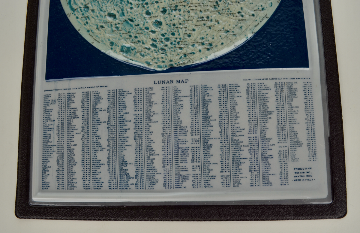
'COPYRIGHT RICO FLORENCE MADE IN ITALY PATENT No. 558142' [bottom left of map]
'LUNAR MAP' [bottom centre of map]
'from the TOPOGRAPHIC LUNAR MAP of the ARMY MAP SERVICE.' [bottom right of map]
'PRODUCTS OF WESTAB INC.,
DAYTON, OHIO.
- MADE IN ITALY'' [bottom right]
Underneath the lunar map are alphabetically listed named lunar formations and their locations by longitude and latitude.
Description Notes
Unframed, laminated raised relief map of the moon with table of lunar formations, by RICO, Florence, and U.S. Army Map Service, Italian, c1970.
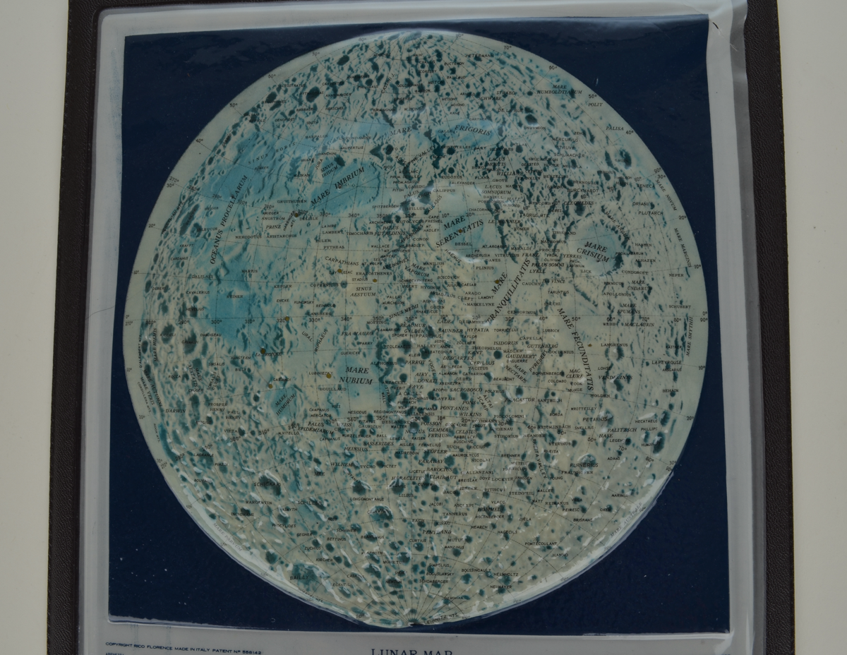
An unusual laminated raised relief map of the moon, created using U.S. Army mapping data for the 'Topographic Lunar Map' and using photographs taken by lunar probes during the 1960s. The map is sat above a table of alphabetically listed named lunar formations and their locations, by longitude and latitude. Presented at a scale of 1:110,000,000, with printed shading to highlight topography.
The map shows a detailed view of the moon's surface, including scaled mountain heights, craters, sea floors and place names.
Examples of this map can be found in the Library of Congress and Stanford University David Rumsey Map Collection.
References
Events
Description
The US Army Map Service was the military cartographic agency of the United States Department of Defence, from 1941-1968, subordinated to the United States Army Corps of Engineers. The organisation's main tasks comprised compiling, publicising, and distributing military topographic maps and related goods, primarily for use by US military forces. The Army Map Service was formed during WW2 from the consolidation of other bodies, due to the increased wartime demand for mapping.
Whilst topographic maps served military concerns, the organisation also prepared extraterrestrial maps of satellite and planetary bodies, such as this one. Mapping the moon was a major interest, and the Army Map Service compiled the first topographic map of the moon by stereo-photogrammetric methods.
The Army Map Service pioneered the production of plastic relief maps in quantity, such as this one. This helped us to see the face of the earth or moon in three-dimensions, as well as conventional map details.
22/08/2022
Created by: Eleanor Brittain on 22/08/2022
FM:47544
Images (Click to view full size):