Accession No
4525
Brief Description
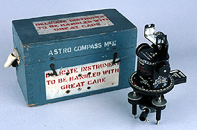
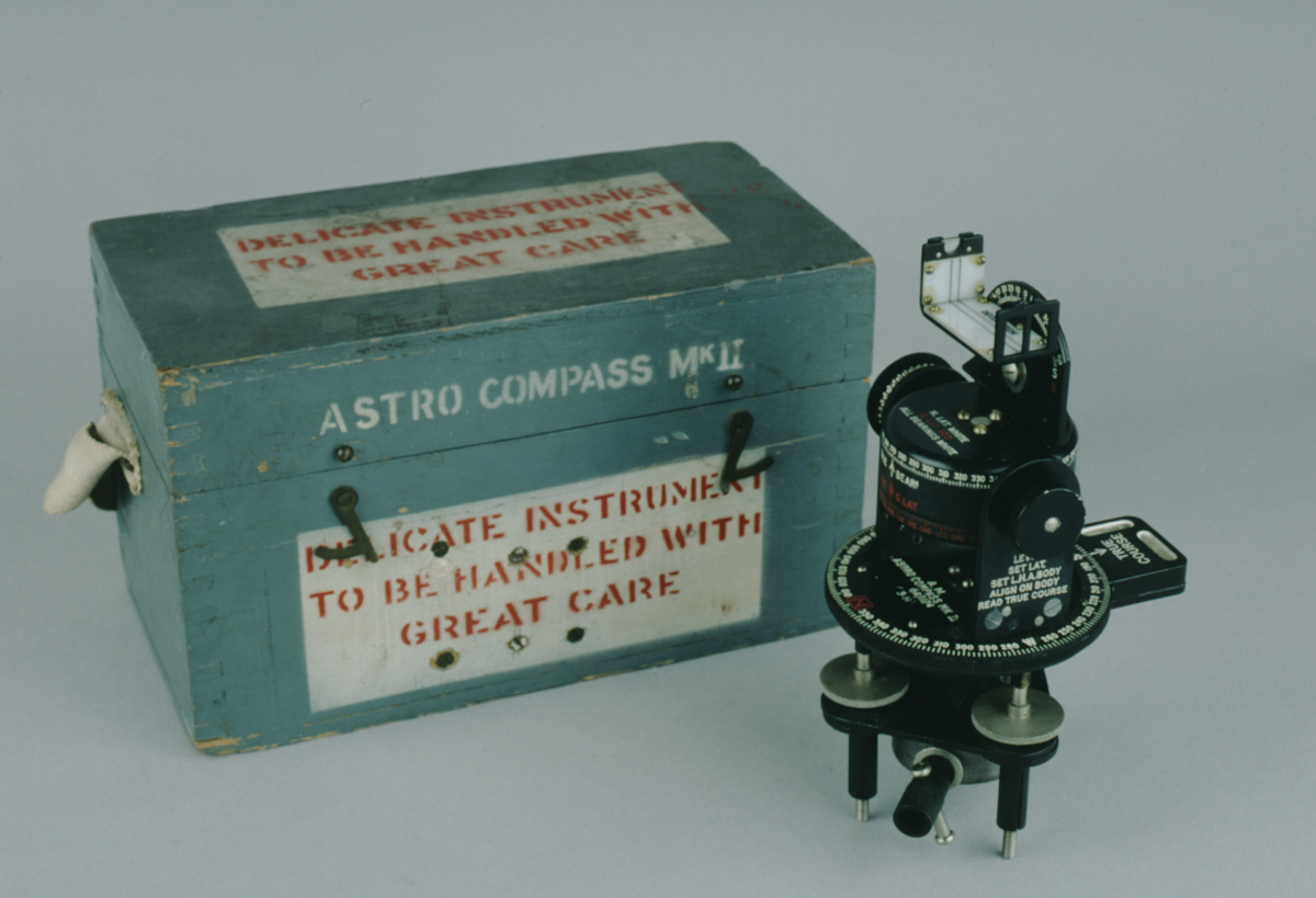
Astro compass MKII in its original box, 20th C
Origin
Maker
Class
navigation; military; magnetism
Earliest Date
1920
Latest Date
1944
Inscription Date
Material
metal (brass, white metal, metal, copper); plastic (perspex, black plastic); glass; wood; cloth (felt, canvas); paper
Dimensions
compass height 210mm; breadth 97mm; depth 135mm box length 275mm; breadth 175mm; height 160mm
Special Collection
Provenance
Donated.
Inscription
‘A.M.
Astro Compass MKII
6A/1174
3-H’ (main plate)
Description Notes
Triangular metal base on two levelling screws and one fixed foot. Supports circular scale of ‘TRUE COURSE’ divided ‘N’ - [360˚], numbered by 10˚, divided to 2˚; also two orthogonal bubble levels. Two pillars set at opposite sides of circle, supporting pivoted ‘TRUE BEARING’ scale. East pillar carries circular scale for latitude, divided 0 - 9[0] - 0, numbered by 1[0]; divided to degrees by tangent screw which carries scale marked in degrees. Also release mechanism for true bearing scale. West pillar is inscribed ‘LEVEL / SET LAT. / SET L.H.A. BODY / ALIGN ON BODY / READ TRUE COURSE’. True bearing scale divided 0 - [360˚], numbered by 10˚, divided to 1˚. Same component carries L.H.A. scale divided as true bearing scale but in opposite direction. True bearing scale rotated by screw on West pillar. Mounted on true bearing scale is vertical scale for declination carrying an alidade with two sights (one with magnifying lens). Scale divided [62˚] - 0 - [62˚], numbered by 10˚, divided to 2˚.
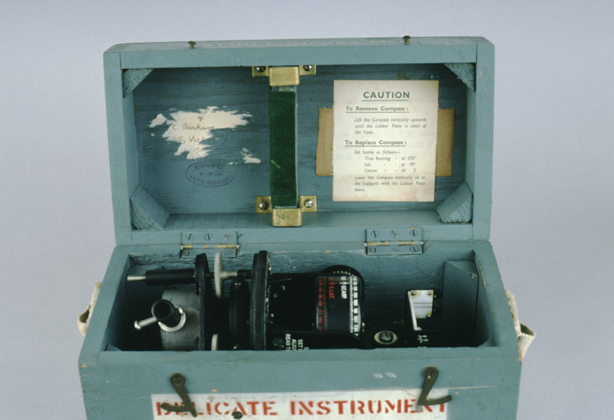
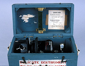
Fitted wooden box with brass screws and hook fasteners. Canvas carrying handle.
Inside lid of box has label for positioning compass in box, stamp ‘EXAMINED 8-JAN-1944 A.C.T.S. DUNSTABLE’, and remains of owner’s label.
Condition good; complete.
References
Events
Description
Magnetic compass
The magnetic compass consists of a magnetic needle attached to a compass card, graduated into angular points, and is used for navigation. The first known dry pivoted compass is dated as early as 1269.
The compass indicates the direction of the magnetic pole but there are problems caused by the difference between magnetic and true north (true north being the useful reading). The variation between the two must be calculated in order to obtain an accurate reading. True north was sometimes simply offset from the direction of magnetic north, but this did not allow for geographical variation. For this, charts were needed. The iron used in building ships during 19th century also led to problems because the magnetism of iron affected the compasses on board.
18/10/2002
Created by: Saffron Clackson on 18/10/2002
FM:39471
Images (Click to view full size):