Accession No
3951
Brief Description
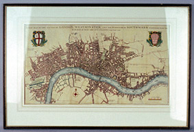
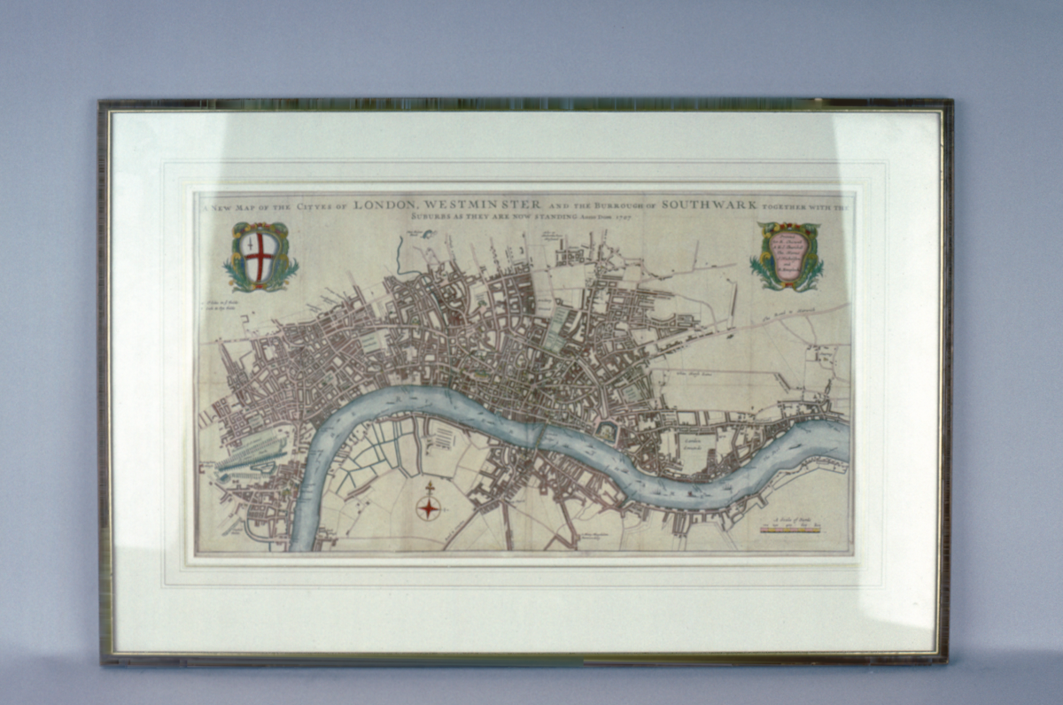
map of central London, English, 1707
Origin
England; London
Maker
Class
prints; cartography
Earliest Date
1707
Latest Date
1707
Inscription Date
1707
Material
paper; card; wood; glass
Dimensions
breadth 748mm; height 500mm
Special Collection
Provenance
Inscription
‘A New Map of the Cityes of LONDON, WESTMINSTER and the Burrough of SOUTHWARK together with the
Suburbs as they are now standing Anno Dom. 1707’ (top of print)
‘Printed
for R. Chiswell.
A & J. Churchill.
Tho. Horne.
J. Nicholson
and
R. Knaplock.’ (cartouche at top RH corner)
Description Notes
Hand-coloured engraving showing the River Thames and the districts of Westminster and Southwark. ‘Scale of Yards’ shown in bottom right corner. Fold marks clearly visible.
Mounted and framed.
Condition good; complete
References
Events
FM:40976
Images (Click to view full size):