Accession No
3456
Brief Description
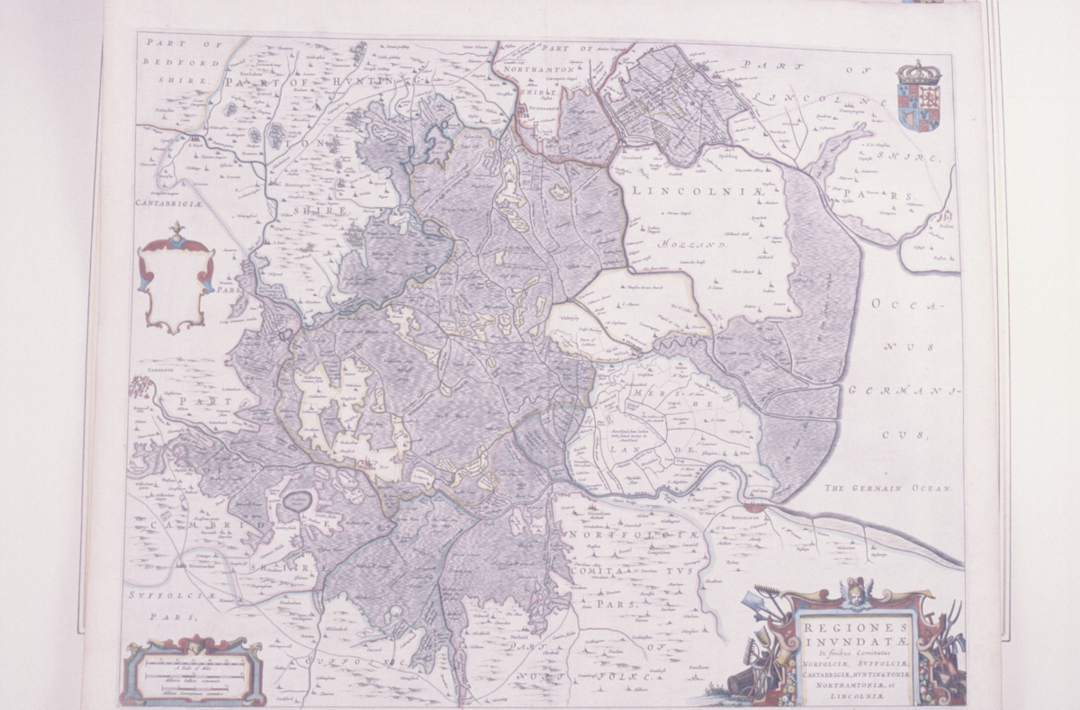
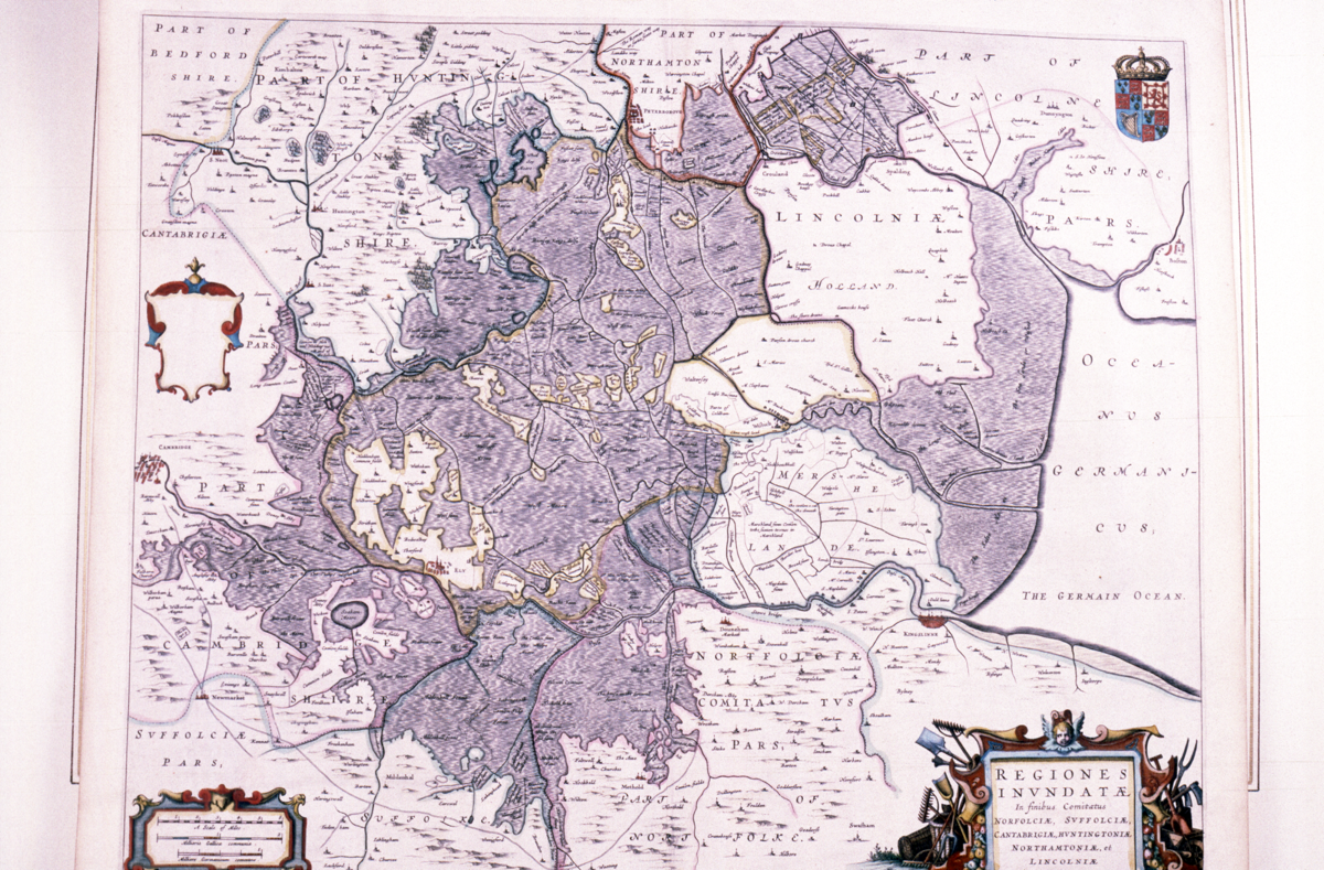
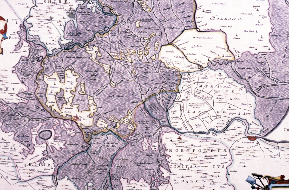
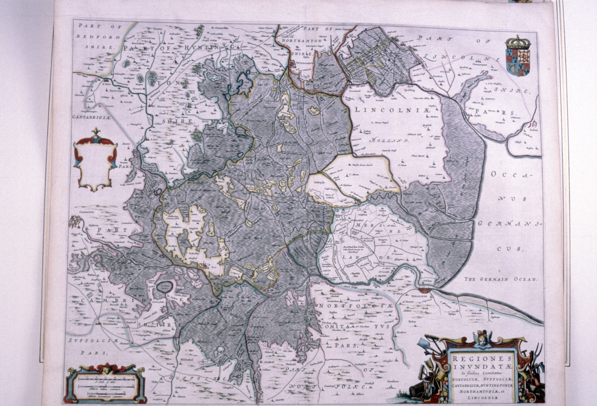
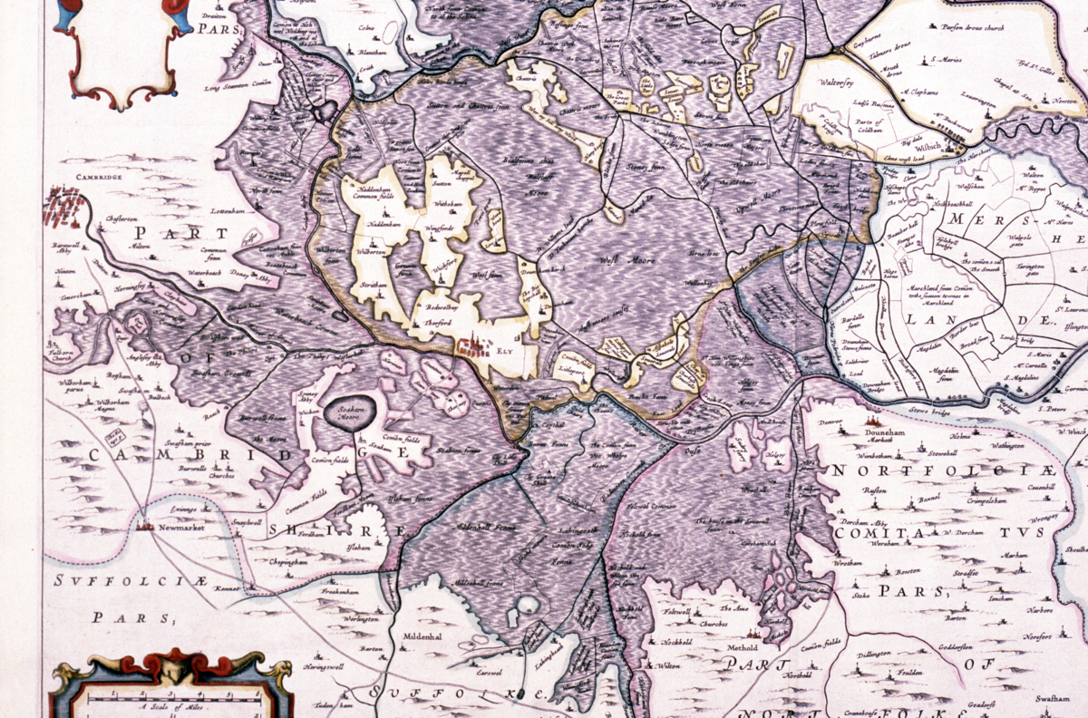
map of flooded area of the Fens, by W. Blaeu, Dutch, 1645
Origin
Netherlands
Maker
Blaeu, W.
Class
prints; cartography
Earliest Date
1650
Latest Date
1650
Inscription Date
Material
paper; card; wood; glass
Dimensions
breadth 780mm; height 648mm
Special Collection
Provenance
Purchased from Cox and co., 1986.
Inscription
‘Regiones
invndatæ
In finibus Comitatus
Norfolciæ, Svffolciæ,
Cantabrigiæ, hvntingtoniæ
Northamtoniæ, et
Lincolniæ’ (bottom right hand corner)
Description Notes
Map of flooded area of the Fens by Blaeu, Dutch, 1645.
Regiones Inundatae In finibus Comitatus Norfolciae, Suffolciae, Cantabrigiae, Huntingtoniae Northamtoniae et Lincolniae.
Dutch couloured engraved print showing the Fens with shading showing flooded areas. Royal court of arms in top right corner. Scale in bottom left corner with 3 different miles: English miles, French miles and German miles. Hand colouring messy in some areas. From an edition of one of Blaeu’s atlases. Mounted and framed.
Condition good; complete
References
Events
FM:41004
Images (Click to view full size):